Category:Town hall of Bondy
Jump to navigation
Jump to search
| Object location | | View all coordinates using: OpenStreetMap |
|---|
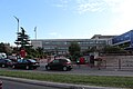
building in Bondy, France  | |||||
| Upload media | |||||
| Instance of | |||||
|---|---|---|---|---|---|
| Location | Bondy, arrondissement of Bobigny, Seine-Saint-Denis, Île-de-France, Metropolitan France, France | ||||
| Street address |
| ||||
| Located on street | |||||
| Owned by | |||||
| Operator | |||||
 | |||||
Media in category "Town hall of Bondy"
The following 4 files are in this category, out of 4 total.
-
 Hôtel Ville Bondy 1.jpg 13,506 × 3,136; 29.71 MB
-
 Hôtel Ville Bondy 2.jpg 5,184 × 3,456; 5.02 MB
-
 Hôtel Ville Bondy 3.jpg 5,184 × 3,456; 6.06 MB
-
 Hôtel Ville Bondy 4.jpg 5,184 × 3,456; 4.37 MB

