Category:Tourist maps of Poland
Jump to navigation
Jump to search
Media in category "Tourist maps of Poland"
The following 70 files are in this category, out of 70 total.
-
 2012 Powiat cieszyński, Marklowice Górne, Mapa turystyczna gminy Zebrzydowice (01).jpg 2,537 × 3,805; 9.15 MB
-
 2012 Powiat cieszyński, Marklowice Górne, Mapa turystyczna gminy Zebrzydowice (02).jpg 3,863 × 2,617; 9.22 MB
-
 2012 Powiat cieszyński, Marklowice Górne, Mapa turystyczna gminy Zebrzydowice (03).jpg 2,635 × 4,013; 9.13 MB
-
 2012 Powiat cieszyński, Marklowice Górne, Mapa turystyczna gminy Zebrzydowice (04).jpg 3,687 × 2,497; 8.65 MB
-
 2012 Powiat cieszyński, Marklowice Górne, Mapa turystyczna gminy Zebrzydowice (05).jpg 2,536 × 3,804; 8.13 MB
-
 2012 Powiat cieszyński, Strumień, Mapa szlaków rowerowych.jpg 3,874 × 2,837; 9.6 MB
-
 2012 Powiat cieszyński, Zebrzydowice, Mapa turystyczna gminy Zebrzydowice (01).jpg 3,310 × 2,207; 6.41 MB
-
 2012 Powiat cieszyński, Zebrzydowice, Mapa turystyczna gminy Zebrzydowice (02).jpg 2,476 × 3,714; 7.48 MB
-
 2012 Powiat cieszyński, Zebrzydowice, Mapa turystyczna gminy Zebrzydowice (03).jpg 2,851 × 4,277; 10.5 MB
-

-

-
 2012 Powiat pszczyński, Pawłowice, Mapa szlaków rowerowych (01).jpg 2,634 × 4,177; 9.37 MB
-
 2012 Powiat pszczyński, Pawłowice, Mapa szlaków rowerowych (02).jpg 2,361 × 3,544; 6.62 MB
-
 2012 Powiat pszczyński, Pawłowice, Mapa szlaków rowerowych (03).jpg 2,467 × 3,676; 7.55 MB
-
 2012 Powiat pszczyński, Pawłowice, Mapa szlaków rowerowych (04).jpg 2,611 × 3,917; 8.71 MB
-
 2012 Powiat pszczyński, Pszczyna, Mapa i znaki szlaku rowerowego "Plessówka".jpg 2,766 × 3,953; 10.27 MB
-
 2012 Powiat raciborski, Zabełków, Mapa szlaków rowerowych.jpg 2,108 × 3,149; 5.99 MB
-
 2012 Powiat wodzisławski, Gołkowice, Mapa trasy rowerowej (01).jpg 4,123 × 2,892; 9.21 MB
-
 2012 Powiat wodzisławski, Gołkowice, Mapa trasy rowerowej (02).jpg 3,612 × 2,499; 6.73 MB
-
 2012 Powiat wodzisławski, Uchylsko, Mapa szlaków rowerowych (01).jpg 3,856 × 2,452; 8.49 MB
-
 2012 Powiat wodzisławski, Uchylsko, Mapa szlaków rowerowych (02).jpg 4,075 × 2,717; 10.04 MB
-
 2012 Rybnik, Ulica księdza Henryka Groborza, Mapa szlaków rowerowych.jpg 2,827 × 4,338; 11.13 MB
-
 2012-06 Łambinowice 01.jpg 4,369 × 2,913; 3.8 MB
-
 2012-06 Łambinowice 02.jpg 4,902 × 3,268; 3.9 MB
-

-
 2016 Brzeźnica 02.jpg 3,671 × 2,858; 8 MB
-
 Bielany-Wr-08021053m.jpg 1,885 × 1,985; 787 KB
-
 Borsuki-map-180916-19.jpg 3,648 × 2,736; 3.39 MB
-
 Chrosna 13 7-2015.jpg 1,435 × 1,080; 319 KB
-
 Dargocice ~070204✲10.jpg 640 × 436; 63 KB
-
 Debowiec, trail (2).jpg 2,976 × 3,968; 2.07 MB
-
 Dubie, Poland - panoramio (2).jpg 3,264 × 4,928; 7.55 MB
-
 Footpath signs in Bydgoszcz, Oplawiec and Smukala districts (2).JPG 2,048 × 1,360; 585 KB
-
 Gmina-Kobierzyce-08021054.JPG 2,112 × 2,816; 1.44 MB
-
 Gostynin, trails.JPG 1,360 × 1,945; 654 KB
-
 Gołuń tablice PTTK.jpg 2,955 × 2,932; 1.64 MB
-
 Góry Sowie ~20rphvib.jpg 2,077 × 3,282; 2.44 MB
-
 Iłża ~22llnlff.jpg 4,365 × 2,782; 3.72 MB
-
 Janow-Podlaski-20LOKJEM.jpg 3,648 × 2,736; 4.85 MB
-
 Karczmiska ~22pspbgj.jpg 3,000 × 4,000; 4.62 MB
-
 Kowalskie trails.jpg 2,736 × 2,829; 994 KB
-
 Las Wolski Krakow kolo ZOO (3).jpg 4,303 × 3,227; 2.6 MB
-
 Malbork scheme.jpg 3,000 × 4,000; 2.26 MB
-
 Maroz-100731-141510.jpg 2,304 × 1,728; 818 KB
-
 MOs810, WG 2014 39, Milicz Ponds Rudy pond (98).JPG 1,360 × 2,048; 744 KB
-
 Mołtowo ~22paavku.jpg 2,880 × 2,160; 2.32 MB
-
 Niechorze ~11062926.jpg 2,816 × 2,112; 1.17 MB
-
 Osola (4).jpg 3,968 × 2,976; 3.37 MB
-
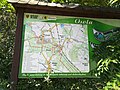 Osola (5).jpg 3,968 × 2,976; 3.8 MB
-
 P49 S30 A SWOSZOWICE WYDANIE TURYSTYCZNE - Wrząsowice.jpg 1,519 × 1,520; 1.07 MB
-
 P49 S30 A SWOSZOWICE WYDANIE TURYSTYCZNE.jpg 8,154 × 7,797; 14.98 MB
-
 Parczew ~23lnqhia.jpg 2,353 × 2,911; 1.97 MB
-
 Przełęcz Sokola ~20rpgkof.jpg 3,401 × 3,401; 2.81 MB
-
 Romanów ~22japwzr.jpg 2,160 × 2,160; 1.6 MB
-
 Samszczyt.jpg 1,688 × 1,528; 652 KB
-
 Sierpc ~180714-C.jpg 2,000 × 2,000; 1.45 MB
-
 Slezabasic.png 782 × 693; 270 KB
-
 Sola-Reservoirs.jpg 1,396 × 547; 93 KB
-
 Stoczek-Łukowski--21GrmCrb.jpg 3,380 × 3,380; 2.38 MB
-
 Tatarska Valley, Gilow (7).jpg 3,648 × 2,423; 1.58 MB
-
 Trails in Duszniki (2).jpg 3,968 × 2,976; 2.63 MB
-
 Trails in Lebork, railway station.jpg 2,875 × 3,376; 1.43 MB
-
 Uraz-080224-403.jpg 2,304 × 1,728; 829 KB
-
 USTKA, AB. 216.JPG 1,067 × 800; 208 KB
-
 WEJHEROWO. AB-046.JPG 3,264 × 2,448; 2.22 MB
-
 Wieszczyna 335 m.jpg 2,883 × 3,272; 2.38 MB
-
 Zwierzyniec ~150502-A.jpg 1,441 × 1,441; 654 KB
-
 Zygmuntowka schronisko (trails plaque).jpg 3,403 × 2,248; 1.14 MB
-
 Mapa trasy szlaku powstania wielkopolskiego w Regionie Kozła - Nądnia - 000440c.jpg 1,280 × 1,920; 243 KB
-
 Żelowice, trails (2).jpg 3,202 × 2,301; 1.33 MB
.jpg)
.jpg)
.jpg)
.jpg)
.jpg)

.jpg)
.jpg)
.jpg)
.jpg)
.jpg)
.jpg)
.jpg)
.jpg)
.jpg)


.jpg)
.jpg)
.jpg)
.jpg)


.jpg)
.jpg)
.JPG)


.jpg)


.JPG)


.jpg)
.jpg)


.jpg)
.jpg)


.jpg)

.jpg)