Category:Tourist drive signs
Jump to navigation
Jump to search
Subcategories
This category has the following 4 subcategories, out of 4 total.
Media in category "Tourist drive signs"
The following 82 files are in this category, out of 82 total.
-
 2016-08 Tadoussac 05.jpg 4,899 × 3,266; 8.55 MB
-
 A5-llwybrhanesyddol.JPG 2,048 × 1,536; 672 KB
-
 AlleenstrasseRuegen1.jpg 1,600 × 1,200; 560 KB
-
 B17-schild.JPG 1,714 × 2,658; 1,002 KB
-
 Baronscourt Scenic Route - geograph.org.uk - 1074655.jpg 640 × 479; 87 KB
-
 BBMR Teiler Wilferdingen.jpg 2,461 × 2,273; 2.84 MB
-
 Beginn Burgenstraße Mannheim.jpg 4,500 × 3,000; 3.43 MB
-
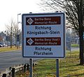
 Bertha Benz Memorial Route in Nußloch.JPG 3,648 × 2,736; 3.22 MB
-
 Bois de la Géronstère (Parc Naturel des Sources) 02.jpg 3,648 × 5,472; 5.35 MB
-
 Bruchsal Durlacher-Grabener.jpg 1,440 × 1,152; 278 KB
-
 Bunde - Ditzumerhammrich + Wynhamster Kolk 01 ies.jpg 5,616 × 3,743; 15.56 MB
-
 Burgenstrasse Mannheim.JPG 1,533 × 940; 174 KB
-
 Burgenstraße-Schild.jpg 2,592 × 1,944; 176 KB
-
 Chemin du Roy Quebec City.JPG 1,200 × 1,600; 750 KB
-
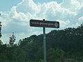
 Crowley-s Ridge Parkway Lee County AR 001.jpg 1,024 × 768; 920 KB
-
 Crowley-s Ridge Parkway Phillips County AR 002.jpg 768 × 1,024; 657 KB
-
 Deutsche Alleenstrasse Reichenau.jpg 1,184 × 1,769; 1.13 MB
-
 Deutsche Faehrstrasse.jpg 2,448 × 3,264; 3.82 MB
-
 Deutsche Uhrenstraße Lenzkirch.jpg 2,048 × 1,536; 921 KB
-
 Dieterode Märchenstraße.JPG 4,320 × 3,240; 4.51 MB
-
 Door County Coastal Byway March 2011.jpg 1,752 × 1,188; 737 KB
-
 Dortmund - Evinger Straße 01 ies.jpg 5,616 × 3,744; 15.14 MB
-
 Drogowskaz do rezerwatu przyrody Kadzielnia (jw14).JPG 4,608 × 3,456; 3.57 MB
-
 Duisburg - Friedrich-Ebert-Brücke - Türme 08 ies.jpg 3,888 × 2,592; 3.08 MB
-
 Eilenburg Burgtor.JPG 2,304 × 1,728; 730 KB
-
 Erlebnisstraße.jpg 1,026 × 526; 38 KB
-
 Etyek Wine Route sign. - Nagy street, Bia, Biatorbágy, Pest County, Hungary.jpg 1,704 × 2,272; 964 KB
-
 Grüne Küstenstrasse DSC01098.JPG 3,672 × 4,896; 9.27 MB
-
 Herten - Feldstraße 01 ies.jpg 5,616 × 3,744; 19.84 MB
-
 Hochrhoenring Hinweisschild.jpg 3,648 × 2,736; 3.9 MB
-
 Hopfenstraße.jpg 1,899 × 1,443; 734 KB
-
 Hämeen Härkätien matkailutien opaste.jpg 836 × 683; 501 KB
-
 IL53nUS66wSignsRoad-BraidwoodIL (40156968241).jpg 2,400 × 1,600; 2.22 MB
-
 IL53sUS66wRoadSigns-Joliet (40156976061).jpg 2,400 × 1,600; 1.77 MB
-
 Kettle Moraine Scenic Drive Turn in Southern Unit.jpg 3,888 × 2,592; 6.67 MB
-
 KettleMoraineScenicDriveDundeeWisconsin.jpg 2,304 × 1,728; 751 KB
-
 Küsten - Oldemühle Göttien 05 ies.jpg 3,888 × 2,592; 1.66 MB
-
 Lake Huron Circle Tour east of Bruce Mines ON.jpg 4,416 × 2,767; 3.4 MB
-
 Lake Superior Tour over International Bridge at Sault Ste Marie.jpg 2,160 × 1,405; 906 KB
-
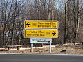
 Lakes to Locks Passage northern terminus US11 north terminus US2 west terminus.jpg 5,184 × 3,456; 6.44 MB
-
 Luckau Zeetze - Wassermühle Zeetze 02 ies.jpg 3,888 × 2,592; 2.01 MB
-
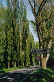
 Lörrach-Tüllingen - Weinweg.jpg 4,180 × 2,810; 4.13 MB
-
 Marguerite road.jpg 3,008 × 2,000; 1.29 MB
-
 Margueritrute-skilt.JPG 600 × 802; 455 KB
-
 Megalithkultur wildeshausen 2011 004.jpg 2,048 × 1,536; 1.23 MB
-
 Međimurska vinska cesta - Podrum Levačić.jpg 3,864 × 5,152; 7.06 MB
-
 Moselweinstrasse-hinweisschild.jpg 391 × 506; 41 KB
-
 Motorway sign, northbound on the M6 - geograph.org.uk - 1304097.jpg 640 × 424; 50 KB
-
 Nibelungenstrassenschild.jpg 800 × 443; 205 KB
-
 Niedersächsische Spargelstraße IMG 8682.jpg 2,000 × 1,333; 880 KB
-
 Oberjoch Deutsche Alpenstraße Schild.jpg 2,560 × 1,920; 1.1 MB
-
 Oldendorf (Luhe) - Wassermühle 03 ies.jpg 3,888 × 2,592; 2.32 MB
-
 ON 2 - Heritage Highway.jpg 4,288 × 3,216; 2.86 MB
-
 Park at Abbey Road, Clonmel - geograph.org.uk - 1251231.jpg 640 × 428; 162 KB
-
 Rantatie opastekyltti.JPG 1,600 × 1,200; 569 KB
-
 Roads at Glen East - geograph.org.uk - 811204.jpg 640 × 479; 58 KB
-
 RomanticRoad.jpg 1,024 × 765; 300 KB
-
 Rosche - Neumühle Borg 07 ies.jpg 3,888 × 2,592; 1.32 MB
-
 Röttingen an der Romantischen Straße.jpg 2,888 × 2,541; 6.2 MB
-
 Schild Niedersächsische Mühlenstrasse Norderney.jpg 2,000 × 3,008; 2.05 MB
-
 Schild niedersächsische mühlenstrasse P7210063.JPG 1,712 × 2,288; 2.38 MB
-
 Schild RomanAlpenstraße.jpg 912 × 684; 180 KB
-
 Schwäbische Albstrasse.jpg 3,008 × 2,000; 3.07 MB
-
 Sign DeutscheFehnroute in Papenburg.jpg 1,280 × 960; 295 KB
-
 Sign DeutscheFehnroute.jpg 363 × 228; 35 KB
-
 Signs at Glen East - geograph.org.uk - 1720174.jpg 3,648 × 2,736; 2.59 MB
-
 Stavern - Berßener Straße 05 ies.jpg 3,744 × 5,616; 26.03 MB
-
 Straße der Romanik - Gernrode.jpg 2,304 × 3,072; 385 KB
-
 Tadoussac - Whale road sign.jpg 2,786 × 4,206; 2.6 MB
-
 Tourist signs Hulst 03.jpg 3,648 × 5,472; 5.41 MB
-
 Uhlbach-weinstrasse.jpg 400 × 248; 27 KB
-
 Unterrichtungstafel Weinstraße Saale-Unstrut (2009).jpg 2,495 × 1,474; 906 KB
-
 Verkeerstekens, Bestanddeelnr 058-1197.jpg 1,455 × 3,600; 780 KB
-
 Via Karelia.jpg 600 × 559; 91 KB
-
 Viezstrasse-tafel.jpg 965 × 581; 144 KB
-
 WAK Treffurt 003.jpg 1,332 × 1,998; 1.8 MB
-
 Westoverledingen - Marker Straße 01 ies.jpg 3,744 × 5,616; 26.98 MB
-
 Westoverledingen - Marker Straße 02 ies.jpg 5,616 × 3,744; 27.83 MB
-
 Westoverledingen - Marker Straße 08 ies.jpg 5,616 × 3,744; 21.88 MB
-
 Westoverledingen - Marker Straße 09 ies.jpg 3,744 × 5,616; 24.51 MB
-
 Wippingen - Zum Turm 02 ies.jpg 3,744 × 5,616; 12.89 MB
-
 Wittinger Straße Celle Straßenschild Deutsche Fachwerk Straße Historische Altstadt.jpg 3,024 × 2,016; 6.89 MB


_02.jpg)


.JPG)


.jpg)
.jpg)


_-_Wasserm%C3%BChle_03_ies.jpg)


.jpg)


