Category:Tourbière de l'Arselle
Jump to navigation
Jump to search
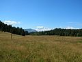
Français : Tourbière de l'Arselle, espace naturel sensible de Chamrousse, en Isère, France.
| Object location | | View all coordinates using: OpenStreetMap |
|---|
protected area in France  | |||||
| Upload media | |||||
| Instance of | |||||
|---|---|---|---|---|---|
| Location | Chamrousse, canton of Domène | ||||
| IUCN protected areas category | |||||
| Start time |
| ||||
| Inception |
| ||||
| Mountain range | |||||
| Area |
| ||||
| Elevation above sea level |
| ||||
 | |||||
Media in category "Tourbière de l'Arselle"
The following 11 files are in this category, out of 11 total.
-
 Chamrousse UT4M abc19.jpg 2,078 × 1,559; 2.87 MB
-
 Chamrousse UT4M abc20.jpg 2,288 × 1,712; 748 KB
-
 Chamrousse UT4M abc21.jpg 2,288 × 1,712; 771 KB
-
 Chamrousse UT4M abc22.jpg 2,288 × 1,712; 722 KB
-
 Chamrousse UT4M abc23.jpg 2,288 × 1,712; 765 KB
-
 Chamrousse UT4M abc24.jpg 2,288 × 1,712; 754 KB
-
 Massif du Vercors @ Lac Achard.jpg 4,608 × 3,456; 4.8 MB
-
 Mont Aiguille @ Chamrousse.jpg 4,608 × 3,456; 6.74 MB
-
 Mont Aiguille @ Lac Achard.jpg 4,608 × 3,456; 4.49 MB
-
 Plateau de l'Arselle hiver.jpg 4,331 × 3,248; 1.86 MB
-
 Tájkép Chamrousse-ból.jpg 7,647 × 2,050; 6.94 MB


