Category:Tour de la Pucelle
Jump to navigation
Jump to search
| Object location | | View all coordinates using: OpenStreetMap |
|---|
|
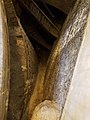
This building is inscrit au titre des monuments historiques de la France. It is indexed in the base Mérimée, a database of architectural heritage maintained by the French Ministry of Culture, under the reference PA00101012
|
 | |||||
| Upload media | |||||
| Instance of | |||||
|---|---|---|---|---|---|
| Part of | |||||
| Location | Rouen, arrondissement of Rouen, Seine-Maritime, Normandy, Metropolitan France, France | ||||
| Located on street |
| ||||
| Heritage designation |
| ||||
| Dissolved, abolished or demolished date |
| ||||
 | |||||
Media in category "Tour de la Pucelle"
The following 4 files are in this category, out of 4 total.
-
 Plaque tour de la Pucelle Jeanne d'Arc emprisonnee.JPG 2,376 × 4,260; 1.87 MB
-
 Tour de la Pucelle - 102 rue Jeanne-d'Arc 01.jpg 3,024 × 4,032; 4.57 MB
-
 Tour de la Pucelle - 102 rue Jeanne-d'Arc 02.jpg 3,024 × 4,032; 4.51 MB
-
 Tour de la Pucelle.JPG 2,345 × 3,225; 3.45 MB


