Category:Tour de France maps of the 1950s
Jump to navigation
Jump to search
Media in category "Tour de France maps of the 1950s"
The following 20 files are in this category, out of 20 total.
-
 Tour de France 1950.png 600 × 600; 272 KB
-
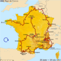
 Tour de France 1951.png 600 × 600; 279 KB
-
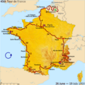
 Tour de France 1952.png 600 × 600; 283 KB
-
 Tour de France 1953.png 600 × 600; 274 KB
-
 Tour de France 1954 map.svg 600 × 650; 373 KB
-
 Tour de France 1955 map.svg 600 × 600; 368 KB
-
 Tour de France 1956 map.svg 600 × 600; 368 KB
-
 Tour de France 1957 map.svg 600 × 600; 369 KB
-
 Tour de France 1958 map.svg 600 × 600; 375 KB
-
 Route of the 1959 Tour de France.png 3,198 × 3,204; 2.67 MB
-
 Tour de France 1959 map.svg 600 × 600; 373 KB
-
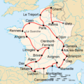
 Route of the 1950 Tour de France.png 2,998 × 3,004; 3.9 MB
-
 Route of the 1951 Tour de France.png 2,998 × 3,004; 3.87 MB
-
 Route of the 1952 Tour de France.png 3,198 × 3,204; 2.69 MB
-
 Route of the 1953 Tour de France.png 3,198 × 3,204; 2.67 MB
-
 Route of the 1954 Tour de France.png 3,198 × 3,462; 2.7 MB
-
 Route of the 1955 Tour de France.png 3,193 × 3,195; 2.66 MB
-
 Route of the 1956 Tour de France.png 3,193 × 3,195; 2.57 MB
-
 Route of the 1957 Tour de France.png 3,198 × 3,204; 2.63 MB
-
 Route of the 1958 Tour de France.png 3,198 × 3,204; 2.67 MB


