Category:Toryglen
Jump to navigation
Jump to search
area in the south of Glasgow, Scotland, UK | |||||
| Upload media | |||||
| Instance of | |||||
|---|---|---|---|---|---|
| Location |
| ||||
 | |||||
Media in category "Toryglen"
The following 36 files are in this category, out of 36 total.
-
 2018 European Mountain Bike Championships DSCF6205 (43193681244).jpg 1,980 × 1,485; 343 KB
-
 2018 European Mountain Bike Championships DSCF6207 (43007134725).jpg 1,980 × 1,485; 359 KB
-
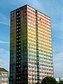
 A View to Prospecthill Circus Tower Block - panoramio.jpg 2,592 × 1,944; 1.35 MB
-
 Aikenhead Road (geograph 1920463).jpg 640 × 480; 65 KB
-
 Aitkenhead Road (geograph 5699204).jpg 1,600 × 1,105; 263 KB
-
 Approaching Toryglen Asda - geograph.org.uk - 1138155.jpg 640 × 480; 123 KB
-
 BRAVIA Glasgow paint.jpg 960 × 1,280; 220 KB
-
 Demolished Flats, Prospecthill Circus (geograph 3472999).jpg 640 × 480; 116 KB
-

-
 Flats on Prospecthill Crescent - geograph.org.uk - 1138145.jpg 640 × 480; 104 KB
-
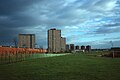
 Football pitches at Toryglen Regional Football Centre (geograph 5699165).jpg 1,600 × 1,129; 276 KB
-
 Glasgow wards 2017 no07 Langside.png 2,000 × 2,040; 504 KB
-
 Highrise flats in Prospecthill - geograph.org.uk - 1138149.jpg 640 × 480; 112 KB
-
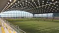
 Indoor pitch, Toryglen Regional Football Centre (geograph 5699172).jpg 1,600 × 1,200; 428 KB
-
 Indoor pitch, Toryglen Regional Football Centre (geograph 5699176).jpg 1,600 × 1,200; 392 KB
-
 Malawian football coaches on partnership visit (15024690843).jpg 5,760 × 3,840; 10.04 MB
-
 Malawian football coaches on partnership visit (15458134179).jpg 5,760 × 3,840; 6.24 MB
-
 Malawian football coaches on partnership visit (15458887467).jpg 5,760 × 3,840; 8.9 MB
-
 Map of Lanarkshire Sheet 010, Ordnance Survey, 1863-1865.jpg 10,680 × 7,158; 7.6 MB
-
 Map of Lanarkshire Sheet 010, Ordnance Survey, 1863-1865.tiff 10,680 × 7,158; 218.72 MB
-
 New sports facility in Toryglen - geograph.org.uk - 1138152.jpg 640 × 480; 106 KB
-
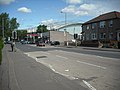
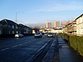
 Prospecthill Road (B768) - geograph.org.uk - 1168519.jpg 640 × 480; 65 KB
-
 St Brigids Church, Toryglen, Glasgow (geograph 4121621).jpg 1,600 × 1,067; 593 KB
-
 St Brigids Primary School, Toryglen, Glasgow (geograph 4121630).jpg 5,184 × 3,456; 5.87 MB
-
 The A728 near Mount Florida (geograph 6139645).jpg 1,600 × 900; 349 KB
-
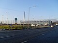
 Toryglen National Football Centre (geograph 5662875).jpg 2,000 × 1,520; 1.87 MB
-
 Toryglen Police Station - geograph.org.uk - 1138159.jpg 640 × 480; 115 KB
-
 Toryglen Regional Football Centre (geograph 2733263).jpg 640 × 481; 71 KB
-
 Toryglen Regional Football Centre (geograph 5699187).jpg 1,600 × 1,170; 290 KB
-
 Toryglen Regional Football Centre (geograph 5699213).jpg 1,600 × 1,123; 337 KB
-
 Toryglen Regional Football Centre - geograph.org.uk - 2605149.jpg 640 × 512; 79 KB
-
 Toryglen Regional Football Centre.jpg 5,152 × 2,896; 5.41 MB
-
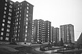 Tower Block UK photo glw3-22 (Toryglen Prospecthill Cr 1983) (monochrome).jpg 2,602 × 1,721; 1.45 MB
-
 Tower Block UK photo glw3-22 (Toryglen Prospecthill Cr 1983).jpg 2,602 × 1,721; 711 KB
-
 Tower Block UK photo glw3-23 (Toryglen 1981).jpg 2,610 × 1,750; 1.06 MB
-
 Westmuir Place - geograph.org.uk - 1138142.jpg 640 × 480; 111 KB
.jpg)
.jpg)

.jpg)
.jpg)


.jpg)


.jpg)


.jpg)
.jpg)
.jpg)
.jpg)
.jpg)


_-_geograph.org.uk_-_1168519.jpg)
.jpg)
.jpg)
.jpg)
.jpg)

.jpg)
.jpg)
.jpg)


_(monochrome).jpg)
.jpg)
.jpg)
