Category:Tornado track maps
Jump to navigation
Jump to search
Subcategories
This category has only the following subcategory.
Media in category "Tornado track maps"
The following 146 files are in this category, out of 146 total.
-
 1950–1999 Connecticut tornado tracks.png 567 × 416; 18 KB
-
 1952 Tornadoes.png 1,130 × 700; 257 KB
-
 1953 Tornadoes.png 1,130 × 700; 279 KB
-
 1954 Tornadoes.png 1,130 × 700; 283 KB
-
 1955 F5 Blackwell and Udall tornado tracks.gif 700 × 700; 15 KB
-
 1955 Tornadoes.png 1,130 × 700; 283 KB
-
 1956 Tornadoes.png 1,130 × 700; 282 KB
-
 1957 Tornadoes.png 1,130 × 700; 305 KB
-
 1958 Tornadoes.png 1,130 × 700; 280 KB
-
 1959 Tornadoes.png 1,130 × 700; 281 KB
-
 1960 Tornadoes.png 1,130 × 700; 280 KB
-
 1961 Tornadoes.png 1,130 × 700; 292 KB
-
 1962 Tornadoes.png 1,130 × 700; 284 KB
-
 1963 Tornadoes.png 1,130 × 700; 273 KB
-
 1964 Tornadoes.png 1,130 × 700; 291 KB
-
 1965 Tornadoes.png 1,130 × 700; 305 KB
-
 1966 Candlestick tornado map.JPG 1,518 × 1,163; 358 KB
-
 1966 Candlestick tornado revised map.jpg 1,518 × 1,163; 368 KB
-
 1966 Tornadoes.png 1,130 × 700; 278 KB
-
 1967 Tornadoes.png 1,130 × 700; 299 KB
-
 1968 Tornadoes.png 1,130 × 700; 286 KB
-
 1969 Tornadoes.png 1,130 × 700; 285 KB
-
 1974 Super Outbreak Fujita color map Monticello crop.jpg 1,251 × 886; 336 KB
-
 1974 Super Outbreak Fujita color map.jpg 3,315 × 4,500; 6.16 MB
-
 1983 US tors.png 1,130 × 700; 187 KB
-
 1985-05-31 tornado outbreak map.PNG 705 × 520; 141 KB
-
 1987 Edmonton Tornado path.png 678 × 625; 176 KB
-
 1994 Palm Sunday tornado outbreak tracks.jpg 621 × 400; 106 KB
-
 19981004map.png 778 × 661; 181 KB
-
 1999 Salt Lake City Tornado path.jpg 702 × 492; 280 KB
-
 1999-05-03 bigoutbreak.png 1,067 × 768; 53 KB
-
 2000 tornado paths in the United States.png 5,940 × 4,200; 4.67 MB
-
 2001 tornado paths in the United States.png 5,940 × 4,200; 4.73 MB
-
 2002 La Plata Tornado Track.png 1,211 × 778; 1.45 MB
-
 2002 tornado paths in the United States.png 5,940 × 4,200; 4.65 MB
-
 2003 tornado paths in the United States.png 5,940 × 4,200; 4.79 MB
-
 2004 tornado paths in the United States.png 5,940 × 4,200; 4.85 MB
-
 2005 tornado paths in the United States.png 5,940 × 4,200; 4.76 MB
-
 2006 tornado paths in the United States.png 4,700 × 3,323; 3.83 MB
-
 2007 tornado paths in the United States.png 4,700 × 3,323; 3.73 MB
-
 2008 tornado paths in the United States.png 4,700 × 3,323; 4.16 MB
-
 2008mntor.jpg 600 × 689; 94 KB
-
 2009 tornado paths in the United States.png 4,700 × 3,323; 3.95 MB
-
 2009mntor.jpg 598 × 691; 98 KB
-
 2010 tornado paths in the United States.png 4,700 × 3,323; 4.02 MB
-
 2011 El Reno–Piedmont tornado NWS map.jpg 800 × 659; 557 KB
-
 2011 tornado paths in the United States.png 4,700 × 3,323; 4.18 MB
-
 2011 United States tornado map.png 1,130 × 700; 226 KB
-
 2012 tornado paths in the United States.png 4,700 × 3,323; 3.91 MB
-
 2013 El Reno Tornado Timeline.jpg 1,915 × 939; 1.17 MB
-
 2013 tornado paths in the United States.png 4,700 × 3,323; 3.9 MB
-
 2014 tornado paths in the United States.png 4,700 × 3,323; 3.9 MB
-
 2015 tornado paths in the United States.png 4,700 × 3,323; 4 MB
-
 2016 tornado paths in the United States.png 4,700 × 3,323; 3.92 MB
-
 2017 tornado paths in the United States.png 4,700 × 3,323; 4.08 MB
-
 2018 tornado track map summary.png 15,226 × 9,239; 15.89 MB
-
 2022 tornado track map summary.png 15,200 × 9,239; 16.17 MB
-
 2023 Canada tornado track map summary.png 7,000 × 3,609; 1.65 MB
-
 2023 tornado track map summary.png 15,200 × 9,239; 16.38 MB
-
 2024 Lakeview Tornado Track and Intensity Map.jpg 1,211 × 1,193; 585 KB
-
 2024 tornado track map summary.png 15,200 × 9,239; 16.55 MB
-
 2024 Tornado Track Through Lakeview, Ohio.jpg 1,207 × 1,099; 567 KB
-
 2024 Valley View, Texas Tornado Track and Intensity Map.jpg 867 × 702; 191 KB
-

-
 A track map of the July 23, 2023 long-tracked EF0 tornado in Kentucky.jpg 2,262 × 1,394; 2.44 MB
-
 April 16, 2011 North Carolina Tornado Outbreak.gif 671 × 320; 11 KB
-
 April 2022 tornado confirmations and warnings.png 3,507 × 2,480; 2.12 MB
-
 August 2022 tornado confirmations and warnings.png 3,507 × 2,480; 1.92 MB
-
 BingerTornado1981.JPG 512 × 411; 29 KB
-
 Blackwelldamage.gif 700 × 700; 21 KB
-
 Břeclav a Hodonín 2021-06-24 Mapy cz.png 1,146 × 859; 998 KB
-
 Canton IL Tornado 1975.jpg 1,200 × 474; 79 KB
-
 Charleston-Mattoon Tornado Outbreak map.PNG 892 × 925; 63 KB
-
 Csptracks.png 1,245 × 767; 479 KB
-
 Intensidad Tornado.PNG 396 × 390; 35 KB
-
 Demonstração - Tornado em Marechal Cândido Rondon 2015.png 1,920 × 1,080; 214 KB
-
 Ef5 NWAL large.png 1,111 × 789; 1.48 MB
-
 Evansville Tornado of 2005 Track Map.gif 500 × 295; 78 KB
-
 February 2022 tornado confirmations and warnings.png 3,507 × 2,480; 1.88 MB
-
 Finley Map Of The Enigma Outbreak, Feb 19 1884 (7994743682).jpg 1,528 × 1,116; 339 KB
-
 Flint Tornado 1953.jpg 600 × 700; 44 KB
-
 Four-State Tornado Swarm.PNG 414 × 348; 9 KB
-
 Fujita Map Of The Carolinas Outbreak, March 28 1984 (7995064756).jpg 2,176 × 928; 277 KB
-
 Greenfield, IA EF4 Tornado Satellite Image.jpg 754 × 581; 561 KB
-
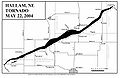 Hallam-NE-tornado-map.jpg 1,700 × 1,100; 205 KB
-
 Huntsville1989track.png 634 × 833; 406 KB
-
 Jackson, MS WFO Hurricane Rita tornado outbreak track map.png 650 × 615; 379 KB
-
 Jan1950-2006 tornadoes.PNG 809 × 649; 30 KB
-
 January 2017 Georgia tornado outbreak.png 1,097 × 842; 266 KB
-
 January 2022 tornado confirmations and warnings.png 3,507 × 2,480; 1.91 MB
-
 January 22, 2017, Albany, Georgia, tornado damage swath.png 1,238 × 773; 2.05 MB
-
 July 2022 tornado confirmations and warnings.png 3,507 × 2,480; 1.97 MB
-
 June17 2010 tornadoes.jpg 416 × 476; 53 KB
-
 Kalamazoo-tornado-path.jpg 1,008 × 725; 588 KB
-
 Map of the February 12, 1945 Montgomery, Alabama tornado.jpg 1,702 × 1,487; 220 KB
-
 Map of the March 22, 2023 EF1 Tornado in the Los Angeles Metro.jpg 1,535 × 811; 470 KB
-
 March 2022 tornado confirmations and warnings.png 3,507 × 2,480; 2.15 MB
-
 May 2022 tornado confirmations and warnings.png 3,507 × 2,480; 2.19 MB
-
 May 24 2011 El Reno tornado track satellite image.png 918 × 919; 1.83 MB
-
 May 6 Tornado Path.jpg 660 × 510; 60 KB
-
 May31CLEtracks.gif 780 × 730; 68 KB
-
 New England tornado paths.png 564 × 668; 37 KB
-
 Nov10map2.JPG 398 × 453; 24 KB
-
 November 2022 tornado confirmations and warnings.png 3,507 × 2,480; 1.98 MB
-
 November.outbreak.1992.png 517 × 351; 25 KB
-

-
 October 12, 2023 Palm Coast, Florida EF2 Tornado Track Map.jpg 1,892 × 1,102; 1.25 MB
-
 October24 2001 tornadoes.gif 510 × 575; 31 KB
-
 Palmsundayalltornadoes.jpg 1,024 × 768; 181 KB
-
 Riegelwood North Carolina tornado track Nov 16 2006.png 600 × 625; 178 KB
-
 Satellite imagery of the scar left behind the Bassfield, MS EF4 tornado.png 883 × 706; 1.45 MB
-
 September 2022 tornado confirmations and warnings.png 3,507 × 2,480; 1.91 MB
-
 South Dakota Tornadoes.PNG 915 × 636; 21 KB
-
 Super Outbreak Map.jpg 1,345 × 1,631; 2.46 MB
-
 The March 24, 2023 EF4 tornado’s path and intensity through the city of Rolling Fork.jpg 1,420 × 1,286; 962 KB
-
 The March 24, 2023 EF4 tornado’s path and intensity through the town of Silver City.jpg 1,403 × 1,106; 592 KB
-
 Tornado 2021-06-24.png 1,062 × 819; 543 KB
-
 Tornado outbreak of April 27–28, 2002.png 3,507 × 2,480; 2.48 MB
-
 Tornado outbreak of April 4–7, 2022.png 3,507 × 2,480; 2.49 MB
-
 Tornado outbreak of December 12–15, 2022.png 3,507 × 2,480; 2.62 MB
-
 Tornado outbreak of January 12, 2023.png 3,507 × 2,480; 2.27 MB
-
 Tornado outbreak of March 21–23, 2022.png 3,507 × 2,480; 2.8 MB
-
 Tornado outbreak of March 29–31, 2022.png 3,507 × 2,480; 2.81 MB
-
 Tornado outbreak of March 5–7, 2022.png 3,507 × 2,480; 2.31 MB
-
 Tornado outbreak of May 12, 2022.png 3,507 × 2,480; 1.44 MB
-
 Tornado outbreak of May 6–9, 2024.png 3,507 × 2,480; 3.2 MB
-
 Tornado outbreak of November 4–5, 2022.png 3,507 × 2,480; 2.22 MB
-
 Tornado outbreak sequence of April 25–28, 2024.png 3,507 × 2,480; 2.59 MB
-
 Tornado outbreak sequence of June 14–19, 2023.png 3,507 × 2,480; 2.42 MB
-
 Tornado outbreak sequence of May 19–27, 2024.png 3,507 × 2,480; 3.29 MB
-
 Tornado track map 1999 Oklahoma tornado outbreak.gif 1,599 × 1,297; 113 KB
-
 Tornado Track near Sturbridge, Massachusetts (cropped).jpg 372 × 299; 167 KB
-
 Tornado Track near Sturbridge, Massachusetts.jpg 2,000 × 775; 1.65 MB
-

-
 Tornado's During April 16 2011 Tornado Outbreak in NC.gif 671 × 342; 12 KB
-
 Tornadoes near Vaughnsville.jpg 740 × 348; 84 KB
-
 Tornados en Occitània - Periòde 1999-2018.png 1,835 × 1,062; 417 KB
-
 Tri-State Tornado cyclone track map key.jpg 1,808 × 1,168; 293 KB
-
 Tri-State Tornado cyclone track map.jpg 1,812 × 1,168; 1.44 MB
-
 Tri-State Tornado map.PNG 852 × 695; 61 KB
-
 Tri-State Tornado trackmap (PAH).jpg 555 × 542; 80 KB
-
 Tri-State Tornado trackmap cropped.png 366 × 320; 33 KB
-
 Veterans Day Tornado Outbreak.JPG 722 × 690; 172 KB
-
 Wallingford tornado track.PNG 967 × 540; 95 KB
-
 Wetterereignisse am 1. Juli 1891.jpg 1,214 × 707; 363 KB
-
 Wisconsin Tornado Paths.PNG 555 × 467; 16 KB


.jpg)


.jpg)


.jpg)


.jpg)


