Category:Torbay-Totnes Trail
Jump to navigation
Jump to search
Subcategories
This category has only the following subcategory.
Media in category "Torbay-Totnes Trail"
The following 43 files are in this category, out of 43 total.
-
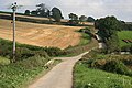
 Approaching Netherton - geograph.org.uk - 982681.jpg 640 × 427; 123 KB
-
 Bourton Bridge - geograph.org.uk - 803859.jpg 480 × 640; 119 KB
-
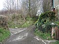
 Bourton Lane - geograph.org.uk - 803893.jpg 480 × 640; 123 KB
-
 Bourton Lane - geograph.org.uk - 803904.jpg 640 × 480; 113 KB
-
 Bourton Lane - geograph.org.uk - 803909.jpg 640 × 480; 95 KB
-
 Bourton Lane - geograph.org.uk - 982472.jpg 640 × 427; 110 KB
-
 Bourton, Totnes - geograph.org.uk - 803802.jpg 640 × 514; 87 KB
-
 Bridge over the Mill Tail, Totnes - geograph.org.uk - 1150021.jpg 640 × 480; 249 KB
-
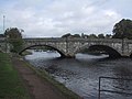 Bridge over the River Dart, Totnes - geograph.org.uk - 993292.jpg 640 × 480; 65 KB
-
 Buildings near Gatcombe House - geograph.org.uk - 982644.jpg 640 × 427; 97 KB
-
 Combepark Cross - geograph.org.uk - 982624.jpg 640 × 427; 102 KB
-
 Footpath at Marldon Tor - geograph.org.uk - 1588775.jpg 640 × 483; 116 KB
-
 Footpath east of Marldon - geograph.org.uk - 1015663.jpg 640 × 427; 125 KB
-
 Footpath junction near Loventor - geograph.org.uk - 804578.jpg 640 × 480; 158 KB
-
 Footpath meets bridlepath - Marldon - geograph.org.uk - 1083754.jpg 640 × 429; 112 KB
-
 Footpath near Marldon - geograph.org.uk - 1588754.jpg 640 × 446; 102 KB
-
 Footpath to Love Lane, Marldon - geograph.org.uk - 1064395.jpg 640 × 480; 90 KB
-
 Footpath, Marldon - geograph.org.uk - 765299.jpg 640 × 480; 130 KB
-
 Gap in wall near Netherton - geograph.org.uk - 1332977.jpg 640 × 493; 127 KB
-
 Gatcombe Mill - geograph.org.uk - 804294.jpg 480 × 640; 104 KB
-
 Gate on footpath, Marldon - geograph.org.uk - 715654.jpg 480 × 640; 137 KB
-
 Horse chestnut at Cockington - geograph.org.uk - 1561852.jpg 640 × 480; 148 KB
-
 House at Netherton - geograph.org.uk - 1588906.jpg 476 × 640; 97 KB
-
 In Scadson Wood - geograph.org.uk - 1015743.jpg 427 × 640; 157 KB
-

-
 Lane at Coombe Park - geograph.org.uk - 804238.jpg 480 × 640; 136 KB
-
 Lane near Netherton - geograph.org.uk - 804317.jpg 640 × 480; 107 KB
-
 Lane to Castle Mill - geograph.org.uk - 1588874.jpg 480 × 640; 131 KB
-
 Lane to Castle Mill - geograph.org.uk - 1588904.jpg 480 × 640; 157 KB
-
 Love Lane, Marldon - geograph.org.uk - 1064496.jpg 640 × 480; 108 KB
-
 Marldon footpath 5 - geograph.org.uk - 715634.jpg 640 × 452; 120 KB
-
 Netherton, Gatcombe turning - geograph.org.uk - 643313.jpg 640 × 480; 140 KB
-
 Path above Cockington valley - geograph.org.uk - 1381784.jpg 640 × 480; 103 KB
-
 Path below Occombe - geograph.org.uk - 1588724.jpg 640 × 480; 106 KB
-
 Path near Occombe - geograph.org.uk - 804597.jpg 640 × 480; 136 KB
-
 Signpost on the Footpath - geograph.org.uk - 1015757.jpg 640 × 427; 115 KB
-
 Spring flowers on Bourton Lane - geograph.org.uk - 804026.jpg 480 × 640; 142 KB
-
 Spring flowers on Bourton Lane - geograph.org.uk - 804085.jpg 640 × 480; 137 KB
-
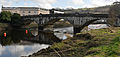 Totnes Bridge.jpg 5,515 × 2,632; 6.51 MB
-
 Track in Gatcombe Brook valley - geograph.org.uk - 1332970.jpg 640 × 480; 106 KB
-
 Valley below Cockington - geograph.org.uk - 1381812.jpg 640 × 465; 107 KB
-
 Woodland Path - geograph.org.uk - 982713.jpg 427 × 640; 136 KB
-
 Woodland Path - geograph.org.uk - 983354.jpg 427 × 640; 153 KB


