Category:Toposcopes in Scotland
Jump to navigation
Jump to search
Subcategories
This category has the following 7 subcategories, out of 7 total.
A
- Allermuir Hill toposcope (2 F)
B
- Ben Macdui toposcope (3 F)
C
- Craigs Top viewfinders (4 F)
E
L
- Lyle Hill viewfinder (11 F)
Media in category "Toposcopes in Scotland"
The following 21 files are in this category, out of 21 total.
-
 Ben Vrackie toposcope - geograph.org.uk - 1323641.jpg 640 × 480; 125 KB
-

-
 Dumbarton Castle, location of toposcope - geograph.org.uk - 5348685.jpg 1,600 × 1,280; 436 KB
-
 Dumbarton Rock, White Tower Crag - geograph.org.uk - 1381575.jpg 640 × 480; 74 KB
-
 East Lomond Summit - geograph.org.uk - 1449362.jpg 640 × 480; 66 KB
-
 Goat Fell summit - geograph.org.uk - 810594.jpg 640 × 427; 82 KB
-
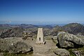 Goatfell Summit2.jpg 3,872 × 2,592; 3.48 MB
-
 Newtonmore toposcope geograph-3481571-by-Ben-Brooksbank.jpg 2,343 × 1,418; 3.7 MB
-

-
 Ralia Toposcope - geograph.org.uk - 1334831.jpg 427 × 640; 80 KB
-
 Summit, Ben Vrackie - geograph.org.uk - 1327298.jpg 640 × 480; 100 KB
-
 Toposcope at Pulpit Hill - geograph.org.uk - 1728301.jpg 430 × 640; 96 KB
-
 Toposcope at Pulpit Hill - geograph.org.uk - 1728309.jpg 640 × 451; 95 KB
-
 Toposcope at The Plock of Kyle - geograph.org.uk - 1399895.jpg 640 × 480; 91 KB
-
 Toposcope Face - geograph.org.uk - 1334849.jpg 640 × 427; 108 KB
-
 Toposcope, Dundee Law - geograph.org.uk - 1626009.jpg 480 × 640; 104 KB
-
 View point indicator Ben Cleuch - geograph.org.uk - 850818.jpg 640 × 480; 74 KB
-
 Viewpoint on East Lomond - geograph.org.uk - 1365809.jpg 640 × 480; 76 KB
-

-
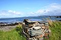 Bruichladdich Toposcope - geograph.org.uk - 1477920.jpg 640 × 427; 81 KB
-
 View from topograph - geograph.org.uk - 158871.jpg 640 × 427; 62 KB


