Category:Topography and history of the Rhine Valley (1870)
Jump to navigation
Jump to search
Media in category "Topography and history of the Rhine Valley (1870)"
The following 28 files are in this category, out of 28 total.
-
Andernach.png 1,974 × 1,707; 5.56 MB
-
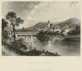
Bacharach.png 1,955 × 1,715; 4.58 MB
-
Basle.png 1,985 × 1,719; 4.38 MB
-
Bonn.png 1,957 × 1,729; 5.32 MB
-
Bregenz.png 2,023 × 1,723; 4.8 MB
-
Castle of Marksburg.png 1,962 × 1,715; 3.99 MB
-
Cologne9.png 1,997 × 1,414; 2.45 MB
-
Constanz, as seen from the harbour.png 1,985 × 1,726; 4.25 MB
-
Council hall at Constanz.png 1,951 × 1,715; 3.84 MB
-
Eglisau.png 1,997 × 1,719; 4.83 MB
-
Ehrenbreitstein.png 1,955 × 1,699; 5.32 MB
-
Elfeldt.png 1,974 × 1,734; 4.06 MB
-
Freiburg.png 2,034 × 1,772; 4.92 MB
-
Friedrichshafen.png 1,997 × 1,692; 4.48 MB
-
Heidelberg9.png 1,942 × 1,716; 4.72 MB
-
Lake of Constanz, and the island of Mainau and Reichenau.png 1,970 × 1,735; 4.68 MB
-
Laufenburg.png 1,974 × 1,707; 4.83 MB
-
Liebenstein - Sternenfels.png 1,951 × 1,711; 4.26 MB
-
Mannheim.png 1,978 × 1,711; 4.25 MB
-
Mayence.png 1,985 × 1,715; 4.94 MB
-
Oppenheim.png 1,985 × 1,738; 5.51 MB
-
Rheinfelden.png 1,989 × 1,724; 5.6 MB
-
Rhine falls, Schaffhausen.png 1,969 × 1,695; 4.57 MB
-
Schaffhausen9.png 1,963 × 1,700; 4.35 MB
-
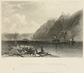
St. Goarhausen.png 2,008 × 1,715; 4.77 MB
-
Strasburg.png 1,430 × 2,348; 4.01 MB
-
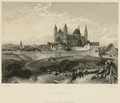
View of Speyer by Myles Birket Forster.png 1,959 × 1,710; 5.71 MB
-
Worms.png 1,975 × 1,696; 4.25 MB

