Category:Topographic maps of the Solomon Islands
Jump to navigation
Jump to search
Media in category "Topographic maps of the Solomon Islands"
The following 8 files are in this category, out of 8 total.
-
Choiseul Topography.png 2,393 × 1,412; 948 KB
-
Guadalcanal Topography.png 2,244 × 1,531; 1.68 MB
-
Makira Topography.png 1,810 × 1,196; 943 KB
-
Malaita Topography.png 1,625 × 1,884; 1.33 MB
-
Map of Guadalcanal.jpg 1,146 × 1,659; 306 KB
-
Map of the Russell Islands.jpg 563 × 387; 77 KB
-
MapaTopográficoIslasSalomón.svg 1,005 × 687; 4.23 MB
-
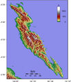
Santa Isabel Island Topography.png 2,789 × 1,931; 1.37 MB


