Category:Topographic maps of the Galápagos Islands
Jump to navigation
Jump to search
Media in category "Topographic maps of the Galápagos Islands"
The following 29 files are in this category, out of 29 total.
-
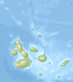
 Ecuador Galápagos Islands location topographic map.png 1,700 × 1,928; 1.14 MB
-
 Ecuador Galápagos Islands physical map.png 850 × 964; 269 KB
-
 Espanola topographic map-de.png 1,931 × 1,396; 465 KB
-
 Espanola topographic map-en.png 1,931 × 1,396; 463 KB
-
 Espanola topographic map-es.png 1,931 × 1,396; 467 KB
-
 Floreana topographic map-de.png 2,138 × 1,454; 788 KB
-
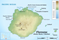 Floreana topographic map-en.png 2,138 × 1,454; 786 KB
-
 Floreana topographic map-es.png 2,138 × 1,454; 793 KB
-
 Galapagos Islands topographic map be.svg 2,160 × 2,160; 2.56 MB
-
 Galapagos Islands topographic map-blank (2).png 2,160 × 2,160; 1.7 MB
-
 Galapagos Islands topographic map-blank.svg 2,160 × 2,160; 2.31 MB
-
 Galapagos Islands topographic map-de.svg 2,160 × 2,160; 2.62 MB
-
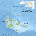
 Galapagos Islands topographic map-en.svg 2,160 × 2,160; 2.62 MB
-
 Galapagos Islands topographic map-fi.svg 2,160 × 2,160; 2.62 MB
-
 Galapagos Islands topographic map-fr.png 2,160 × 2,160; 2.14 MB
-
 Galapagos Islands topographic map-fr.svg 2,160 × 2,160; 2.62 MB
-
 Galapagos Islands topographic map-mk.svg 2,160 × 2,160; 3.51 MB
-
 Genovesa.topographic map-de.png 3,543 × 3,208; 856 KB
-
 Genovesa.topographic map-en.png 3,543 × 3,208; 858 KB
-
 Genovesa.topographic map-es.png 3,543 × 3,208; 847 KB
-
 San Cristobal topographic map-de.png 3,189 × 2,319; 1.55 MB
-
 San Cristobal topographic map-en.png 3,189 × 2,319; 1.55 MB
-
 San Cristobal topographic map-es.png 3,189 × 2,319; 1.55 MB
-
 Santa Cruz topographic map-de.png 3,189 × 3,208; 2.12 MB
-
 Santa Cruz topographic map-en.png 3,189 × 3,208; 2.12 MB
-
 Santa Cruz topographic map-es.png 3,189 × 3,208; 2.12 MB
-
 Santiago (Galapagos) topographic map-de.png 3,548 × 2,485; 1.51 MB
-
 Santiago (Galapagos) topographic map-en.png 3,548 × 2,485; 1.52 MB
-
 Santiago (Galapagos) topographic map-es.png 3,548 × 2,485; 1.53 MB


_topographic_map-de.png)
_topographic_map-en.png)
_topographic_map-es.png)
.png)