Category:Topographic maps of Suriname
Jump to navigation
Jump to search
Subcategories
This category has only the following subcategory.
S
Media in category "Topographic maps of Suriname"
The following 10 files are in this category, out of 10 total.
-
Guianas location map disputed relief.png 2,542 × 1,902; 6.85 MB
-
Map of Surinam Demis.png 954 × 1,048; 241 KB
-
Suriname location map Topographic.png 910 × 927; 1.71 MB
-
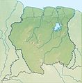
Suriname relief location map.jpg 725 × 740; 115 KB
-
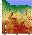
Suriname Topography.png 1,290 × 1,378; 2.8 MB
-
Surinammap.png 546 × 600; 390 KB
-
Topografisch Kaart van Suriname.jpg 800 × 855; 764 KB
-
Topographic Map of Suriname.png 910 × 927; 1.59 MB
-
Vampyrum spectrum distribution (colored).png 1,259 × 944; 2.09 MB
-
Vampyrum spectrum distribution (gray).png 1,259 × 944; 1.03 MB


