Category:Topographic maps of South America
Jump to navigation
Jump to search
Subcategories
This category has the following 9 subcategories, out of 9 total.
+
D
T
Media in category "Topographic maps of South America"
The following 26 files are in this category, out of 26 total.
-
Advanced Geography (1899) (14595061178).jpg 2,912 × 3,828; 2.54 MB
-
Amazon River from space.png 1,527 × 970; 1.74 MB
-
Andes.png 1,062 × 1,144; 1.79 MB
-
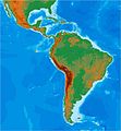
CentralAmerica-Mexico-Caribbean.png 1,920 × 2,133; 270 KB
-
Del Amerika.jpg 750 × 924; 68 KB
-
Europe and other continents (1901) (14576985129).jpg 1,470 × 1,962; 869 KB
-
Falkland Islands topographic map-en librsvg.png 2,550 × 1,990; 1.97 MB
-
Falkland Islands topographic map-en rendersvg.png 2,550 × 1,990; 2.23 MB
-
Geohistoria e.jpg 645 × 700; 64 KB
-
HooglandGuyana.png 852 × 455; 438 KB
-
Kolumbien suedamerika.jpg 1,024 × 1,548; 173 KB
-
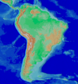
Mapa Hipsometryczna Ameryki Południowej.png 2,744 × 3,500; 2.73 MB
-
Maury Geography 089A South America relief.jpg 1,935 × 2,490; 706 KB
-
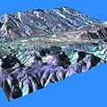
MPP stereo analysis.jpg 512 × 512; 40 KB
-
Peru-Chile trench.jpg 573 × 1,500; 213 KB
-
Relief map of South America.jpg 7,200 × 10,886; 6.33 MB
-
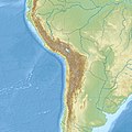
South America laea relief location map.jpg 1,181 × 1,732; 1.71 MB
-
SouthAmerica-ContinentalDivide.png 648 × 838; 795 KB
-
Suedamerika topo.png 1,000 × 1,530; 1.27 MB
-
Syd-Amerika. Flod- och bergssystem, Nordisk familjebok.jpg 2,213 × 3,117; 1.03 MB
-
Tehuantepec Ridge.jpg 1,461 × 864; 817 KB
-
Tiwanaku SA.jpg 794 × 794; 634 KB
-
Topographic map of South America.jpg 7,200 × 10,886; 7.82 MB
-
Weddell-Island-Map.png 588 × 630; 245 KB


