Category:Topographic maps of New Brunswick
Jump to navigation
Jump to search
Provinces and territories of Canada: Alberta · British Columbia · New Brunswick · Ontario · Quebec · Nunavut · Yukon
Media in category "Topographic maps of New Brunswick"
The following 10 files are in this category, out of 10 total.
-
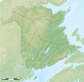
Administrative areas of New Brunswick topographic map-blank.svg 2,237 × 2,199; 3.75 MB
-
Administrative areas of New Brunswick with First Nations land topographic map-blank.svg 2,237 × 2,199; 3.83 MB
-
Carte topographique Bathurst en.svg 1,150 × 800; 444 KB
-
Carte topographique Bathurst fr.svg 1,150 × 800; 444 KB
-
Carte topographique des Provinces Maritimes du Canada.svg 2,928 × 2,106; 973 KB
-
Counties of New Brunswick topographic map-blank.svg 2,237 × 2,199; 3.8 MB
-
Mountains of New Brunswick topographic map-fr.svg 2,237 × 2,199; 3.2 MB
-
New Brunswick topographic map-fr.svg 2,237 × 2,199; 3.31 MB
-
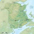
Rivers of New Brunswick topographic map-fr.svg 2,237 × 2,199; 3.41 MB
-
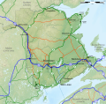
Roads of New Brunswick topographic map-fr.svg 2,237 × 2,199; 3.27 MB


