Category:Topographic maps of Marseille
Jump to navigation
Jump to search
Media in category "Topographic maps of Marseille"
The following 9 files are in this category, out of 9 total.
-
 Aix-Marseille-Provence-Topographie.png 1,460 × 1,218; 1.65 MB
-
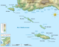
 Archipel de Riou topographic map-blank.svg 1,052 × 840; 546 KB
-
 Archipel de Riou topographic map-fr.svg 1,052 × 840; 936 KB
-
 Carte calanques marseille.jpg 3,307 × 844; 170 KB
-
 Carte d'État-major de la France, Feuille Marseille N.E.jpg 22,913 × 13,880; 114.52 MB
-
 Carte d'État-major de la France, Feuille Marseille N.O.jpg 23,386 × 13,964; 90.38 MB
-
 Marseille Bay.jpg 922 × 605; 55 KB
-
 Marseille carte topographique.jpeg 1,968 × 1,968; 1.11 MB
-
 Sources GIS Coast-fr.svg 4,052 × 2,670; 208 KB


