Category:Topographic maps of Cundinamarca Department
Jump to navigation
Jump to search
Media in category "Topographic maps of Cundinamarca Department"
The following 9 files are in this category, out of 9 total.
-
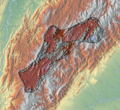 Altiplano Cundiboyacense (subdivisions).png 1,740 × 1,600; 6.57 MB
-
 Altiplano Cundiboyacense.png 1,740 × 1,600; 6.59 MB
-
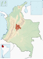 Colombia-deps-cundinamarca.svg 1,420 × 1,896; 875 KB
-
 Cundinamarca Topographic 2.png 1,439 × 1,611; 5.43 MB
-
 Cundinamarca Topographic.png 216 × 250; 98 KB
-
 Parque Nacional Natural Chingaza map de.png 1,191 × 1,048; 2.13 MB
-
 Parque Nacional Natural Chingaza map es.png 1,191 × 1,048; 2.13 MB
-
 Rio Bogota map.png 965 × 833; 1.28 MB
-
 Sabana de Bogota.png 1,068 × 902; 2.4 MB
.png)


