Category:Topographic maps of Châtillon-sur-Loire
Jump to navigation
Jump to search
Media in category "Topographic maps of Châtillon-sur-Loire"
The following 2 files are in this category, out of 2 total.
-
 45087-Châtillon-sur-Loire-Orthophoto.jpeg 10,559 × 7,440; 11.48 MB
-
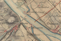 Mantelot - Carte d'État-Major.png 1,228 × 841; 1.68 MB

