Category:Topographic maps of Central America
Jump to navigation
Jump to search
Subcategories
This category has only the following subcategory.
Media in category "Topographic maps of Central America"
The following 23 files are in this category, out of 23 total.
-
 Central America volcanic arc.jpg 4,800 × 4,500; 4.55 MB
-
 Central America volcanic belt.jpg 4,081 × 2,866; 3.02 MB
-
 CentralAmerica-Mexico-Caribbean.png 1,920 × 2,133; 270 KB
-
 CentralAmerica-Mexico-Caribbean2.png 1,221 × 771; 141 KB
-
 Centralamerican-subcontinen.png 414 × 311; 125 KB
-
 Chortis Block.jpg 1,562 × 1,200; 354 KB
-

-
 La2-demis-caribbean gs.png 891 × 561; 68 KB
-
 La2-demis-caribbean.png 891 × 561; 149 KB
-
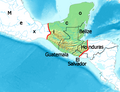
 Maya civilization location map - zh-cn.svg 1,800 × 1,500; 1.52 MB
-
 Maya civilization location map - zh-tw.svg 1,800 × 1,500; 1.52 MB
-
 Maya civilization location map-blank.svg 1,800 × 1,500; 1.49 MB
-
 Maya civilization location map-fa.svg 1,800 × 1,500; 1.53 MB
-
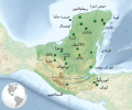
 Maya region w english names.png 1,076 × 828; 312 KB
-
 Maya region w german names.png 1,076 × 828; 320 KB
-
 Mayas.png 1,031 × 757; 1.03 MB
-
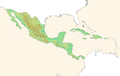
 Mesoamerica topographic map-blank.svg 4,200 × 2,800; 1.55 MB
-
 Middle America relief location map.png 2,000 × 1,344; 3.56 MB
-
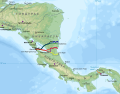 Nicaragua canal proposals - ru.svg 2,149 × 1,684; 713 KB
-
 Relief map of Central America.jpg 1,562 × 1,200; 304 KB
-
 Satellite radar topography of Guatemala.jpg 1,024 × 768; 82 KB
-
 Sites Mayas.png 1,074 × 789; 1.25 MB
-
 Topographic map of Central America.jpg 9,600 × 9,000; 8.2 MB


