Category:Topographic maps of Côtes-d'Armor
Jump to navigation
Jump to search
Media in category "Topographic maps of Côtes-d'Armor"
The following 17 files are in this category, out of 17 total.
-
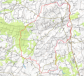 Boqueho opentopomap.png 1,827 × 1,657; 3.68 MB
-
 Brusvily OSM 02.png 459 × 439; 220 KB
-
 Callac opentopomap.png 1,784 × 1,707; 3.74 MB
-
 Cambout opentopomap.png 1,733 × 1,358; 2.6 MB
-
 Canihuel OSM 02.png 419 × 478; 204 KB
-
 Caurel (Côtes-d'Armor) OSM 02.png 562 × 529; 274 KB
-
 Duault opentopomap.png 1,776 × 961; 1.91 MB
-
 Glomel opentopomap.png 1,734 × 1,447; 4.2 MB
-
 Grâces (Côtes-d'Armor) OSM 02.png 402 × 417; 264 KB
-
 Haut corlay opentopomap.png 1,764 × 1,489; 3.07 MB
-
 Hemonstoir opentopomap.png 1,305 × 967; 1.51 MB
-
 La motte 22 opentopomap.png 2,392 × 1,435; 4.21 MB
-
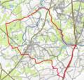
 Lamballe OSM 02.png 658 × 618; 418 KB
-
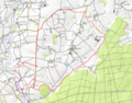
 Lannion OSM 02.png 916 × 712; 1.33 MB
-
 Le Hinglé OSM 02.png 489 × 499; 353 KB
-
 Le Leslay OSM 02.png 582 × 535; 313 KB
-
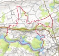
 Lescouet gouarec opentopomap.png 1,685 × 1,283; 2.81 MB


_OSM_02.png)


_OSM_02.png)


