Category:Topographic location maps of provinces of Argentina
Jump to navigation
Jump to search
Elevation legend
[edit]Applies to the series "File:Argentina [province name] topographic location map.png" (December 2022).
Land elevations (inside the province):
negative
0 to 50 m
50 to 100 m
100 to 200 m
200 to 300 m
300 to 400 m
400 to 600 m
600 to 800 m
800 to 1000 m
1000 to 1500 m
1500 to 2000 m
2000 to 2500 m
2500 to 3000 m
3000 to 4000 m
4000 to 5000 m
5000 to 6000 m
above 6000 m
Sea depths:
0 to 50 m
50 to 100 m
100 to 200 m
200 to 300 m
300 to 500 m
500 to 1000 m
1000 to 2000 m
2000 to 3000 m
below 3000 m
Media in category "Topographic location maps of provinces of Argentina"
The following 23 files are in this category, out of 23 total.
-
 Argentina Buenos Aires topographic location map.png 769 × 1,023; 198 KB
-
 Argentina Catamarca topographic location map.png 653 × 768; 130 KB
-
 Argentina Chaco topographic location map.png 664 × 599; 58 KB
-
 Argentina Chubut topographic location map.png 1,024 × 707; 198 KB
-
 Argentina Corrientes topographic location map.png 614 × 599; 96 KB
-
 Argentina Córdoba topographic location map.png 499 × 768; 77 KB
-
 Argentina Entre Ríos topographic location map.png 534 × 768; 103 KB
-
 Argentina Formosa topographic location map.png 776 × 768; 77 KB
-
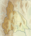
 Argentina Jujuy topographic location map.png 605 × 600; 101 KB
-
 Argentina La Pampa topographic location map.png 705 × 768; 82 KB
-
 Argentina La Rioja topographic location map.png 675 × 768; 132 KB
-
 Argentina Mendoza topographic location map.png 542 × 767; 129 KB
-
 Argentina Misiones topographic location map.png 499 × 600; 105 KB
-
 Argentina Neuquén topographic location map.png 478 × 768; 129 KB
-
 Argentina Río Negro topographic location map.png 1,022 × 768; 206 KB
-
 Argentina Salta topographic location map.png 1,013 × 768; 181 KB
-
 Argentina San Juan topographic location map.png 650 × 767; 143 KB
-
 Argentina San Luis topographic location map.png 450 × 768; 48 KB
-
 Argentina Santa Cruz topographic location map.png 842 × 1,024; 338 KB
-
 Argentina Santa Fe topographic location map.png 614 × 1,023; 102 KB
-
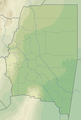 Argentina Santiago del Estero topographic location map.png 519 × 768; 70 KB
-

-
 Argentina Tucumán topographic location map.png 422 × 480; 58 KB


