Category:Tongham
Jump to navigation
Jump to search
English: Tongham is a small Surrey village located close to the north-east Hampshire and Surrey border. The village lies in a triangle between the A31 and the A331. Neighbouring villages include Ash and Badshot Lea.
village in the United Kingdom .jpg) | |||||
| Upload media | |||||
| Instance of | |||||
|---|---|---|---|---|---|
| Location | Guildford, Surrey, South East England, England | ||||
| Area |
| ||||
 | |||||
Subcategories
This category has the following 4 subcategories, out of 4 total.
F
- Former oast houses, Tongham (10 F)
T
- Tongham Christian Fellowship (5 F)
W
- White Hart pub, Tongham (7 F)
Media in category "Tongham"
The following 125 files are in this category, out of 125 total.
-
 A31 - A331 junction - geograph.org.uk - 3539040.jpg 640 × 430; 57 KB
-
 A31 - geograph.org.uk - 5642815.jpg 640 × 426; 39 KB
-
 A31 - geograph.org.uk - 5642818.jpg 640 × 426; 37 KB
-
 A31 bridge over slip road - geograph.org.uk - 5642822.jpg 640 × 426; 45 KB
-
 A31, Blackwater Valley Road turning - geograph.org.uk - 3539025.jpg 640 × 430; 45 KB
-
 Aldershot Crematorium - geograph.org.uk - 336499.jpg 640 × 480; 128 KB
-
 Aldershot Crematorium - geograph.org.uk - 336500.jpg 640 × 480; 66 KB
-
 Aldershot Park - geograph.org.uk - 4883122.jpg 2,000 × 1,333; 3.19 MB
-
 Ash Green - geograph.org.uk - 2498767.jpg 1,800 × 1,200; 299 KB
-
 Ash Green - geograph.org.uk - 3033999.jpg 4,288 × 3,216; 3.45 MB
-

-
 Blackwater Valley Path, Aldershot - geograph.org.uk - 4885131.jpg 2,000 × 1,333; 3.31 MB
-
 Branch Line^ - geograph.org.uk - 2998121.jpg 4,288 × 3,216; 3.66 MB
-
 Chinook Helicopter - geograph.org.uk - 2998158.jpg 2,977 × 1,666; 1.04 MB
-
 Complicated slip road arrangement - geograph.org.uk - 565634.jpg 639 × 420; 48 KB
-
 Disused railway, Tongham - geograph.org.uk - 2382574.jpg 480 × 640; 337 KB
-
 Downland Above White Lane Farm - geograph.org.uk - 3033965.jpg 4,288 × 3,216; 4.2 MB
-
 Downland, Ash Green - geograph.org.uk - 3033954.jpg 4,288 × 3,216; 3.8 MB
-
 Entering Ash Green - geograph.org.uk - 5632256.jpg 640 × 480; 163 KB
-
 Entrance to the A31, Tongham - geograph.org.uk - 2933276.jpg 1,570 × 1,197; 424 KB
-
 Entrance to the Hog's Back Hotel - geograph.org.uk - 4037570.jpg 800 × 600; 116 KB
-
 Evangelical Free Church - geograph.org.uk - 4602702.jpg 640 × 480; 118 KB
-
 Fallow field, Tomgham - geograph.org.uk - 4812804.jpg 2,000 × 1,333; 2.59 MB
-
 Field Edge, Tongham - geograph.org.uk - 2998142.jpg 4,288 × 3,216; 3.56 MB
-
 Field near Tongham - geograph.org.uk - 4812807.jpg 2,000 × 1,333; 2.88 MB
-
 Field near Tongham - geograph.org.uk - 4813530.jpg 1,999 × 1,333; 2.48 MB
-
 Fields, Poyle Park - geograph.org.uk - 2381290.jpg 640 × 480; 290 KB
-
 Footbridge, Blackwater Valley Path - geograph.org.uk - 4883611.jpg 2,000 × 1,333; 3.94 MB
-
 Footbridge, River Blackwater - geograph.org.uk - 4883114.jpg 2,000 × 1,333; 3.29 MB
-
 Footpath across a wheat field - geograph.org.uk - 4602725.jpg 640 × 480; 171 KB
-
 Footpath around field - geograph.org.uk - 4037439.jpg 800 × 600; 150 KB
-

-
 Footpath gate into woodland strip - geograph.org.uk - 4037466.jpg 800 × 600; 243 KB
-
 Footpath going north off Poyle Road - geograph.org.uk - 4037485.jpg 800 × 600; 192 KB
-
 Footpath in Tongham - geograph.org.uk - 2998125.jpg 4,288 × 3,216; 3.74 MB
-
 Footpath near Tongham - geograph.org.uk - 4812169.jpg 2,000 × 1,333; 2.76 MB
-

-
 Footpath reaches White Lane - geograph.org.uk - 4037431.jpg 800 × 600; 218 KB
-

-
 Footpath to Poyle Park - geograph.org.uk - 2998149.jpg 4,288 × 3,216; 3.52 MB
-
 Footpath with pony by Poyle Farm - geograph.org.uk - 4037487.jpg 800 × 600; 205 KB
-
 Footpath with riders - geograph.org.uk - 4037488.jpg 800 × 600; 141 KB
-
 Footpath, Poyle Park - geograph.org.uk - 2381314.jpg 640 × 480; 305 KB
-
 Footpath, Tongham - geograph.org.uk - 2998153.jpg 3,216 × 4,288; 3.45 MB
-
 Former gravel pit, Aldershot - geograph.org.uk - 4883446.jpg 2,000 × 1,333; 2.74 MB
-
 Grange Road, Tongham - geograph.org.uk - 4812809.jpg 2,000 × 1,333; 2.55 MB
-
 Grange Road, Tongham - geograph.org.uk - 4813523.jpg 2,000 × 1,333; 2.44 MB
-
 Green pond at Poyle Farm - geograph.org.uk - 4037478.jpg 800 × 600; 248 KB
-
 Grit bin on White Lane - geograph.org.uk - 3046657.jpg 640 × 428; 109 KB
-
 Hog's Back - geograph.org.uk - 3033933.jpg 4,288 × 3,216; 3.52 MB
-
 Hog's Back Brewery, Tongham - geograph.org.uk - 4812180.jpg 2,000 × 1,333; 1.99 MB
-
 Hog's Back Hotel - geograph.org.uk - 4037553.jpg 800 × 600; 135 KB
-
 Hog's back landing strip - geograph.org.uk - 4812175.jpg 2,000 × 1,333; 2.77 MB
-
 Hogs Back Brewery - geograph.org.uk - 854954.jpg 640 × 480; 84 KB
-
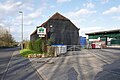
 Hogs Back Brewery, The Street, Tongham, Surrey.jpg 2,587 × 1,940; 1.45 MB
-
 Hogs Back Off Licence - geograph.org.uk - 854969.jpg 480 × 640; 107 KB
-
 House on the Hog's Back - geograph.org.uk - 4813189.jpg 2,000 × 1,333; 3.34 MB
-

-
 Large house on Poyle Road - geograph.org.uk - 4037482.jpg 800 × 600; 193 KB
-
 Leafy seat - geograph.org.uk - 4446107.jpg 640 × 427; 127 KB
-
 Looking along Poyle Road from White Lane - geograph.org.uk - 4037533.jpg 800 × 600; 146 KB
-
 Manor Farm, Tongham - geograph.org.uk - 4812173.jpg 1,999 × 1,333; 2.31 MB
-
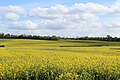
 Oilseed rape.JPG 5,184 × 3,456; 10.04 MB
-

-
 Old Tongham - geograph.org.uk - 2998161.jpg 4,288 × 3,216; 3.83 MB
-
 Overgrown footpath, Tongham - geograph.org.uk - 4812810.jpg 2,000 × 1,333; 2.67 MB
-
 Oxenden Road - geograph.org.uk - 2997147.jpg 4,288 × 3,216; 3.58 MB
-
 Oxenden Road, Tongham - geograph.org.uk - 2998114.jpg 4,288 × 3,216; 3.54 MB
-
 Parade of shops, The Street, Tongham, Surrey.jpg 1,940 × 2,587; 1.49 MB
-
 Poyle Corner Cottages - geograph.org.uk - 4037535.jpg 800 × 600; 153 KB
-
 Poyle Road - geograph.org.uk - 2382616.jpg 640 × 480; 277 KB
-
 Poyle Road looking west - geograph.org.uk - 4037476.jpg 800 × 600; 192 KB
-
 Poyle Road, Tongham - geograph.org.uk - 4812183.jpg 2,000 × 1,333; 2.56 MB
-
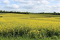
 Rapeseed field in Tongham.jpg 5,184 × 3,456; 8.75 MB
-
 Red Brick Texture - geograph.org.uk - 3033991.jpg 4,288 × 3,216; 3.66 MB
-

-
 Rough pasture - geograph.org.uk - 2632225.jpg 2,272 × 1,704; 2 MB
-
 Slip road off the A31 - geograph.org.uk - 3539029.jpg 640 × 430; 33 KB
-
 Slow Slow Slow - geograph.org.uk - 3033980.jpg 4,288 × 3,216; 3.63 MB
-
 Squire's Holt car park - geograph.org.uk - 2933284.jpg 1,600 × 1,200; 599 KB
-
 St Paul's graveyard, Tongham - geograph.org.uk - 4813525.jpg 2,000 × 1,333; 2.71 MB
-
 St Paul's School - geograph.org.uk - 2998135.jpg 4,288 × 3,216; 3.44 MB
-
 Subway under A331 - geograph.org.uk - 4602680.jpg 640 × 480; 166 KB
-
 Table with a view - geograph.org.uk - 3238651.jpg 640 × 427; 78 KB
-
 The A31 by Squire's Holt restaurant - geograph.org.uk - 2933281.jpg 1,600 × 1,200; 584 KB
-
 The A31 by Squire's Holt restaurant - geograph.org.uk - 2933287.jpg 1,600 × 1,200; 597 KB
-
 The Cricketers, Oxenden Road, Tongham, Surrey.jpg 2,262 × 1,697; 903 KB
-
 The drive to White Lane Farm - geograph.org.uk - 4037424.jpg 800 × 600; 186 KB
-
 The Street, Tongham - geograph.org.uk - 4812805.jpg 2,000 × 1,333; 2.65 MB
-
 Tongham Bowling Club, Oxenden Road, Tongham, Surrey 01.jpg 2,587 × 1,940; 1.59 MB
-
 Tongham Bowling Club, Oxenden Road, Tongham, Surrey 02.jpg 2,552 × 1,914; 971 KB
-
 Tongham Cricket Club - geograph.org.uk - 2998209.jpg 4,288 × 3,216; 3.61 MB
-
 Tongham Pool - geograph.org.uk - 2632218.jpg 2,272 × 1,704; 1.72 MB
-
 Tongham Post Office - geograph.org.uk - 4446100.jpg 427 × 640; 82 KB
-
 Tongham railway station.jpg 1,149 × 737; 147 KB
-
 Tongham Shops (geograph 2997143).jpg 4,288 × 3,216; 3.7 MB
-
 Tongham Village - geograph.org.uk - 2997115.jpg 4,288 × 3,216; 3.7 MB
-
 Tongham village - geograph.org.uk - 4813533.jpg 2,000 × 1,333; 1.97 MB
-
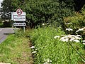
 Tongham village fingerpost sign (cropped).jpg 731 × 1,022; 503 KB
-
 Tongham village fingerpost sign.jpg 2,174 × 1,223; 1.82 MB
-
 Tongham village hall - geograph.org.uk - 4812165.jpg 2,000 × 1,333; 1.95 MB
-
 Tongham War Memorial (geograph 2998216).jpg 3,216 × 4,288; 3.37 MB
-
 Tongham War Memorial, Poyle Road, Tongham, Surrey 01.jpg 1,730 × 2,884; 1.92 MB
-
 Tongham War Memorial, Poyle Road, Tongham, Surrey 02.jpg 1,841 × 2,455; 1.81 MB
-
 Tongham, Spoil Lane - geograph.org.uk - 2382571.jpg 640 × 480; 316 KB
-
 Ugly industrial building in Poyle Park - geograph.org.uk - 4037458.jpg 800 × 600; 149 KB
-
 View from Squire's Holt restaurant car park - geograph.org.uk - 2933291.jpg 1,200 × 1,600; 574 KB
-
 View towards Tongham - geograph.org.uk - 4813200.jpg 2,000 × 1,333; 2.08 MB
-
 Welcome to Ash Parish - geograph.org.uk - 3033924.jpg 4,288 × 3,216; 3.74 MB
-
 White Lane - geograph.org.uk - 3033942.jpg 4,288 × 3,216; 3.67 MB
-
 White Lane, Ash Green - geograph.org.uk - 2855084.jpg 1,600 × 1,200; 564 KB
-
 White Lane, Ash Green - geograph.org.uk - 2855094.jpg 1,600 × 1,200; 543 KB
-
 Windsock, Manor Farm - geograph.org.uk - 4812179.jpg 2,000 × 1,333; 2 MB
-
 Wood, Poyle Park - geograph.org.uk - 2381278.jpg 480 × 640; 331 KB
-
 Woodland, Poyle Park - geograph.org.uk - 2381297.jpg 640 × 480; 405 KB
-
 Aldershot Park - geograph.org.uk - 276839.jpg 640 × 635; 200 KB
-
 Carfax Avenue, Tongham - geograph.org.uk - 101986.jpg 640 × 480; 77 KB
-
 Crooksbury Common - geograph.org.uk - 383097.jpg 640 × 480; 175 KB
-
 Crooksbury Common - geograph.org.uk - 383152.jpg 428 × 640; 202 KB
-
 Crooksbury Hill - geograph.org.uk - 3755.jpg 640 × 480; 68 KB
-
 Grassland by the North Downs Way - geograph.org.uk - 453713.jpg 640 × 480; 122 KB
-
 Hog's Back Hotel - geograph.org.uk - 101991.jpg 640 × 480; 86 KB
-
 Old Road off the Hog's Back - geograph.org.uk - 102333.jpg 640 × 480; 174 KB
-
 Poyle Farm, near Tongham. - geograph.org.uk - 101983.jpg 640 × 480; 136 KB
-
 Timbered House in Tongham - geograph.org.uk - 101987.jpg 640 × 480; 84 KB


.jpg)


.jpg)


