Category:Tolleshunt Major
Jump to navigation
Jump to search
English: Tolleshunt Major is a small village approximately 5 miles north east of Maldon Town,(Maldon District Council) in the county of Essex, UK. Its only streets are Beckingham Street, Bakers Lane, Mill Lane, Witham Road, Tudwick Road and Tolleshunt D'Arcy Road, all situated within the built up part of the village, which consists of just over 100 dwellings.

village in Essex, England, UK  | |||||
| Upload media | |||||
| Instance of | |||||
|---|---|---|---|---|---|
| Location | Maldon, Essex, East of England, England | ||||
| Population |
| ||||
 | |||||
Subcategories
This category has the following 2 subcategories, out of 2 total.
Media in category "Tolleshunt Major"
The following 72 files are in this category, out of 72 total.
-

-
 2020 vision, Day 199 - geograph.org.uk - 6542396.jpg 640 × 480; 86 KB
-
 A Reedy Pond in Tolleshunt Major (geograph 3440880).jpg 640 × 424; 79 KB
-

-
 Baker's Lane, Tolleshunt Major - geograph.org.uk - 4416730.jpg 1,024 × 768; 365 KB
-
 Blackthorn and Bridlepath - geograph.org.uk - 384299.jpg 640 × 426; 108 KB
-
 Bridleway Near Bickleigh Farm - geograph.org.uk - 3452626.jpg 424 × 640; 48 KB
-
 Bridleway off Church Road - geograph.org.uk - 6386185.jpg 1,600 × 1,067; 354 KB
-
 Bridleway off Loamy Hill Road, Tolleshunt Major - geograph.org.uk - 4324575.jpg 1,024 × 1,024; 576 KB
-
 Church Road - geograph.org.uk - 3329788.jpg 1,234 × 1,856; 684 KB
-
 Church Road - geograph.org.uk - 5382943.jpg 640 × 480; 73 KB
-
 Church Road, Tolleshunt Major - geograph.org.uk - 4758618.jpg 640 × 480; 167 KB
-
 Crop field off Maldon Road (B1026) - geograph.org.uk - 5382938.jpg 640 × 480; 35 KB
-
 Crop field off Maldon Road (B1026) - geograph.org.uk - 5382944.jpg 640 × 480; 44 KB
-
 Drain and Bridleway - geograph.org.uk - 3440936.jpg 424 × 640; 106 KB
-
 End of Church Road - geograph.org.uk - 6386194.jpg 1,600 × 1,067; 374 KB
-

-
 Farm track near Goldhanger - geograph.org.uk - 3421661.jpg 640 × 480; 91 KB
-
 Faustian Pact^ - geograph.org.uk - 5171995.jpg 640 × 424; 67 KB
-
 Field by Maldon Road, Goldhanger - geograph.org.uk - 6081230.jpg 1,920 × 1,280; 969 KB
-
 Field near Tolleshunt Major - geograph.org.uk - 4535133.jpg 640 × 480; 139 KB
-
 Field of barley - geograph.org.uk - 4535145.jpg 640 × 480; 124 KB
-
 Footbridge on the Path to Little Totham - geograph.org.uk - 3440958.jpg 424 × 640; 117 KB
-
 Footbridge ^ Primrose Hill - geograph.org.uk - 3452424.jpg 640 × 424; 98 KB
-
 Footpath From Witham Rd - geograph.org.uk - 3452599.jpg 640 × 424; 77 KB
-
 Footpath to Beckingham St - geograph.org.uk - 3440914.jpg 430 × 640; 70 KB
-
 Footpath to Church Rd - geograph.org.uk - 384327.jpg 640 × 426; 83 KB
-
 Footpath to Church Road - geograph.org.uk - 6386058.jpg 1,600 × 1,067; 401 KB
-
 Footpath to Little Totham - geograph.org.uk - 3440950.jpg 424 × 640; 85 KB
-
 Footpath to Loamy Hill Rd - geograph.org.uk - 3452471.jpg 640 × 424; 79 KB
-
 Forestry thinning operation - geograph.org.uk - 6176096.jpg 1,024 × 768; 443 KB
-
 Goldhanger Creek Panorama - geograph.org.uk - 5172022.jpg 640 × 215; 41 KB
-
 Gore Saltings Chalet - geograph.org.uk - 5172032.jpg 640 × 424; 75 KB
-
 Hedge ^ Field Margin - geograph.org.uk - 3452612.jpg 640 × 424; 86 KB
-
 Hedgerow on Maldon Road - geograph.org.uk - 3986878.jpg 1,600 × 1,064; 323 KB
-
 Joyces Marsh - geograph.org.uk - 5172010.jpg 640 × 424; 81 KB
-
 Kissingate to Plains Rd - geograph.org.uk - 3452487.jpg 640 × 424; 65 KB
-

-
 Low Tide west of Gore Saltings. - geograph.org.uk - 195651.jpg 640 × 438; 149 KB
-

-
 Modern Farming in Tolleshunt Major - geograph.org.uk - 3440926.jpg 640 × 424; 64 KB
-
 Orchard, Daymens Hill Farm - geograph.org.uk - 4535255.jpg 640 × 480; 123 KB
-
 Path to Sawyer's Rd - geograph.org.uk - 3452503.jpg 424 × 640; 108 KB
-
 Penny's Brook - geograph.org.uk - 3452463.jpg 424 × 640; 57 KB
-
 Penny's Brook Near Moorah Farm - geograph.org.uk - 3452646.jpg 424 × 640; 71 KB
-

-

-
 Reservoir embankment - geograph.org.uk - 5768715.jpg 1,600 × 1,067; 334 KB
-
 Road junction on Maldon Road (B1026) - geograph.org.uk - 5382941.jpg 640 × 480; 57 KB
-
 Rush hour in Tolleshunt Major - geograph.org.uk - 6547368.jpg 640 × 480; 70 KB
-
 Salt Marsh Channel, by Gore Saltings. - geograph.org.uk - 195658.jpg 640 × 402; 158 KB
-
 Sawyer's Road - geograph.org.uk - 6385981.jpg 1,600 × 1,067; 434 KB
-
 Signpost and stile to footpath, Tolleshunt Major - geograph.org.uk - 4324579.jpg 3,648 × 2,432; 3.27 MB
-

-

-

-
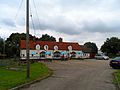 The Beckingham Bell pub, Tolleshunt Major (geograph 4175466).jpg 4,320 × 3,240; 4.06 MB
-
 The south end of Church Road - geograph.org.uk - 4758612.jpg 640 × 480; 129 KB
-
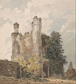 Thomas Girtin - Tolleshunt-Beckingham, Essex - Google Art Project.jpg 3,449 × 3,801; 3.34 MB
-
 Tolleshunt Major church - geograph.org.uk - 4758621.jpg 640 × 428; 140 KB
-
 "New Barn" off Joyce's Chase - geograph.org.uk - 384354.jpg 640 × 426; 114 KB
-
 Toward's Rockleys Farm - geograph.org.uk - 3440969.jpg 640 × 424; 101 KB
-
 Tree on footpath, Tolleshunt Major - geograph.org.uk - 4416853.jpg 1,600 × 1,600; 895 KB
-
 Wheat field, Tolleshunt Major - geograph.org.uk - 4112405.jpg 3,648 × 2,736; 2.87 MB
-
 Entrance to Beckingham Business Park - geograph.org.uk - 262684.jpg 640 × 426; 59 KB
-
 Farmhouse at Little Renters Farm - geograph.org.uk - 262682.jpg 640 × 480; 71 KB
-
 Farmhouse at Voucher's Farm - geograph.org.uk - 262645.jpg 640 × 426; 63 KB
-
 Footpath to Little Totham - geograph.org.uk - 413142.jpg 640 × 437; 61 KB
-
 Footpath to Oxley Green - geograph.org.uk - 413132.jpg 640 × 425; 71 KB
-
 Towards Frame Farm - geograph.org.uk - 425393.jpg 640 × 426; 153 KB
-
 Wicks Manor Farm - geograph.org.uk - 262678.jpg 640 × 411; 63 KB
-

.jpg)


_-_geograph.org.uk_-_5382938.jpg)
_-_geograph.org.uk_-_5382944.jpg)


_off_Maldon_Road_(B1026)_-_geograph.org.uk_-_5382946.jpg)


_towards_Tolleshunt_D%27Arcy_-_geograph.org.uk_-_5382947.jpg)


_-_geograph.org.uk_-_5382941.jpg)


_-_geograph.org.uk_-_6547379.jpg)
_-_geograph.org.uk_-_6547483.jpg)
_-_geograph.org.uk_-_6547496.jpg)
.jpg)


