Category:Tissington and Lea Hall
Jump to navigation
Jump to search
civil parish in Derbyshire Dales district, Derbyshire, England | |||||
| Upload media | |||||
| Instance of |
| ||||
|---|---|---|---|---|---|
| Location | Derbyshire Dales, Derbyshire, East Midlands, England | ||||
 | |||||
Subcategories
This category has the following 3 subcategories, out of 3 total.
L
- Lea Hall, Derbyshire Dales (3 F)
T
- Tissington Ford (20 F)
Media in category "Tissington and Lea Hall"
The following 200 files are in this category, out of 291 total.
(previous page) (next page)-
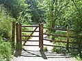 A gate on the path (1) - geograph.org.uk - 5846906.jpg 4,320 × 3,240; 5.06 MB
-
 A gate on the path (2) - geograph.org.uk - 5847016.jpg 4,320 × 3,240; 4.57 MB
-
 A rocky face in Dovedale - geograph.org.uk - 5589397.jpg 4,000 × 3,000; 4.43 MB
-
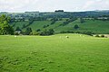
 A view of Dovedale - geograph.org.uk - 5845746.jpg 4,320 × 3,240; 3.71 MB
-
 A view over Dove Dale - geograph.org.uk - 1940330.jpg 640 × 480; 65 KB
-
 A weir below Lea Hall in the Bradbourne Brook - geograph.org.uk - 3823260.jpg 1,368 × 1,824; 640 KB
-
 A Weir In Dovedale - geograph.org.uk - 5226362.jpg 2,399 × 1,599; 837 KB
-
 Along the Limestone Way - geograph.org.uk - 3829014.jpg 4,000 × 2,248; 4.43 MB
-
 An old milepost - geograph.org.uk - 2992542.jpg 3,264 × 2,448; 2.64 MB
-
 Approaching the ford at Bradbourne Mill - geograph.org.uk - 4583965.jpg 800 × 533; 120 KB
-
 Back to the river - geograph.org.uk - 5847033.jpg 4,320 × 3,240; 3.36 MB
-
 Barn in the Bletch Brook valley - geograph.org.uk - 4796244.jpg 800 × 589; 129 KB
-
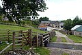
 Barn near Shaw's Farm - geograph.org.uk - 3810158.jpg 4,912 × 3,264; 4.75 MB
-
 Barn or farm^ - geograph.org.uk - 2342769.jpg 3,648 × 2,736; 3.99 MB
-
 Bassett Wood Farm - geograph.org.uk - 3331581.jpg 640 × 427; 196 KB
-

-
 Battered tree near Crake Low - geograph.org.uk - 5581225.jpg 5,040 × 3,667; 4.47 MB
-
 Bentley Brook and Woodeaves Cottage - geograph.org.uk - 320720.jpg 640 × 480; 114 KB
-
 Boardwalk along the River Dove, Dovedale - geograph.org.uk - 4781995.jpg 800 × 600; 200 KB
-
 Boardwalk by River Dove - geograph.org.uk - 5535841.jpg 1,200 × 1,600; 810 KB
-
 Boardwalk on path through Dovedale - geograph.org.uk - 4475797.jpg 1,024 × 768; 356 KB
-
 Bose Low - geograph.org.uk - 5633722.jpg 1,280 × 960; 594 KB
-
 Bradbourne Brook - geograph.org.uk - 320576.jpg 640 × 432; 101 KB
-
 Bridge along the Tissington Trail - geograph.org.uk - 4798398.jpg 800 × 592; 166 KB
-
-
 Bridge over the Tissington Trail near Crakelow Farm - geograph.org.uk - 4173740.jpg 4,000 × 3,000; 2.86 MB
-
 Brookwood Farm - geograph.org.uk - 5009283.jpg 5,025 × 3,350; 1.71 MB
-
 Buttercups and Bradbourne Mill - geograph.org.uk - 4520890.jpg 4,979 × 3,651; 5.61 MB
-
 Buttercups in a new plantation - geograph.org.uk - 1922054.jpg 640 × 480; 104 KB
-
 Causing a splash^ - geograph.org.uk - 4684475.jpg 2,169 × 1,323; 2.81 MB
-
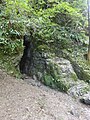
 Cave entrance - geograph.org.uk - 5846910.jpg 3,240 × 4,320; 3.39 MB
-
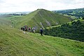
 Climbing Lover's Leap - geograph.org.uk - 5222351.jpg 1,599 × 2,399; 1.01 MB
-
 Clump of nettles and a willow tree - geograph.org.uk - 1922067.jpg 640 × 480; 151 KB
-
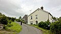
 Cottage at Lees Farm - geograph.org.uk - 1940451.jpg 640 × 480; 86 KB
-
 Cottages in Tissington - geograph.org.uk - 4592183.jpg 6,000 × 4,000; 4.19 MB
-
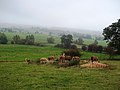
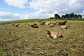 Cows in a harvested field - geograph.org.uk - 4798354.jpg 5,550 × 3,700; 4.83 MB
-
 Cows policing footpaths - geograph.org.uk - 3542197.jpg 3,528 × 2,520; 1.86 MB
-
 Crop near Bassett Wood Farm - geograph.org.uk - 3331585.jpg 640 × 427; 241 KB
-
 Crossing The River Dove - geograph.org.uk - 5222334.jpg 427 × 640; 61 KB
-
 Cyclist's memorial, Tissington - geograph.org.uk - 2866063.jpg 425 × 640; 259 KB
-
 Cyclists on the Tissington Trail - geograph.org.uk - 3331644.jpg 640 × 640; 348 KB
-
 Darfield Barn - geograph.org.uk - 5007789.jpg 5,184 × 3,456; 1.57 MB
-
 Darfield Plantation - geograph.org.uk - 4866132.jpg 1,280 × 960; 511 KB
-
 Descending past The Priory - geograph.org.uk - 4686566.jpg 3,072 × 1,728; 2.9 MB
-
 Dew pond north of Tissington - geograph.org.uk - 5581228.jpg 4,988 × 3,597; 6.7 MB
-
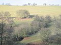
 Dove Dale from path along its eastern rim - geograph.org.uk - 5621931.jpg 5,184 × 2,920; 6.05 MB
-
 Dovedale - geograph.org.uk - 4798488.jpg 6,000 × 4,000; 5.29 MB
-
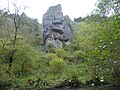
 Dovedale Castle rock formation in the woods by Dove - geograph.org.uk - 5535824.jpg 1,200 × 1,600; 782 KB
-
 Dovedale weir - geograph.org.uk - 3704162.jpg 1,400 × 1,079; 294 KB
-

-

-
 Duck pond at Tissington - geograph.org.uk - 4592177.jpg 6,000 × 4,000; 5.51 MB
-
 Duckboards by the River Dove - geograph.org.uk - 4561034.jpg 6,000 × 4,000; 5.1 MB
-
 East flank of Wibben Hill to the B5056 - geograph.org.uk - 1875973.jpg 1,500 × 996; 1.45 MB
-
 Fallen tree - geograph.org.uk - 5846912.jpg 4,223 × 3,143; 5.02 MB
-
 Farm and Grassland viewed from Bent Lane - geograph.org.uk - 3564818.jpg 3,992 × 2,990; 1.69 MB
-
 Farm buildings at Bent Farm - geograph.org.uk - 3083102.jpg 979 × 734; 244 KB
-
 Farm track south of Wibben Hill - geograph.org.uk - 4854759.jpg 3,800 × 5,184; 6.17 MB
-
 Farmland round Gaglane Barn - geograph.org.uk - 1938954.jpg 640 × 479; 34 KB
-
 Fields above Bletch Brook - geograph.org.uk - 4592306.jpg 6,000 × 4,000; 5.45 MB
-
 Fishing In The River Dove - geograph.org.uk - 5227152.jpg 2,399 × 1,599; 621 KB
-
 Flatts Lane - Tissington - geograph.org.uk - 1875551.jpg 1,500 × 996; 1.78 MB
-
 Footbridge and path over Bletch Brook - geograph.org.uk - 4520406.jpg 3,888 × 5,184; 6.09 MB
-
 Footbridge over Bletch Brook - geograph.org.uk - 772683.jpg 640 × 427; 184 KB
-
 Footpath from Tissington crossing the A515, Derbyshire - geograph.org.uk - 2168616.jpg 2,640 × 1,980; 912 KB
-
-
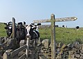
 Footpath signpost near Lees Farm - geograph.org.uk - 1940443.jpg 640 × 480; 82 KB
-
 Footpath to Chapel Lane - geograph.org.uk - 5136352.jpg 1,280 × 960; 425 KB
-
 Footpath to Tissington - geograph.org.uk - 4592223.jpg 6,000 × 4,000; 5.9 MB
-
 Footpath to Tissington - geograph.org.uk - 4592299.jpg 6,000 × 4,000; 4.68 MB
-
 Footpath to Tissington Village - geograph.org.uk - 6020236.jpg 2,000 × 1,333; 1.84 MB
-
 Footpath towards Bostern Grange Farm - geograph.org.uk - 1940486.jpg 640 × 480; 173 KB
-
 Gag Lane - geograph.org.uk - 4348524.jpg 4,000 × 3,000; 3.29 MB
-
 Gagg Lane, near Thorpe, Ashbourne - geograph.org.uk - 314473.jpg 640 × 480; 149 KB
-
 Gardens of Tissington Hall - geograph.org.uk - 5093736.jpg 640 × 427; 60 KB
-
 Gate and stile on a path to Tissington - geograph.org.uk - 1940461.jpg 640 × 480; 110 KB
-
 Gate beside the Tissington Trail - geograph.org.uk - 698699.jpg 640 × 426; 72 KB
-
 Gate on Darfield Lane, Tissington - geograph.org.uk - 1940475.jpg 640 × 480; 88 KB
-
 Gorsehill farm - geograph.org.uk - 2342645.jpg 2,736 × 3,648; 3.87 MB
-
 Gradient indicator by the Tissington Trail - geograph.org.uk - 4592290.jpg 6,000 × 4,000; 3.58 MB
-
 Grassland sloping down towards Ashbourne - geograph.org.uk - 4798390.jpg 6,000 × 4,000; 6.26 MB
-
 Grassland west of Gag Lane - geograph.org.uk - 3542195.jpg 3,648 × 2,736; 2.28 MB
-
 Grazing land above Dovedale - geograph.org.uk - 4798430.jpg 6,000 × 4,000; 5.15 MB
-
 Hall Well Tissington - geograph.org.uk - 5773590.jpg 1,333 × 2,000; 3.26 MB
-
 Hall Well, Tissington - geograph.org.uk - 4427342.jpg 640 × 480; 105 KB
-
 Hand's Well - geograph.org.uk - 5773592.jpg 1,333 × 2,000; 3.29 MB
-
 Heading south on the Tissington Trail - geograph.org.uk - 3829272.jpg 4,000 × 2,248; 6.77 MB
-
 Highwayclose Barn - geograph.org.uk - 5007820.jpg 5,067 × 2,883; 1.71 MB
-
 Hill country north of Thorpe - geograph.org.uk - 1940345.jpg 640 × 480; 73 KB
-
 Hillside above Shaw's Farm - geograph.org.uk - 4592293.jpg 6,000 × 4,000; 5.36 MB
-
 Hollington Barn - geograph.org.uk - 4348513.jpg 4,000 × 3,000; 2.5 MB
-
 Hollington End Farm - geograph.org.uk - 1940350.jpg 640 × 480; 79 KB
-
 Hollington End Farm - geograph.org.uk - 3831308.jpg 800 × 533; 98 KB
-
 Hunger Hill - geograph.org.uk - 5136349.jpg 1,280 × 960; 405 KB
-
 Inquisitive cows west of Gag Lane - geograph.org.uk - 3542196.jpg 3,648 × 2,736; 2.38 MB
-
 Islands in the River Dove near Tissington Spires - geograph.org.uk - 4476236.jpg 1,024 × 768; 358 KB
-
 Jacob's Ladder, Dovedale - geograph.org.uk - 5589946.jpg 4,000 × 3,000; 4.53 MB
-
 King of The Llamas - geograph.org.uk - 4520409.jpg 4,876 × 3,785; 4.87 MB
-
 Landscape above Bentley Brook at Woodeaves Mill - geograph.org.uk - 4686571.jpg 3,072 × 1,728; 3.41 MB
-
 Lea Cottage Farm - geograph.org.uk - 4583968.jpg 800 × 533; 143 KB
-
 Llamas near Gorsehill Farm - geograph.org.uk - 4173426.jpg 4,000 × 3,000; 2.1 MB
-
 Looking south towards Thorpe - geograph.org.uk - 1940333.jpg 640 × 480; 67 KB
-
 Looking towards Tissington Spires in Dovedale - geograph.org.uk - 5589399.jpg 4,000 × 3,000; 4.63 MB
-
 Looking up to Reynard's Cave - geograph.org.uk - 5589957.jpg 4,000 × 3,000; 4.68 MB
-
 Lover's Leap - geograph.org.uk - 4561844.jpg 6,000 × 4,000; 5.22 MB
-
 Lover's Leap, Dovedale - geograph.org.uk - 3782169.jpg 1,600 × 1,064; 400 KB
-
 Make hay while the sun shines - geograph.org.uk - 1922048.jpg 640 × 480; 88 KB
-
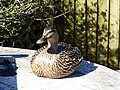 Mallard duck in Tissington - geograph.org.uk - 4427257.jpg 640 × 480; 93 KB
-
 Missing footbridge - geograph.org.uk - 4838917.jpg 1,280 × 960; 637 KB
-
 Moor Barn - geograph.org.uk - 4798452.jpg 6,000 × 4,000; 4.96 MB
-
 Mother and Foal - geograph.org.uk - 2992312.jpg 3,264 × 2,448; 1.77 MB
-
 National Trust Sign - geograph.org.uk - 5222313.jpg 1,599 × 2,399; 636 KB
-
 National Trust sign in Dovedale - geograph.org.uk - 4781811.jpg 800 × 600; 163 KB
-
 Natural arch at Reynard's Cave - geograph.org.uk - 4781962.jpg 800 × 600; 209 KB
-
 Natural arch on east bank of Dovedale - geograph.org.uk - 5535837.jpg 1,200 × 1,600; 849 KB
-
 Natural arch. - geograph.org.uk - 6394058.jpg 1,024 × 768; 261 KB
-
 No flies on me ....^ - geograph.org.uk - 1875539.jpg 1,500 × 996; 1.74 MB
-
 Northern entrance to Thorpe Pastures - geograph.org.uk - 3542361.jpg 3,648 × 2,736; 2.31 MB
-
 Oh dear^ - geograph.org.uk - 2342662.jpg 3,648 × 2,736; 4.39 MB
-
 Old barn near Thorpe Pasture near Dove Dale - geograph.org.uk - 5621928.jpg 5,184 × 2,920; 4.63 MB
-
 Old farming strips - geograph.org.uk - 2342682.jpg 2,736 × 3,648; 3.67 MB
-
 Old Kiln - geograph.org.uk - 5838028.jpg 1,024 × 677; 155 KB
-
 Old limekiln ^ view towards Thorpe Pasture near Dove Dale - geograph.org.uk - 5621927.jpg 5,184 × 2,920; 4.94 MB
-
 On Limestone Way near Shaw's Farm - geograph.org.uk - 3810187.jpg 4,912 × 3,264; 4.19 MB
-
 On the Tissington Trail - geograph.org.uk - 3831320.jpg 800 × 533; 160 KB
-
 On the tops above Dovedale, east side - geograph.org.uk - 2216490.jpg 1,024 × 681; 157 KB
-
 Ordnance Survey Cut Mark - geograph.org.uk - 2992302.jpg 3,264 × 2,448; 2.72 MB
-
 Ordnance Survey Cut Mark - geograph.org.uk - 2992537.jpg 3,264 × 2,448; 2.72 MB
-
 Overgrown pond - geograph.org.uk - 3022387.jpg 2,272 × 1,704; 2.3 MB
-
 Parish Boundary of Tissington and Parwich, Derbyshire - geograph.org.uk - 5434436.jpg 2,710 × 1,795; 3.16 MB
-

-
 Path above Dovedale - geograph.org.uk - 4798478.jpg 6,000 × 4,000; 4.65 MB
-
 Path along the River Dove in Dovedale - geograph.org.uk - 4781905.jpg 800 × 570; 216 KB
-
 Path at the Tissington Spires, Dovedale - geograph.org.uk - 4781919.jpg 800 × 650; 177 KB
-
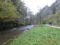
 Path by the River Dove - geograph.org.uk - 4168318.jpg 4,000 × 3,000; 2.66 MB
-
 Path heading northwards through Dovedale - geograph.org.uk - 4781832.jpg 800 × 600; 204 KB
-
 Path in Dove Dale - geograph.org.uk - 4168337.jpg 4,000 × 3,000; 2.35 MB
-
 Path leading down from Lover's Leap - geograph.org.uk - 4781901.jpg 800 × 600; 225 KB
-
 Path leading into Dovedale - geograph.org.uk - 4781755.jpg 800 × 587; 141 KB
-
 Path leaving the River Dove - geograph.org.uk - 4561830.jpg 6,000 × 4,000; 5.82 MB
-
 Path through a mixed crop - geograph.org.uk - 4798370.jpg 6,000 × 4,000; 4.82 MB
-
 Path to the leap - geograph.org.uk - 5847021.jpg 4,320 × 3,240; 3.34 MB
-
 Picnic area along the Tissington Trail - geograph.org.uk - 4798385.jpg 800 × 495; 120 KB
-
 Picnic tables on the trail - geograph.org.uk - 6020250.jpg 2,000 × 1,333; 3.66 MB
-
 Public footpath to Parwich - geograph.org.uk - 3365172.jpg 640 × 421; 219 KB
-
 Public footpath to Parwich - geograph.org.uk - 4592263.jpg 6,000 × 4,000; 4.17 MB
-
 Queueing for the stepping stones across the River Dove - geograph.org.uk - 5535815.jpg 1,600 × 1,200; 766 KB
-
 Rainbow near Parwich - geograph.org.uk - 3810163.jpg 4,912 × 3,264; 5.38 MB
-
 Rakes Lane at its junction with the A515 - geograph.org.uk - 4855157.jpg 4,863 × 3,562; 4.23 MB
-
 Ram pump house - geograph.org.uk - 5847006.jpg 4,320 × 3,240; 4.24 MB
-
 Reynard's Cave - geograph.org.uk - 4561040.jpg 6,000 × 4,000; 5.53 MB
-
 Reynard's Cave - geograph.org.uk - 5603316.jpg 1,739 × 1,181; 473 KB
-
 Reynard's Cave at Dovedale - geograph.org.uk - 4781974.jpg 800 × 600; 228 KB
-
 Reynard's Cave seen from the bank of the River Dove - geograph.org.uk - 5589962.jpg 4,000 × 3,000; 4.67 MB
-
 Reynard's Cave, Dovedale - geograph.org.uk - 4426544.jpg 480 × 640; 134 KB
-
 Reynard's Trig Point with view over Dove Dale - geograph.org.uk - 5621926.jpg 5,184 × 2,920; 4.97 MB
-
-
 Ridge ^ Furrow strips on Wibben Hill - geograph.org.uk - 3083111.jpg 1,142 × 857; 311 KB
-
 River Dove at Tissington Spires - geograph.org.uk - 4168300.jpg 4,000 × 3,000; 2.59 MB
-
 Rock Outcrop In Dovedale - geograph.org.uk - 5226478.jpg 1,580 × 2,363; 588 KB
-
 Rural Scene near Tissington, Derbyshire - geograph.org.uk - 5436148.jpg 3,696 × 2,448; 4.36 MB
-
 Seat beside the Tissington Trail - geograph.org.uk - 3831321.jpg 800 × 533; 144 KB
-
 Secluded corner - geograph.org.uk - 4693191.jpg 3,072 × 1,728; 5.21 MB
-
 Sharp Low 01.jpg 4,000 × 3,000; 5.09 MB
-
 Sharp Low 02.jpg 4,000 × 3,000; 4.93 MB
-
 Sharplow Farm - geograph.org.uk - 3367412.jpg 640 × 424; 226 KB
-
 Sharplow Farm - geograph.org.uk - 3367417.jpg 640 × 427; 217 KB
-
 Sharplow Farm, Tissington - geograph.org.uk - 1938947.jpg 640 × 478; 76 KB
-
 Sharplow Farm, Tissington.jpg 4,000 × 3,000; 1.27 MB
-
 Shaw's farm - geograph.org.uk - 2342699.jpg 3,648 × 2,736; 3.83 MB
-
 Shaw's Farm - geograph.org.uk - 3810192.jpg 2,800 × 2,803; 2.29 MB
-
 Shaw's Farm - geograph.org.uk - 5007831.jpg 5,184 × 3,082; 1.5 MB
-
 Shaw's Farm - geograph.org.uk - 5007838.jpg 5,184 × 2,870; 1.67 MB
-
-
 Sheep grazing hillside by Shaw's Farm - geograph.org.uk - 4592255.jpg 6,000 × 4,000; 4.63 MB
-
-
 Sheep in a mown field - geograph.org.uk - 4592205.jpg 6,000 × 4,000; 5.27 MB
-
 Siegework at Tissington - geograph.org.uk - 4592167.jpg 6,000 × 4,000; 4.91 MB
-
 Slopes above Dovedale - geograph.org.uk - 4798467.jpg 6,000 × 4,000; 4.83 MB
-
 Small cave in Dovedale - geograph.org.uk - 5535842.jpg 1,200 × 1,600; 857 KB
-
 Small islands in the River Dove - geograph.org.uk - 4561047.jpg 6,000 × 4,000; 6.74 MB
-
 Small Valley near Gag Lane - geograph.org.uk - 4348530.jpg 4,000 × 3,000; 2.35 MB
-
 Snow in March - geograph.org.uk - 5366262.jpg 2,000 × 1,333; 1.56 MB
-
 Square Plantation - geograph.org.uk - 4866162.jpg 1,280 × 960; 428 KB
-
 Squeeze stile and gate - geograph.org.uk - 4866183.jpg 1,280 × 960; 866 KB
-
 St Mary's church, Tissington - geograph.org.uk - 4427308.jpg 480 × 640; 150 KB
-
 St Mary's Church, Tissington - geograph.org.uk - 4854735.jpg 5,039 × 3,548; 5.08 MB
-
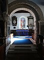 St Mary's Church, Tissington - interior view - geograph.org.uk - 4857596.jpg 3,663 × 5,004; 4.37 MB
-
 St. Mary's church, Tissington - geograph.org.uk - 4427292.jpg 480 × 640; 71 KB
-
 St. Mary's church, Tissington - geograph.org.uk - 4427301.jpg 480 × 640; 87 KB
-
 St. Mary's church, Tissington - geograph.org.uk - 4427311.jpg 480 × 640; 111 KB
-
 St. Mary's church, Tissington - geograph.org.uk - 4427318.jpg 640 × 459; 99 KB
-
 Stained glass window - St Mary's Church, Tissington - geograph.org.uk - 4857597.jpg 3,477 × 4,382; 4.45 MB
-
 Steps leading up to Lover's Leap - geograph.org.uk - 4781888.jpg 800 × 632; 203 KB
-
 Steps leading up to Lover's Leap - geograph.org.uk - 4781895.jpg 708 × 800; 250 KB
-
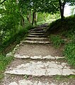
 Steps up to Lover's Leap - geograph.org.uk - 5589393.jpg 4,000 × 3,000; 4.39 MB
-
 Stile on path above Lover's Leap, Dove Dale - geograph.org.uk - 5621929.jpg 5,184 × 2,920; 5 MB
-
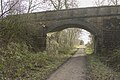 Still has a signal on the bridge - geograph.org.uk - 6020241.jpg 2,000 × 1,333; 3.21 MB
-
 Stone stile in evening light - geograph.org.uk - 3729453.jpg 3,800 × 3,437; 3.87 MB
-
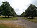 The Avenue near Tissington - geograph.org.uk - 3564802.jpg 4,000 × 3,000; 2.04 MB
_-_geograph.org.uk_-_5846906.jpg)
_-_geograph.org.uk_-_5847016.jpg)


