Category:Tilton on the Hill
Jump to navigation
Jump to search
English: Tilton on the Hill is a village in the civil parish of Tilton on the Hill and Halstead in the Harborough district of Leicestershire. It lies some way north of the A47, on the B6047 to Melton Mowbray. As well as Tilton itself the parish includes Marefield, Halstead . St. Peter's, Tilton, the parish Church is in the parish of Halstead, as is the vicarage.

village in Leicestershire, England, UK  | |||||
| Upload media | |||||
| Instance of | |||||
|---|---|---|---|---|---|
| Location | Tilton on the Hill and Halstead, Harborough, Leicestershire, East Midlands, England | ||||
 | |||||
Subcategories
This category has the following 2 subcategories, out of 2 total.
T
- St Peter, Tilton on the Hill (12 F)
- Tilton railway station (2 F)
Media in category "Tilton on the Hill"
The following 41 files are in this category, out of 41 total.
-
-
 Approaching Tilton on the Hill - geograph.org.uk - 522669.jpg 640 × 446; 133 KB
-
 Back Road near Tilton on the Hill - geograph.org.uk - 752741.jpg 640 × 372; 81 KB
-
 Church and Pub - geograph.org.uk - 522670.jpg 640 × 449; 98 KB
-
 Cottages along Loddington Road in Tilton on the Hill - geograph.org.uk - 4322225.jpg 1,600 × 1,158; 533 KB
-
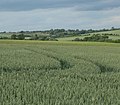
 Countryside viewed from Tilton Lane - geograph.org.uk - 522679.jpg 640 × 467; 127 KB
-
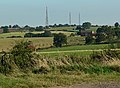
 Electricity Pylons - geograph.org.uk - 522674.jpg 425 × 640; 105 KB
-

-
 Farmhouse south of Tilton on the Hill - geograph.org.uk - 752806.jpg 640 × 407; 69 KB
-

-
 Farmland near Tilton on the Hill - geograph.org.uk - 752627.jpg 629 × 640; 81 KB
-
 Farmland south of Tilton on the Hill - geograph.org.uk - 752973.jpg 640 × 465; 98 KB
-
 Gate and Cattle Grid - geograph.org.uk - 145982.jpg 640 × 480; 80 KB
-
 Main Street, Tilton on the Hill - geograph.org.uk - 3986236.jpg 800 × 600; 233 KB
-
 Main Street, Tilton on the Hill - geograph.org.uk - 3986241.jpg 600 × 800; 310 KB
-

-

-
 Red Lodge Farm, Red Lodge Road, Tilton on the Hill - geograph.org.uk - 6367405.jpg 3,776 × 2,520; 2.99 MB
-
 Robin-a-tiptoe hill.JPG 4,000 × 3,000; 5.74 MB
-
 Scenic view of Tilton on the Hill - geograph.org.uk - 5347541.jpg 3,648 × 2,736; 2.63 MB
-

-
 St Peter's Church spire in Tilton on the Hill - geograph.org.uk - 4322287.jpg 1,600 × 1,181; 593 KB
-
 The Main Street in Tilton on the Hill - geograph.org.uk - 4322216.jpg 1,600 × 1,200; 705 KB
-
 The Old School, Tilton on the Hill (geograph 7013453).jpg 1,024 × 768; 309 KB
-
 Tilton Cutting (SSSI) - geograph.org.uk - 423638.jpg 640 × 480; 93 KB
-
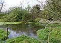 Tilton Moated Site, east side.JPG 3,778 × 2,678; 4.59 MB
-
 Tilton on the Hill headstone, Leicestershire.jpg 881 × 1,200; 356 KB
-
 Tilton on the Hill houses and sheep - geograph.org.uk - 752735.jpg 640 × 443; 77 KB
-
 Tilton on the Hill slate headstone, Leicestershire.jpg 859 × 1,200; 344 KB
-
 Tilton on the Hill Swithland gravestones.jpg 1,200 × 782; 338 KB
-
 Tilton on the Hill Swithland slate headstone.jpg 821 × 1,200; 330 KB
-
 Water Trough - geograph.org.uk - 423673.jpg 640 × 480; 90 KB
-
 Welcome to Tilton on the Hill - geograph.org.uk - 522671.jpg 640 × 480; 136 KB
-
 Whatborough Hill, DMV on eastern slopes.JPG 4,000 × 2,478; 4.21 MB
-
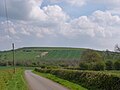
 Whatborough Hill, Leicestershire - geograph.org.uk - 522461.jpg 640 × 468; 116 KB
-

-
 Countryside near Tilton-on-the-Hill - geograph.org.uk - 168281.jpg 640 × 421; 42 KB
-
 Electricity Pylons - geograph.org.uk - 752722.jpg 407 × 640; 61 KB
-
 Farmland near Tilton on the Hill - geograph.org.uk - 205314.jpg 640 × 427; 101 KB
-
 Public footpath to Tilton on the Hill - geograph.org.uk - 205303.jpg 640 × 427; 97 KB
-
 Railway Bridge on Loddington Road - geograph.org.uk - 208335.jpg 640 × 427; 106 KB


.jpg)
_-_geograph.org.uk_-_423638.jpg)


