Category:Tillington, West Sussex
Jump to navigation
Jump to search
Main Wikipedia article: Tillington, West Sussex.

village and civil parish in West Sussex, UK  | |||||
| Upload media | |||||
| Instance of | |||||
|---|---|---|---|---|---|
| Location | Chichester, West Sussex, South East England, England | ||||
| Population |
| ||||
| Area |
| ||||
| official website | |||||
 | |||||
Subcategories
This category has the following 6 subcategories, out of 6 total.
H
- The Horse Guards, Tillington (7 F)
- Tillington House (2 F)
P
- Petworth Park Tower (7 F)
- Pitshill House (10 F)
T
Media in category "Tillington, West Sussex"
The following 200 files are in this category, out of 274 total.
(previous page) (next page)-

-
 A footpath off New Road, Dene Dip - geograph.org.uk - 3969877.jpg 1,536 × 1,032; 996 KB
-
 A272 approaching Tillington - geograph.org.uk - 2539020.jpg 4,000 × 3,000; 3.25 MB
-
 A272 approaching Tillington - geograph.org.uk - 6009965.jpg 1,024 × 683; 697 KB
-
 A272 at Little Common - geograph.org.uk - 3123974.jpg 640 × 480; 59 KB
-
 A272 crossroads at Little Common - geograph.org.uk - 3969917.jpg 1,536 × 1,154; 951 KB
-
 A272 near Tillington - geograph.org.uk - 6000736.jpg 683 × 1,024; 633 KB
-
 A272, eastbound - geograph.org.uk - 5222369.jpg 640 × 336; 38 KB
-
 A272, Little Common - geograph.org.uk - 5222375.jpg 640 × 265; 26 KB
-
 A272, Tillington - geograph.org.uk - 5222386.jpg 640 × 408; 62 KB
-
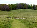
 Across the deer park - geograph.org.uk - 6007713.jpg 1,024 × 683; 473 KB
-
 Agricultural machinery in field - geograph.org.uk - 1213155.jpg 640 × 272; 33 KB
-
 All Hallows Church, Tillington - geograph.org.uk - 6245880.jpg 683 × 1,024; 191 KB
-
 All Hallows Churchyard, Tillington - geograph.org.uk - 6245861.jpg 1,024 × 683; 257 KB
-
 Along the wall - geograph.org.uk - 6009963.jpg 683 × 1,024; 610 KB
-
 An abundance of signposts - geograph.org.uk - 2539041.jpg 4,000 × 3,000; 3.38 MB
-
 Approaching the tiny hamlet of Halfway Bridge - geograph.org.uk - 1872936.jpg 1,600 × 1,200; 608 KB
-
 Approaching Upperton in Spring - geograph.org.uk - 3893069.jpg 3,264 × 2,448; 3.18 MB
-

-
 Bank erosion on the River Rother - geograph.org.uk - 2538887.jpg 4,000 × 3,000; 3.37 MB
-
 Barn at Perryfields - geograph.org.uk - 2538813.jpg 4,000 × 3,000; 3.48 MB
-
 Barn near Coxlands Cottages - geograph.org.uk - 1640139.jpg 640 × 480; 99 KB
-
 Beggar's Corner at Halfway Bridge - geograph.org.uk - 1872931.jpg 1,600 × 1,200; 629 KB
-
 Beggars’ Corner - geograph.org.uk - 6006464.jpg 1,600 × 1,200; 794 KB
-
 Bluebell bank in River Wood - geograph.org.uk - 1872334.jpg 1,600 × 1,200; 900 KB
-
 Bridge on drive to Lordswood Barn - geograph.org.uk - 6449538.jpg 1,024 × 768; 621 KB
-
 Bridge on drive to Lordswood Barn - geograph.org.uk - 6449896.jpg 1,024 × 768; 683 KB
-
 Bridleway BW1027 - geograph.org.uk - 3235866.jpg 4,000 × 3,000; 4.53 MB
-
 Bridleway to River - geograph.org.uk - 2939309.jpg 640 × 480; 172 KB
-
 Brookfield Lane - geograph.org.uk - 6006453.jpg 1,600 × 1,200; 745 KB
-
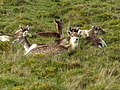
 Buck and does in Petworth Park - geograph.org.uk - 6285567.jpg 640 × 480; 87 KB
-
 Bucks and does in Petworth Park - geograph.org.uk - 6285569.jpg 640 × 480; 108 KB
-
 Building at River Farms - geograph.org.uk - 6006456.jpg 1,024 × 768; 152 KB
-

-
 Cemetery Lane - geograph.org.uk - 6000726.jpg 1,024 × 683; 505 KB
-

-
 Combine harvester at rest - geograph.org.uk - 2538945.jpg 4,000 × 3,000; 3.58 MB
-

-
 Corner stile near Woodbarn - geograph.org.uk - 1872348.jpg 1,600 × 1,200; 569 KB
-
 Cottage seen from the A272 - geograph.org.uk - 6009964.jpg 1,024 × 770; 703 KB
-
 Cottages in Upperton - geograph.org.uk - 6007625.jpg 683 × 1,024; 628 KB
-
 Cricket pavilion at dawn - geograph.org.uk - 6007624.jpg 1,024 × 683; 499 KB
-
 Crop spraying of Beetroot field - geograph.org.uk - 2538925.jpg 4,000 × 3,000; 3.73 MB
-

-
 Dean Lane, Halfway Bridge - geograph.org.uk - 5896212.jpg 1,920 × 1,280; 1.5 MB
-

-
 Deer at Petworth - geograph.org.uk - 6007522.jpg 1,024 × 730; 646 KB
-
 Deer in Petworth - geograph.org.uk - 6007709.jpg 1,024 × 714; 614 KB
-
 Deer in Petworth Park - geograph.org.uk - 6007523.jpg 1,024 × 683; 457 KB
-
 Deer in Petworth Park - geograph.org.uk - 6007736.jpg 1,024 × 683; 444 KB
-
 Deer near the path - geograph.org.uk - 6008468.jpg 1,024 × 683; 549 KB
-

-

-
 Derelict farm building south of Tillington - geograph.org.uk - 2538914.jpg 4,000 × 3,000; 3.35 MB
-
 Dewpond in Petworth Park - geograph.org.uk - 6285171.jpg 640 × 480; 108 KB
-

-
 Ditched in ditch - geograph.org.uk - 2539067.jpg 4,000 × 3,000; 3.46 MB
-
 Dual Carriageway on the A272 - geograph.org.uk - 6006462.jpg 1,024 × 768; 313 KB
-
 Early morning in Petworth - geograph.org.uk - 6007728.jpg 1,024 × 683; 429 KB
-
 Early Purple Orchid.JPG 960 × 1,280; 467 KB
-
 Eel Bridge , midway between Lodsworth and River - geograph.org.uk - 1872322.jpg 1,600 × 1,200; 758 KB
-
 Electricity transmission lines - geograph.org.uk - 5495550.jpg 4,608 × 3,456; 3.9 MB
-

-
 End of Cemetery Lane - geograph.org.uk - 6000727.jpg 1,024 × 683; 638 KB
-
 Entering Tillington, A272 - geograph.org.uk - 5222382.jpg 640 × 362; 50 KB
-
 Entrance to Upperton House - geograph.org.uk - 3893094.jpg 3,264 × 2,448; 2.94 MB
-
 Estate road to Hilltop Barn - geograph.org.uk - 5495558.jpg 4,608 × 3,456; 5.2 MB
-
 Fallen tree - geograph.org.uk - 6007630.jpg 1,024 × 683; 444 KB
-
 Fallow Deer - geograph.org.uk - 3661435.jpg 4,448 × 2,664; 2.94 MB
-
 Fallow deer grazing at Petworth Park - geograph.org.uk - 2401856.jpg 4,000 × 3,000; 2.99 MB
-
 Fallow deer in Petworth Park - geograph.org.uk - 1959979.jpg 2,048 × 1,536; 667 KB
-
 Fallow deer in Petworth Park - geograph.org.uk - 6285572.jpg 640 × 480; 95 KB
-

-

-
 Field and footpath east of Lordswood Barn - geograph.org.uk - 6449840.jpg 1,024 × 768; 278 KB
-
 Field with a view - geograph.org.uk - 1850859.jpg 800 × 600; 96 KB
-
 Flood meadow to the north of River Rother - geograph.org.uk - 2539100.jpg 4,000 × 3,000; 3.43 MB
-
 Flooded minor road - geograph.org.uk - 1212722.jpg 640 × 360; 75 KB
-
 Folly at Peworth - geograph.org.uk - 6007700.jpg 1,024 × 683; 517 KB
-
 Footpath 1012 between Perryfields and the A272 - geograph.org.uk - 2538905.jpg 4,000 × 3,000; 3.5 MB
-
 Footpath by Lordswood Barn - geograph.org.uk - 6449852.jpg 1,024 × 768; 401 KB
-
 Footpath FP1052 - geograph.org.uk - 3235872.jpg 4,000 × 3,000; 2.59 MB
-
 Footpath from the Church - geograph.org.uk - 6000733.jpg 1,024 × 683; 508 KB
-
 Footpath through River Wood - geograph.org.uk - 1872329.jpg 1,600 × 1,200; 828 KB
-
 Footpath to Grittenham farm - geograph.org.uk - 2539073.jpg 4,000 × 3,000; 3.37 MB
-
 Former phone box - geograph.org.uk - 6000729.jpg 1,024 × 683; 569 KB
-
-
 Granary at Lodge Farm - geograph.org.uk - 2951715.jpg 640 × 480; 104 KB
-
 Grittenham Farm - geograph.org.uk - 2539085.jpg 4,000 × 3,000; 3.22 MB
-
 Halfmoon Furze - geograph.org.uk - 4752600.jpg 640 × 480; 100 KB
-
 Halfmoon Furze, Petworth Park - geograph.org.uk - 1847536.jpg 1,600 × 1,200; 546 KB
-
 Heading to the A272 - geograph.org.uk - 6006457.jpg 1,600 × 1,200; 866 KB
-
 Heron in field near Selham Bridge - geograph.org.uk - 1637630.jpg 640 × 480; 120 KB
-
 Hill summit on A272 - geograph.org.uk - 2938959.jpg 640 × 428; 76 KB
-
 Horses grazing near Salmons Bridge - geograph.org.uk - 3824807.jpg 640 × 480; 156 KB
-
 House and recreation ground, Upperton - geograph.org.uk - 3893067.jpg 2,179 × 1,632; 948 KB
-
 House at River - geograph.org.uk - 2002005.jpg 640 × 427; 226 KB
-
 House called Firgrove, Tillington - geograph.org.uk - 1099434.jpg 640 × 360; 77 KB
-
 House in Upperton - geograph.org.uk - 3893073.jpg 2,179 × 1,632; 1.1 MB
-
 House on the A272, Tillington - geograph.org.uk - 5896222.jpg 1,920 × 1,280; 854 KB
-
 House on the A272, Tillington - geograph.org.uk - 5896223.jpg 1,872 × 1,204; 1.27 MB
-
 House on the A272, Tillington - geograph.org.uk - 5896224.jpg 1,920 × 1,280; 1.47 MB
-
 Household cavalry at Tillington (1).JPG 1,280 × 960; 460 KB
-
 Household cavalry at Tillington (2).JPG 960 × 1,280; 485 KB
-
 Household cavalry at Tillington.JPG 1,280 × 960; 410 KB
-
 In Petworth Park - geograph.org.uk - 2002030.jpg 640 × 426; 239 KB
-
 Island transport - geograph.org.uk - 1850712.jpg 800 × 600; 113 KB
-
 Joseph Mallord William Turner 015.jpg 3,200 × 1,420; 417 KB
-
 Junction at Pitshill - geograph.org.uk - 2002018.jpg 640 × 427; 256 KB
-

-
 K6 Telephone Kiosk - geograph.org.uk - 3234773.jpg 4,000 × 3,000; 2.66 MB
-
 K6 Telephone Kiosk ^ ER Post Box - geograph.org.uk - 3235898.jpg 3,051 × 2,344; 1.73 MB
-
 Keepers Lodge - geograph.org.uk - 6006450.jpg 1,024 × 768; 190 KB
-
 Lane Corner - geograph.org.uk - 6006448.jpg 1,024 × 768; 353 KB
-
 Lane Junction near River - geograph.org.uk - 6006446.jpg 1,024 × 768; 368 KB
-
 Lane to Halfway Bridge - geograph.org.uk - 6006463.jpg 1,024 × 768; 311 KB
-
 Lodge at the north of Pheasant Copse - geograph.org.uk - 1850717.jpg 800 × 600; 120 KB
-
 Logpile and lodge - geograph.org.uk - 1850702.jpg 800 × 693; 205 KB
-
 Looking south down unnamed road - geograph.org.uk - 1640118.jpg 640 × 480; 84 KB
-

-
 Male fallow deer in Petworth Park - geograph.org.uk - 6285564.jpg 640 × 480; 78 KB
-
 Manor of Dean.jpg 2,141 × 1,892; 937 KB
-
 Meadow north of Selham - geograph.org.uk - 1637634.jpg 640 × 480; 75 KB
-
 Mistletoe in trees at River - geograph.org.uk - 1639201.jpg 640 × 480; 139 KB
-
 Mobile homes off Brookfield Lane - geograph.org.uk - 3824883.jpg 640 × 480; 103 KB
-
 Morris dancing at Tillington village hall.JPG 1,280 × 960; 503 KB
-
 Muddy track - geograph.org.uk - 5495537.jpg 4,608 × 3,456; 5.95 MB
-
 National speed limit signs - geograph.org.uk - 6007621.jpg 1,024 × 683; 578 KB
-
 New Road - geograph.org.uk - 3824906.jpg 640 × 480; 99 KB
-
 New Road, near Upperton - geograph.org.uk - 3969882.jpg 1,536 × 1,152; 1.27 MB
-

-
-
 Old Manor House.jpg 4,009 × 3,313; 2.19 MB
-
 Old Milestone (geograph 6099237).jpg 442 × 640; 301 KB
-
 One of many locked estate gates into Petworth Park - geograph.org.uk - 1734900.jpg 1,600 × 1,200; 757 KB
-
 Ordnance Survey Trig Pillar S6288 - geograph.org.uk - 2902866.jpg 3,264 × 2,448; 2.83 MB
-
 Over the wall - geograph.org.uk - 6000734.jpg 1,024 × 683; 444 KB
-
 Palms in Upperton - geograph.org.uk - 3893077.jpg 3,264 × 2,448; 1.95 MB
-
 Parkland around dawn - geograph.org.uk - 6007695.jpg 1,024 × 683; 412 KB
-
 Parkland, Tillington - geograph.org.uk - 4257891.jpg 640 × 418; 154 KB
-
 Path across Petworth Park - geograph.org.uk - 6007710.jpg 1,024 × 683; 467 KB
-
 Path and track to River Wood - geograph.org.uk - 1872349.jpg 1,600 × 1,200; 510 KB
-
 Path beside Upperton Road - geograph.org.uk - 6007623.jpg 1,024 × 683; 551 KB
-

-
 Path in Petworth Park - geograph.org.uk - 6007673.jpg 1,024 × 683; 388 KB
-
 Path junction with the A272 near Tillington - geograph.org.uk - 2538963.jpg 4,000 × 3,000; 3.48 MB
-
 Path near the reservoir - geograph.org.uk - 6007707.jpg 1,024 × 683; 500 KB
-
 Path on Upperton Common - geograph.org.uk - 3824923.jpg 640 × 480; 188 KB
-
 Path through Petworth Park - geograph.org.uk - 1960000.jpg 2,048 × 1,536; 647 KB
-
 Perryfields by footpath 1012 - geograph.org.uk - 2538779.jpg 4,000 × 3,000; 3.26 MB
-
 Perryfields seen from the north-west - geograph.org.uk - 1084377.jpg 640 × 360; 33 KB
-
 Petworth after dawn - geograph.org.uk - 6007697.jpg 1,024 × 683; 464 KB
-
 Petworth Park - geograph.org.uk - 3685266.jpg 10,814 × 1,591; 3.51 MB
-
 Petworth Park - geograph.org.uk - 3685271.jpg 4,948 × 1,862; 2.49 MB
-
 Petworth Park - geograph.org.uk - 3941583.jpg 1,200 × 900; 960 KB
-
 Petworth Park - geograph.org.uk - 3941592.jpg 1,198 × 755; 736 KB
-
 Petworth Park - geograph.org.uk - 3941614.jpg 1,200 × 900; 942 KB
-
 Petworth Park - geograph.org.uk - 3941617.jpg 1,200 × 900; 948 KB
-
 Petworth Park - geograph.org.uk - 3941795.jpg 1,214 × 914; 931 KB
-
 Petworth Park - geograph.org.uk - 3941801.jpg 1,024 × 761; 278 KB
-
 Petworth Park - geograph.org.uk - 3942823.jpg 1,200 × 900; 1.45 MB
-
 Petworth Park - geograph.org.uk - 5351232.jpg 4,000 × 3,000; 7.19 MB
-
 Petworth Park - geograph.org.uk - 5351233.jpg 4,000 × 3,000; 6.66 MB
-
 Petworth Park - geograph.org.uk - 5351237.jpg 4,000 × 3,000; 7.68 MB
-
 Petworth Park - geograph.org.uk - 5351244.jpg 4,000 × 3,000; 5.37 MB
-
 Petworth Park - geograph.org.uk - 5351253.jpg 4,000 × 3,000; 5.92 MB
-
 Petworth Park - geograph.org.uk - 5351256.jpg 4,000 × 3,000; 6.53 MB
-
 Petworth Park - geograph.org.uk - 5351259.jpg 4,000 × 3,000; 5.84 MB
-
 Petworth Park - geograph.org.uk - 5351271.jpg 4,000 × 3,000; 4.82 MB
-
 Petworth Park near Upperton Gate - geograph.org.uk - 6007629.jpg 1,024 × 683; 675 KB
-
 Petworth Park path - geograph.org.uk - 6007726.jpg 1,024 × 683; 524 KB
-
 Petworth Park retreat - geograph.org.uk - 5351235.jpg 4,000 × 3,000; 5.75 MB
-
-
 Plough outside All Hallows, Tillington - geograph.org.uk - 1807700.jpg 640 × 480; 139 KB
-

-
 Post Box, Tillington - geograph.org.uk - 6249571.jpg 683 × 1,024; 261 KB
-
 Property on River Lane - geograph.org.uk - 6006440.jpg 1,600 × 1,200; 613 KB
-
 Pylon near Lordswood Barn - geograph.org.uk - 6449830.jpg 1,024 × 768; 256 KB
-
 Reservoir near Halfway Bridge - geograph.org.uk - 2939280.jpg 640 × 480; 82 KB
-
 River House - geograph.org.uk - 6006445.jpg 1,600 × 1,200; 706 KB
-
 River House at River, West Sussex - geograph.org.uk - 1213191.jpg 640 × 360; 78 KB
-
 River Lane approaching River - geograph.org.uk - 1639079.jpg 640 × 480; 126 KB
-
 River Lane, River, West Sussex - geograph.org.uk - 1212782.jpg 640 × 360; 73 KB
-
 Road junction - geograph.org.uk - 3234786.jpg 4,000 × 3,000; 3.75 MB
-
 Roadside on the A272 - geograph.org.uk - 6006461.jpg 1,024 × 768; 233 KB
-
 Rother valley near Perryfields - geograph.org.uk - 1084360.jpg 640 × 360; 83 KB
-
 Rother Valley Walk 12 - geograph.org.uk - 930837.jpg 640 × 301; 57 KB
-
 Roundabouts Farm from bridleway through River Common - geograph.org.uk - 1730004.jpg 1,600 × 1,200; 554 KB
-
 Rushes by Great Spring Pond - geograph.org.uk - 1850707.jpg 800 × 639; 183 KB
-
 Salmons Bridge - geograph.org.uk - 2939258.jpg 640 × 480; 196 KB
-
 SE on the Upperton road to Parkhurst Farm - geograph.org.uk - 1734867.jpg 1,600 × 1,200; 476 KB
-

-
 Signs on diverted footpaths, Pitshill - geograph.org.uk - 3995546.jpg 769 × 1,024; 477 KB
-
 Slight problem with headroom - geograph.org.uk - 1850694.jpg 800 × 600; 222 KB
-
 Sluice wheel in Pheasant Copse - geograph.org.uk - 1850729.jpg 734 × 800; 214 KB
-
 Small conifer plantation in Petworth park - geograph.org.uk - 1735002.jpg 1,600 × 1,200; 612 KB
-
 Snowdrops and catkins on river bank near Lodge Farm - geograph.org.uk - 1730078.jpg 1,600 × 1,200; 710 KB
-
 Steep drop to River Rother tributary in River Wood - geograph.org.uk - 1872340.jpg 1,600 × 1,200; 797 KB
-
 Steep footpath at River, West Sussex - geograph.org.uk - 1213184.jpg 360 × 640; 110 KB
-
 Steps into Petworth Park - geograph.org.uk - 6007626.jpg 683 × 1,024; 646 KB


.JPG)
.JPG)


_-_geograph.org.uk_-_3995523.jpg)

.jpg)


