Category:Tilford
Jump to navigation
Jump to search
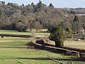
English: Tilford is a small village about two miles South of Farnham in Surrey, England. It lies within an Area of Outstanding Natural Beauty (AONB)
village and civil parish in Surrey, England  | |||||
| Upload media | |||||
| Instance of | |||||
|---|---|---|---|---|---|
| Location | Waverley, Surrey, South East England, England | ||||
| Area |
| ||||
 | |||||
Subcategories
This category has the following 11 subcategories, out of 11 total.
A
B
- Barley Mow, Tilford (18 F)
C
- Coronation Oak, Tilford (2 F)
F
H
- Tilford House (2 F)
R
T
- Tilford Institute, Tilford (4 F)
- Tilford Oak (3 F)
Media in category "Tilford"
The following 200 files are in this category, out of 227 total.
(previous page) (next page)-
 "Stop Line" at Tilford - geograph.org.uk - 2774602.jpg 4,288 × 3,216; 3.72 MB
-
 Tilford 2021-06-03 11.44.12.jpg 4,032 × 3,024; 5.2 MB
-
 Tilford 2021-06-03 12.05.47.jpg 4,032 × 3,024; 4.1 MB
-

-
 Activity area, Garner's Field - geograph.org.uk - 6465131.jpg 4,288 × 2,848; 2.21 MB
-
 Alice Holt Forest - Bourne Wood - geograph.org.uk - 4601703.jpg 640 × 480; 186 KB
-
 Authors Cricket Club 21st-century revival team at Tilford.jpg 5,990 × 3,956; 5.3 MB
-
 B3001 east of Starcross Farm - geograph.org.uk - 4052624.jpg 3,240 × 2,342; 1.61 MB
-
 B3001 in woodland near Farnham - geograph.org.uk - 1918380.jpg 640 × 480; 117 KB
-
 B3001 northeast of Waverley Mill Bridge - geograph.org.uk - 4052623.jpg 3,648 × 2,392; 2.38 MB
-
 Barn, Tilford (geograph 6466008).jpg 4,168 × 2,420; 1.13 MB
-
 Bend in Waverley Lane - geograph.org.uk - 5677818.jpg 640 × 480; 101 KB
-
 Bend on Whitmead Lane near Tilford - geograph.org.uk - 2296285.jpg 800 × 600; 202 KB
-
 Bend past Waverley Mill - geograph.org.uk - 4176153.jpg 1,024 × 683; 239 KB
-
 Bridge under repair, Tilford - geograph.org.uk - 6465506.jpg 4,288 × 2,848; 1.56 MB
-
 Bridge under repair, Tilford - geograph.org.uk - 6465557.jpg 4,288 × 2,848; 1.78 MB
-
 Bridleway by Turner's Hill - geograph.org.uk - 2995418.jpg 4,288 × 3,216; 3.76 MB
-
 Bridleway leaves byway near Tilford - geograph.org.uk - 1352199.jpg 640 × 360; 82 KB
-
 Bridleway off Sheephatch Lane - geograph.org.uk - 2298068.jpg 800 × 600; 209 KB
-
 Bridleway on Farnham Heath - geograph.org.uk - 2774348.jpg 4,288 × 3,216; 3.59 MB
-

-

-
 Bridleway to Tilford - geograph.org.uk - 6465940.jpg 3,749 × 2,245; 1.15 MB
-
 Bridleway to Waverley Cottages - geograph.org.uk - 6466039.jpg 4,288 × 2,848; 2.74 MB
-
 Bugatti - geograph.org.uk - 2774904.jpg 4,288 × 3,216; 3.51 MB
-
 Byway beside Sheephatch Farm - geograph.org.uk - 5350078.jpg 640 × 427; 107 KB
-
 Byway junction with Crooksbury Road - geograph.org.uk - 2296311.jpg 800 × 600; 196 KB
-
 Byway off Whitmead Lane near Tilford - geograph.org.uk - 2296247.jpg 800 × 600; 176 KB
-
 Camp Hill - geograph.org.uk - 3643982.jpg 640 × 430; 136 KB
-
 Camp Hill - geograph.org.uk - 3643990.jpg 640 × 430; 114 KB
-
 Camp Hill junction with Crooksbury Road - geograph.org.uk - 2296336.jpg 800 × 600; 170 KB
-
 Charles Hill - geograph.org.uk - 5870543.jpg 2,078 × 1,517; 588 KB
-
 Climbing tower, Garner's Field - geograph.org.uk - 6465115.jpg 2,671 × 3,875; 1.24 MB
-
 Cobbett's Ridge - geograph.org.uk - 3643994.jpg 640 × 430; 119 KB
-
 Cottage at Tilford.jpg 534 × 274; 52 KB
-
 Cottage on Camp Hill - geograph.org.uk - 2967553.jpg 2,848 × 2,134; 1.12 MB
-
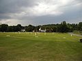
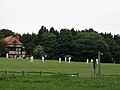 Cricket on the Village Green. Tilford - geograph.org.uk - 453442.jpg 640 × 480; 61 KB
-
 Crooksbury Rd - geograph.org.uk - 3644075.jpg 640 × 430; 94 KB
-
 Crooksbury Road - geograph.org.uk - 6466041.jpg 2,848 × 4,288; 2.37 MB
-
 Donations gratefully accepted - geograph.org.uk - 1351920.jpg 360 × 640; 89 KB
-
 Driveway leading to Foxglade, off Whitmead Lane - geograph.org.uk - 5784077.jpg 768 × 1,024; 305 KB
-
 East end of Stockbridge Pond - geograph.org.uk - 4353550.jpg 640 × 480; 171 KB
-
 Edgeborough School, aerial - geograph.org.uk - 3515393.jpg 1,024 × 683; 198 KB
-
 Entrance on Crooksbury Road - geograph.org.uk - 2296326.jpg 800 × 600; 224 KB
-
 Entrance to Arkesden on Whitmead Lane - geograph.org.uk - 2296271.jpg 800 × 600; 185 KB
-
 Entrance to Whitmead - geograph.org.uk - 2296251.jpg 800 × 600; 152 KB
-
 Farm gates near Tilford, Surrey - geograph.org.uk - 4298292.jpg 3,872 × 2,592; 4.62 MB
-
 Farnham Heath - geograph.org.uk - 2774455.jpg 4,288 × 3,216; 3.73 MB
-
 Farnham Heath Nature Reserve - geograph.org.uk - 2774443.jpg 4,288 × 3,216; 3.49 MB
-
 Farnham Heath Regeneration - geograph.org.uk - 2774323.jpg 4,288 × 3,216; 3.46 MB
-
 Feeding Time by Tilford House Farm - geograph.org.uk - 2774300.jpg 4,288 × 3,216; 3.83 MB
-
 Field in front of the Museum of Rural Life, Tilford - geograph.org.uk - 2220104.jpg 1,600 × 1,200; 612 KB
-
 Flying the flag on Botany Hill - geograph.org.uk - 2296341.jpg 600 × 800; 185 KB
-
 Footpath off Whitmead Lane near Tilford - geograph.org.uk - 2296261.jpg 800 × 600; 178 KB
-
 Forest Meets Heath - geograph.org.uk - 2774480.jpg 4,288 × 3,216; 3.75 MB
-
 Forest Tools, Farnham Heath - geograph.org.uk - 2774538.jpg 4,288 × 3,216; 3.45 MB
-
 Former Independent Chapel, Tilford House, Tilford (June 2015).JPG 4,200 × 2,800; 1.95 MB
-
 Frensham Rural Life Centre - geograph.org.uk - 5631878.jpg 747 × 491; 230 KB
-
 Frensham Rural Life Centre - geograph.org.uk - 5632951.jpg 814 × 555; 327 KB
-
 Garner's Field - geograph.org.uk - 6248330.jpg 3,136 × 2,216; 1.06 MB
-
 Garner's Field - geograph.org.uk - 6465064.jpg 3,902 × 2,574; 2.12 MB
-
 Garner's Field - geograph.org.uk - 6465118.jpg 3,409 × 2,026; 774 KB
-
 Garner's Field - geograph.org.uk - 6465121.jpg 4,211 × 2,453; 1.64 MB
-
 Gorse, Farnham Heath - geograph.org.uk - 2774337.jpg 4,288 × 3,216; 3.49 MB
-
 Grange Road in Rushmoor in Surrey - geograph.org.uk - 1352255.jpg 640 × 360; 65 KB
-
 Grange Road, Rushmoor - geograph.org.uk - 4040305.jpg 2,048 × 1,536; 1.39 MB
-
 Green for Go - geograph.org.uk - 2774566.jpg 4,288 × 3,216; 3.56 MB
-
 Green Lane by the entrance to Starcross Farm - geograph.org.uk - 3179803.jpg 2,048 × 1,536; 1.49 MB
-
 Greensand Way by Sheephatch - geograph.org.uk - 2774556.jpg 4,288 × 3,216; 3.6 MB
-
 Greensand Way by Tilford - geograph.org.uk - 2774585.jpg 4,288 × 3,216; 3.48 MB
-
 Hankley Common, aerial 2016 - geograph.org.uk - 4994942.jpg 640 × 405; 48 KB
-
 Henry S. Salt and his wife Kate in Tilford.jpg 661 × 540; 88 KB
-
 Horse and rider on Tankersford Common - geograph.org.uk - 1352225.jpg 360 × 640; 107 KB
-
 Horses in a field, Sheephatch Copse - geograph.org.uk - 4335953.jpg 4,608 × 3,456; 4.9 MB
-
 Horses led and ridden - geograph.org.uk - 4353532.jpg 640 × 480; 167 KB
-

-
 House at Tilfordmill Bridge - geograph.org.uk - 5069644.jpg 2,448 × 3,264; 3.41 MB
-
 House near Tilford - geograph.org.uk - 2296234.jpg 800 × 600; 188 KB
-
 House, Waverley Lane - geograph.org.uk - 3643962.jpg 640 × 430; 100 KB
-
 Houses near Tilford - geograph.org.uk - 2296227.jpg 800 × 600; 180 KB
-
 Junction with Sheephatch Lane - geograph.org.uk - 6465207.jpg 4,288 × 2,848; 1.64 MB
-

-
 Lodge, Moor Park - geograph.org.uk - 3643951.jpg 640 × 430; 121 KB
-

-
-
 Meadow by the Wey - geograph.org.uk - 6465317.jpg 4,288 × 2,848; 2.1 MB
-
 Meadow by the Wey - geograph.org.uk - 6465823.jpg 4,239 × 2,394; 1.25 MB
-
 Memorial on Stockbridge Pond - geograph.org.uk - 2296193.jpg 600 × 800; 131 KB
-
 Miniature lectern on bridleway - geograph.org.uk - 1352214.jpg 640 × 360; 87 KB
-
 Old entrance - geograph.org.uk - 4175980.jpg 1,024 × 683; 217 KB
-
 Open fields with horses - geograph.org.uk - 5069632.jpg 3,264 × 2,448; 1.68 MB
-
 Paddock by Whitmead Lane near Tilford - geograph.org.uk - 2296281.jpg 800 × 600; 160 KB
-
 Pill Box, Tilford - geograph.org.uk - 2774594.jpg 4,288 × 3,216; 3.41 MB
-
 Pillbox Type 25, Sheephatch Lane (rear).JPG 1,600 × 1,200; 653 KB
-
 Pond at Waverleymill Bridge - geograph.org.uk - 4335896.jpg 4,608 × 3,456; 5.07 MB
-
 Pond on Farnham Heath - geograph.org.uk - 2774424.jpg 4,288 × 3,216; 4.03 MB
-
 Public byway to Stockbridge Pond - geograph.org.uk - 4353542.jpg 640 × 480; 156 KB
-
 Red Car - geograph.org.uk - 2774892.jpg 4,288 × 3,216; 3.5 MB
-
 Red ^ White Parapets, Tilford Bridge - geograph.org.uk - 5674922.jpg 3,888 × 2,592; 3.29 MB
-
 Reeds Road Station - geograph.org.uk - 2774380.jpg 4,288 × 3,216; 3.74 MB
-
 River view from the bridge at Tilford - geograph.org.uk - 4335963.jpg 4,608 × 3,456; 4.51 MB
-
 River Wey (South branch) - geograph.org.uk - 2960645.jpg 2,134 × 2,848; 998 KB
-
 River Wey - geograph.org.uk - 6465970.jpg 2,821 × 3,848; 1.48 MB
-
 River Wey at Tilford - geograph.org.uk - 4335960.jpg 4,608 × 3,456; 4.72 MB
-
 River Wey at Tilford - geograph.org.uk - 5674935.jpg 3,888 × 2,592; 3.36 MB
-
 River Wey at Tilford - geograph.org.uk - 5689981.jpg 3,647 × 2,400; 2.71 MB
-
 River Wey at Tilford - geograph.org.uk - 6465511.jpg 2,848 × 4,288; 839 KB
-
 River Wey at Tilford - geograph.org.uk - 6465564.jpg 4,288 × 2,848; 1.4 MB
-
 River Wey at Tilford Common - geograph.org.uk - 383106.jpg 640 × 480; 158 KB
-
 River Wey near Garner's Field - geograph.org.uk - 6465203.jpg 3,918 × 2,538; 1.13 MB
-
 River Wey near Hankley Farm - geograph.org.uk - 272489.jpg 480 × 640; 181 KB
-
 River Wey near Tilford - geograph.org.uk - 2774549.jpg 4,288 × 3,216; 3.44 MB
-
 Rolling Fields - geograph.org.uk - 5069640.jpg 3,264 × 2,448; 1.46 MB
-
 Sand, heather and pines - geograph.org.uk - 4601645.jpg 640 × 480; 202 KB
-
 Sheep at Tilford - geograph.org.uk - 2298088.jpg 800 × 600; 139 KB
-
 Sheephatch Lane - geograph.org.uk - 4601597.jpg 640 × 480; 192 KB
-
 Sheephatch Lane - geograph.org.uk - 4601626.jpg 640 × 480; 180 KB
-
 Sheephatch Lane - geograph.org.uk - 6465213.jpg 2,848 × 4,288; 2.63 MB
-
 Shelter, Garner's Field - geograph.org.uk - 6465127.jpg 4,288 × 2,848; 2.14 MB
-
 Signpost at path junction - geograph.org.uk - 6465690.jpg 4,288 × 2,848; 2.22 MB
-
 Sluice Gate at Waverleymill Bridge - geograph.org.uk - 2466281.jpg 2,560 × 1,920; 2.26 MB
-
 Squires Hill Lane - geograph.org.uk - 2774572.jpg 4,288 × 3,216; 3.4 MB
-

-
 Squires Hill Lane, Tilford - geograph.org.uk - 6465403.jpg 3,847 × 1,782; 1.09 MB
-
 Steep path to the summit of Crooksbury Hill - geograph.org.uk - 4952214.jpg 3,264 × 2,448; 4.44 MB
-

-
 Stockbridge Pond - geograph.org.uk - 1745494.jpg 2,048 × 1,536; 649 KB
-
 Stockbridge Pond - geograph.org.uk - 4298283.jpg 3,872 × 2,592; 4.37 MB
-
 Stockbridge Pond - geograph.org.uk - 5267221.jpg 2,560 × 1,920; 3.77 MB
-
 Stockbridge Pond between trees - geograph.org.uk - 4335979.jpg 4,608 × 3,456; 5.42 MB
-
 Stockbridge Pond, view south - geograph.org.uk - 4335975.jpg 4,608 × 3,456; 5.45 MB
-
 Stormy Sky at Tilford - geograph.org.uk - 5676074.jpg 3,703 × 2,176; 2.23 MB
-
 Sunset, Farnham Heath - geograph.org.uk - 6466032.jpg 3,550 × 2,160; 464 KB
-
 Sunset, Tilford - geograph.org.uk - 6466012.jpg 3,326 × 2,165; 933 KB
-
 Sunset, Tilford - geograph.org.uk - 6466023.jpg 4,198 × 2,490; 752 KB
-
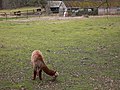 Surrey alpacas - geograph.org.uk - 2296297.jpg 800 × 600; 178 KB
-
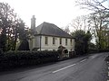
 The Duke of Cambridge pub - geograph.org.uk - 1745506.jpg 1,200 × 1,600; 338 KB
-
 The end of Camp Hill - geograph.org.uk - 3644000.jpg 640 × 430; 121 KB
-
 The King's Oak, Tilford - geograph.org.uk - 2774239.jpg 3,216 × 4,288; 3.53 MB
-
 The Reeds Road - geograph.org.uk - 2774286.jpg 4,288 × 3,216; 3.43 MB
-
 The Reeds Road, Tilford - geograph.org.uk - 3179434.jpg 2,048 × 1,536; 1.52 MB
-
 The River Wey at Waverley Mill Bridge - geograph.org.uk - 5408992.jpg 800 × 600; 194 KB
-
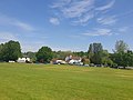
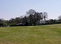 The village green at Tilford, Surrey - geograph.org.uk - 1843022.jpg 1,600 × 1,155; 500 KB
-
 Tilford - geograph.org.uk - 294964.jpg 640 × 480; 137 KB
-
 Tilford Church - geograph.org.uk - 5267205.jpg 2,560 × 1,920; 2.82 MB
-
 Tilford Garage - geograph.org.uk - 3179012.jpg 2,048 × 1,536; 1.56 MB
-
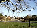
 Tilford Green - geograph.org.uk - 383972.jpg 640 × 480; 155 KB
-
 Tilford Green.jpg 800 × 600; 78 KB
-
 Tilford House Farmhouse (geograph 6466019).jpg 4,002 × 2,219; 1.79 MB
-
 Tilford Road - geograph.org.uk - 3179019.jpg 2,048 × 1,536; 1.49 MB
-
 Tilford Road, Rushmoor - geograph.org.uk - 4040302.jpg 2,048 × 1,536; 1.28 MB
-
 Tilford Village - geograph.org.uk - 2960625.jpg 4,595 × 1,010; 1.04 MB
-
 Tilford village green - geograph.org.uk - 1918373.jpg 800 × 600; 100 KB
-
 Tilford, Bridleway - geograph.org.uk - 4176061.jpg 4,608 × 3,456; 6.19 MB
-
 Tilford, Byway Open to All Traffic - geograph.org.uk - 4176069.jpg 4,608 × 3,456; 6.07 MB
-
 Tilford, Cricket on the village green - geograph.org.uk - 4176039.jpg 4,608 × 3,456; 6.41 MB
-
 Tilford, Cricket on the village green - geograph.org.uk - 4176046.jpg 4,608 × 3,456; 6.3 MB
-
 Tilford, Lane leading to Herons Wey - geograph.org.uk - 4176089.jpg 4,608 × 3,456; 6.62 MB
-
 Tilford, River Wey, Northern Arm - geograph.org.uk - 4176119.jpg 4,608 × 3,456; 6.44 MB
-
 Tilford, Spectators at the cricket match - geograph.org.uk - 4176056.jpg 4,608 × 3,456; 6.17 MB
-
 Tilford, St. Paul's C of E Primary School - geograph.org.uk - 4176132.jpg 4,608 × 3,456; 6.4 MB
-
 Tilford, Surrey, All Saints C of E Primary School - geograph.org.uk - 1959115.jpg 3,456 × 2,304; 5.71 MB
-
 Tilfordmill Cottage - geograph.org.uk - 4176079.jpg 4,608 × 3,456; 6.36 MB
-
 Tilfordmill Cottage - geograph.org.uk - 6248340.jpg 2,718 × 3,844; 1.56 MB
-
 Tower by Squires Hill Lane, Tilford - geograph.org.uk - 6465412.jpg 2,393 × 3,269; 1.47 MB
-
 Tower near Tilhill House, Tilford, Surrey.jpg 5,152 × 3,864; 4.42 MB
-
 Track and field near Islamabad - geograph.org.uk - 6465343.jpg 4,288 × 2,848; 2.1 MB
-
 Track near Sheephatch Farm - geograph.org.uk - 5069647.jpg 3,264 × 2,448; 2.87 MB
-
 Track near the Wey - geograph.org.uk - 6248349.jpg 4,247 × 2,732; 2.43 MB
-
 Track near Tilford - geograph.org.uk - 6465287.jpg 2,629 × 3,252; 1.56 MB
-
 Track near Tilford - geograph.org.uk - 6465360.jpg 2,612 × 3,024; 1.5 MB
-

-
 Track to byway near Tilford - geograph.org.uk - 2296214.jpg 800 × 600; 202 KB
-
 Track to RSPB Farnham Heath - geograph.org.uk - 6466029.jpg 4,288 × 2,848; 1.18 MB
-
 Trees by the North Wey - geograph.org.uk - 6465948.jpg 4,288 × 2,848; 1.8 MB
-
 Twin bridges at Tilford - geograph.org.uk - 6465959.jpg 4,288 × 2,848; 2.18 MB
-
 Victorian Postbox, Waverley Lane - geograph.org.uk - 3643960.jpg 430 × 640; 68 KB
-
 View through a gate - geograph.org.uk - 4298288.jpg 3,872 × 2,592; 4.48 MB
-
 View to the west from Tilfordmill Bridge - geograph.org.uk - 2298073.jpg 600 × 800; 103 KB
-
 Village green, Tilford - geograph.org.uk - 4335966.jpg 4,608 × 3,456; 4.21 MB
-
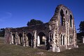 Waverley Abbey, near Farnham - geograph.org.uk - 6460057.jpg 1,799 × 1,199; 434 KB
-
 Waverley Mill Cottage.jpg 5,152 × 3,864; 10.03 MB
-
 Waverley School, Tilford - geograph.org.uk - 2960635.jpg 2,588 × 1,436; 785 KB
-
 Waverleymill Weir - geograph.org.uk - 2466312.jpg 1,920 × 2,560; 2.31 MB
-
 Weir on the corner - geograph.org.uk - 4175978.jpg 1,024 × 683; 233 KB
-
 Whitmead Lane - geograph.org.uk - 5784096.jpg 768 × 1,024; 340 KB
-
 Whitmead Lane near Tilford - geograph.org.uk - 2296277.jpg 600 × 800; 175 KB
-
 Woodland by Camp Hill - geograph.org.uk - 3643983.jpg 640 × 430; 129 KB
-
 Woodland by Camp Hill - geograph.org.uk - 3643989.jpg 640 × 430; 115 KB
-
 Woodland by Camp Hill - geograph.org.uk - 3643996.jpg 640 × 430; 137 KB
-
 Woodland by Camp Hill - geograph.org.uk - 3643998.jpg 640 × 430; 144 KB
-
 Woodland Path on Farnham Heath - geograph.org.uk - 2774530.jpg 4,288 × 3,216; 3.52 MB
-
 Woodland Path, Farnham Heath - geograph.org.uk - 2774513.jpg 4,288 × 3,216; 3 MB
-
 Woodland, Farnham Heath - geograph.org.uk - 4601672.jpg 640 × 480; 206 KB
-
 World War II GHQ Line defences overlooking Tilford Bridge, Surrey 01.jpg 5,152 × 3,864; 10.39 MB
-
 World War II GHQ Line defences overlooking Tilford Bridge, Surrey 02.jpg 3,864 × 5,152; 4.36 MB
-
 World War II GHQ Line defences overlooking Tilford Bridge, Surrey 03.jpg 3,864 × 5,152; 4.38 MB
-
 World War II GHQ Line defences overlooking Tilford Bridge, Surrey 04.jpg 3,864 × 5,152; 4.52 MB
-
 World War II GHQ Line defences overlooking Tilford Bridge, Surrey 05.jpg 5,152 × 3,864; 4.45 MB
-
 World War II GHQ Line defences overlooking Tilford Bridge, Surrey 06.jpg 5,152 × 3,864; 8.51 MB


.jpg)


.JPG)


.JPG)


_-_geograph.org.uk_-_2960645.jpg)


.jpg)


