Category:Tilberthwaite
Jump to navigation
Jump to search

Subcategories
This category has the following 2 subcategories, out of 2 total.
H
- Hodge Close Quarry (41 F)
R
Media in category "Tilberthwaite"
The following 80 files are in this category, out of 80 total.
-
 A593 by the Tilberthwaite turning - geograph.org.uk - 2527065.jpg 1,277 × 1,600; 343 KB
-
 Above High Tilberthwaite - geograph.org.uk - 1342736.jpg 640 × 480; 169 KB
-
 Above Tilberthwaite - geograph.org.uk - 1359670.jpg 640 × 480; 89 KB
-
 Bridge over Yewdale Beck, Tilberthwaite - geograph.org.uk - 785257.jpg 640 × 480; 101 KB
-
 Broom on the High Tilberthwaite track - geograph.org.uk - 1342832.jpg 640 × 480; 150 KB
-
 By Tilberthwaite Gill - geograph.org.uk - 994756.jpg 480 × 640; 119 KB
-
 Car park at Tilberthwaite - geograph.org.uk - 4012907.jpg 1,024 × 683; 822 KB
-
 Cattle grid, Tilberthwaite Road - geograph.org.uk - 3525663.jpg 800 × 533; 533 KB
-
 Cottage at Low Tilberthwaite - geograph.org.uk - 1849777.jpg 2,048 × 1,536; 1.16 MB
-

-
 Cottages and country lane at Tilberthwaite - geograph.org.uk - 4153840.jpg 2,048 × 1,536; 826 KB
-
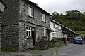
 Cottages at Tilberthwaite - geograph.org.uk - 2340252.jpg 1,500 × 843; 1.45 MB
-
 Disused mine buildings Tilberthwaite - geograph.org.uk - 889398.jpg 640 × 425; 101 KB
-

-
 Footpath near Tilberthwaite Gill - geograph.org.uk - 1853095.jpg 2,048 × 1,536; 1.75 MB
-
 High Tilberthwaite - geograph.org.uk - 2556114.jpg 640 × 480; 81 KB
-
 High Tilberthwaite - geograph.org.uk - 3345885.jpg 2,592 × 1,944; 2.01 MB
-
 High Tilberthwaite - geograph.org.uk - 3463457.jpg 1,066 × 800; 333 KB
-
 High Tilberthwaite - geograph.org.uk - 3463463.jpg 1,066 × 800; 274 KB
-
 High Tilberthwaite - geograph.org.uk - 3463477.jpg 1,066 × 800; 263 KB
-
 High Tilberthwaite Farm - geograph.org.uk - 1008574.jpg 640 × 480; 111 KB
-
 High Tilberthwaite farm - geograph.org.uk - 889099.jpg 640 × 425; 84 KB
-

-
 Highland cattle at Tilberthwaite - geograph.org.uk - 4153884.jpg 2,048 × 1,536; 826 KB
-
 Highland cow at Tilberthwaite - geograph.org.uk - 4153834.jpg 2,048 × 1,536; 858 KB
-
 In Tilberthwaite - geograph.org.uk - 3157156.jpg 2,560 × 1,920; 686 KB
-

-
 Looking across Tilberthwaite Gill - geograph.org.uk - 785229.jpg 640 × 472; 101 KB
-
 Looking down on Low Tilberthwaite - geograph.org.uk - 785237.jpg 640 × 458; 103 KB
-
 Low Tilberthwaite - geograph.org.uk - 1771539.jpg 640 × 426; 339 KB
-
 Low Tilberthwaite - geograph.org.uk - 785241.jpg 640 × 480; 113 KB
-
 Low Tilberthwaite - geograph.org.uk - 875197.jpg 640 × 452; 369 KB
-
 Low Tilberthwaite with Spinning Gallery - geograph.org.uk - 3463467.jpg 1,066 × 800; 321 KB
-
 Old mine buildings Tilberthwaite - geograph.org.uk - 889396.jpg 640 × 425; 118 KB
-
 Old spoil heaps, Tilberthwaite - geograph.org.uk - 875171.jpg 640 × 459; 362 KB
-

-
 Penny Rigg Quarry above Tilberthwaite - geograph.org.uk - 2340219.jpg 1,500 × 1,125; 1.68 MB
-
 Quarry at Low Tilberthwaite - geograph.org.uk - 2138970.jpg 640 × 425; 384 KB
-
 Quarry at Low Tilberthwaite - geograph.org.uk - 2138974.jpg 640 × 425; 396 KB
-
 Quarry road from High Tilberthwaite - geograph.org.uk - 889110.jpg 640 × 425; 85 KB
-

-
 Quarry road to High Tilberthwaite - geograph.org.uk - 889108.jpg 425 × 640; 99 KB
-
 Quarry workers cottages Tilberthwaite - geograph.org.uk - 889088.jpg 640 × 425; 117 KB
-
 Rocky path up from Tilberthwaite - geograph.org.uk - 4153843.jpg 2,048 × 1,536; 851 KB
-

-
 Row of cottages, Low Tilberthwaite - geograph.org.uk - 2536838.jpg 2,433 × 1,606; 2.1 MB
-
 Row of cottages, Low Tilberthwaite - geograph.org.uk - 785246.jpg 480 × 640; 91 KB
-
 Sheep on track above Tilberthwaite - geograph.org.uk - 785231.jpg 480 × 640; 94 KB
-
 Sheep Pens - geograph.org.uk - 1353574.jpg 640 × 480; 88 KB
-
 Sheepfold at Low Tilberthwaite - geograph.org.uk - 1573038.jpg 640 × 480; 99 KB
-
 Sheepfold at Low Tilberthwaite - geograph.org.uk - 2555540.jpg 640 × 480; 132 KB
-

-

-

-
 Terraced Cottages, Low Tilberthwaite - geograph.org.uk - 3463470.jpg 1,066 × 800; 268 KB
-
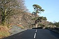
 The A593 at the High Tilberthwaite Road - geograph.org.uk - 3129097.jpg 800 × 600; 286 KB
-
 The gorge of Tilberthwaite Gill - geograph.org.uk - 785038.jpg 640 × 480; 99 KB
-
 The last of the sun over Tilberthwaite - geograph.org.uk - 1395735.jpg 4,592 × 3,056; 6.06 MB
-
 The road from High Tilberthwaite - geograph.org.uk - 3345887.jpg 2,592 × 1,944; 2.22 MB
-

-
 Tilberthwaite - geograph.org.uk - 1353552.jpg 640 × 480; 112 KB
-
 Tilberthwaite - geograph.org.uk - 1353558.jpg 640 × 480; 80 KB
-
 Tilberthwaite - geograph.org.uk - 1383834.jpg 640 × 480; 90 KB
-
 Tilberthwaite - geograph.org.uk - 4153880.jpg 2,048 × 1,536; 715 KB
-
 Tilberthwaite Gill - geograph.org.uk - 784800.jpg 640 × 480; 85 KB
-
 Tilberthwaite Gill - geograph.org.uk - 785047.jpg 480 × 640; 120 KB
-
 Tilberthwaite High Fells - geograph.org.uk - 2555571.jpg 640 × 480; 97 KB
-
 Tilberthwaite Mine - geograph.org.uk - 2555544.jpg 480 × 640; 121 KB
-
 Tilberthwaite old mine workings - geograph.org.uk - 2325598.jpg 2,304 × 3,072; 1.66 MB
-
 Tilberthwaite Touchstone Fold - geograph.org.uk - 2138954.jpg 640 × 425; 385 KB
-
 Tilberthwaite Touchstone Fold - geograph.org.uk - 2138964.jpg 640 × 425; 329 KB
-
 Tilberthwaite valley - geograph.org.uk - 355121.jpg 640 × 437; 125 KB
-

-
 Track to Tilberthwaite - geograph.org.uk - 889386.jpg 640 × 425; 129 KB
-
 Track towards High Tilberthwaite - geograph.org.uk - 3463454.jpg 1,066 × 800; 422 KB
-
 Turnoff for Tilberthwaite - geograph.org.uk - 1742006.jpg 640 × 427; 128 KB
-
 View across Tilberthwaite Gill - geograph.org.uk - 785010.jpg 640 × 480; 103 KB
-
 View towards High Tilberthwaite - geograph.org.uk - 4153870.jpg 2,048 × 1,536; 922 KB
-

-
 Yew Dale beck at Tilberthwaite car park - geograph.org.uk - 1338699.jpg 640 × 480; 177 KB


_-_geograph.org.uk_-_784798.jpg)


