Category:Tidcombe and Fosbury
Jump to navigation
Jump to search
civil parish in Wiltshire, in United Kingdom  | |||||
| Upload media | |||||
| Instance of | |||||
|---|---|---|---|---|---|
| Location | Wiltshire, South West England, England | ||||
| Population |
| ||||
 | |||||
Subcategories
This category has the following 3 subcategories, out of 3 total.
Media in category "Tidcombe and Fosbury"
The following 96 files are in this category, out of 96 total.
-
 A fine house in Tidcombe - geograph.org.uk - 2627691.jpg 3,648 × 2,736; 3.72 MB
-
 Abandoned machinery graffiti - geograph.org.uk - 6543462.jpg 1,024 × 768; 367 KB
-
 Across the steep-sided chalk valley at Hippenscombe - geograph.org.uk - 4711925.jpg 1,600 × 1,000; 478 KB
-

-
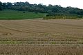
 Arable land west of Maccoombe Down - geograph.org.uk - 2627744.jpg 3,648 × 2,736; 2.45 MB
-
 Beeches, Maccoombe Down - geograph.org.uk - 274979.jpg 640 × 480; 153 KB
-
 Bridleway and farmland, Fosbury - geograph.org.uk - 6080499.jpg 1,024 × 768; 263 KB
-
 Bridleway and farmland, Fosbury - geograph.org.uk - 6080500.jpg 1,024 × 768; 235 KB
-
 Bridleway between Hippenscombe. and Scot’s Poor - geograph.org.uk - 4190042.jpg 4,608 × 3,456; 6.32 MB
-
 Buchan House ^ Christ Church - geograph.org.uk - 3360006.jpg 3,648 × 2,736; 1.73 MB
-

-
 Chalk pasture and arable farmland - geograph.org.uk - 4711888.jpg 1,680 × 1,050; 1.29 MB
-
 Christ Church - geograph.org.uk - 3360003.jpg 3,578 × 2,657; 1.72 MB
-
 Christ Church, Fosbury, Wiltshire - geograph.org.uk - 4150585.jpg 800 × 507; 126 KB
-
 Church of St Michael, Tidcombe - geograph.org.uk - 5405765.jpg 4,320 × 3,240; 3.85 MB
-
 Chute Causeway - geograph.org.uk - 5349600.jpg 4,000 × 3,000; 4.32 MB
-
 Chute Causeway - geograph.org.uk - 5349605.jpg 4,000 × 3,000; 4.97 MB
-
 Chute Causeway - geograph.org.uk - 5349607.jpg 4,000 × 3,000; 4.44 MB
-
 Chute Causeway at Scot's Poor - geograph.org.uk - 5349596.jpg 4,000 × 3,000; 3.86 MB
-
 Cleves Copse - geograph.org.uk - 1471109.jpg 427 × 640; 200 KB
-
 Cloud patterns, Chute, Wiltshire - geograph.org.uk - 4596869.jpg 5,147 × 3,527; 3.98 MB
-
 Country lane, Scot's Poor, Wiltshire - geograph.org.uk - 4435869.jpg 800 × 554; 232 KB
-
 Countryside north of Fosbury Farm - geograph.org.uk - 6442887.jpg 1,799 × 1,199; 385 KB
-
 Crop circle and visitors at Fosbury - geograph.org.uk - 2523287.jpg 640 × 480; 202 KB
-
 Crops in a field at Fosbury - geograph.org.uk - 2523286.jpg 640 × 480; 181 KB
-
 Cultivated hill - geograph.org.uk - 4263208.jpg 640 × 480; 88 KB
-
 Down by Chute Causeway - geograph.org.uk - 4263102.jpg 640 × 480; 103 KB
-
 Downland, Tidcombe, Wiltshire - geograph.org.uk - 4435896.jpg 668 × 800; 206 KB
-
 Downs view from a road leading to Fosbury Farm - geograph.org.uk - 4190080.jpg 4,608 × 3,456; 5.88 MB
-
 Downs view from near to Fosbury Farm - geograph.org.uk - 4190083.jpg 4,608 × 3,456; 4.8 MB
-
 Farmland, Conholt, Wiltshire - geograph.org.uk - 4599439.jpg 4,314 × 2,834; 2.15 MB
-
 Farmland, Fosbury - geograph.org.uk - 6080498.jpg 1,024 × 768; 241 KB
-
 Farmland, Tidcombe - geograph.org.uk - 1561787.jpg 640 × 480; 139 KB
-
 Farmland, Wexcombe - geograph.org.uk - 274211.jpg 640 × 480; 104 KB
-
 Field track - geograph.org.uk - 4711905.jpg 1,600 × 1,000; 534 KB
-
 Fields south-east of Marten - geograph.org.uk - 4263217.jpg 640 × 480; 108 KB
-
 Finishing touches - geograph.org.uk - 5405783.jpg 3,240 × 2,955; 2.36 MB
-
 Footpath west of Tidcombe Church - geograph.org.uk - 6250086.jpg 1,024 × 683; 290 KB
-
 Fosbury Farm - geograph.org.uk - 1471099.jpg 640 × 431; 118 KB
-
 Harvesting wheat - geograph.org.uk - 4711900.jpg 1,600 × 1,000; 343 KB
-
 Haydown Hill from near to Hippenscombe - geograph.org.uk - 4190034.jpg 4,608 × 3,456; 5.2 MB
-
 Haydown Hill, view south-west - geograph.org.uk - 4190089.jpg 4,608 × 3,456; 6.67 MB
-
 Haydown Hill, Wiltshire - geograph.org.uk - 4190085.jpg 4,608 × 3,456; 5.13 MB
-
 Hippenscombe Bottom - geograph.org.uk - 3742221.jpg 800 × 450; 207 KB
-
 Hippenscombe Bottom - geograph.org.uk - 417984.jpg 640 × 480; 113 KB
-
 Hippenscombe Bottom - geograph.org.uk - 4190037.jpg 4,608 × 3,456; 4.98 MB
-
 Hippenscombe Bottom - geograph.org.uk - 420045.jpg 640 × 480; 155 KB
-
 Hippenscombe Bottom - geograph.org.uk - 6442892.jpg 1,799 × 1,199; 361 KB
-
-
 Mixed chalk landscape - geograph.org.uk - 4711911.jpg 1,600 × 854; 417 KB
-
 Oxenwood - geograph.org.uk - 861799.jpg 640 × 480; 92 KB
-
 Oxenwood - House - geograph.org.uk - 1226627.jpg 640 × 480; 96 KB
-
 Oxenwood - House - geograph.org.uk - 1226640.jpg 640 × 480; 110 KB
-
 Oxenwood - House - geograph.org.uk - 1227698.jpg 640 × 480; 133 KB
-
 Oxenwood - Telephone Exchange - geograph.org.uk - 1227724.jpg 640 × 480; 105 KB
-
 Oxenwood Outdoor Education Centre - geograph.org.uk - 861809.jpg 640 × 319; 50 KB
-
 Oxenwood Road - geograph.org.uk - 3742245.jpg 800 × 450; 241 KB
-
 Oxenwood telephone exchange - geograph.org.uk - 861805.jpg 640 × 480; 124 KB
-
 Paddock at Hippenscombe - geograph.org.uk - 999117.jpg 640 × 427; 187 KB
-
 Ploughed field east of Chute Causeway - geograph.org.uk - 4263124.jpg 640 × 480; 115 KB
-
 Ploughed fields high on chalk downland - geograph.org.uk - 4711947.jpg 1,600 × 750; 413 KB
-
 Route leading to Scot's Poor - geograph.org.uk - 4190048.jpg 4,608 × 3,456; 6.39 MB
-
 Shallow valley west of Hippenscombe - geograph.org.uk - 4190038.jpg 4,608 × 3,456; 6.81 MB
-
 Side road to Tidcombe - geograph.org.uk - 2627624.jpg 3,536 × 2,409; 1.19 MB
-
 Spraying in Hippenscombe Bottom - geograph.org.uk - 999084.jpg 640 × 427; 174 KB
-
 Spring Blossom, Tidcombe, Wiltshire - geograph.org.uk - 4437876.jpg 800 × 684; 180 KB
-
 St Michael's Church, Tidcombe - geograph.org.uk - 4711583.jpg 1,600 × 1,000; 640 KB
-
 St Michael's Church, Tidcombe - geograph.org.uk - 4711585.jpg 1,600 × 1,000; 530 KB
-
 St Michael's Church, Tidcombe - geograph.org.uk - 6250080.jpg 1,024 × 683; 234 KB
-
 Stained glass at St Michael's, Tidcombe - geograph.org.uk - 4711964.jpg 739 × 1,024; 323 KB
-
 Stony arable land above Tidcombe, 1 - geograph.org.uk - 3742267.jpg 800 × 450; 211 KB
-
 Stony arable land above Tidcombe, 2 - geograph.org.uk - 3742361.jpg 800 × 450; 211 KB
-
 The church at Fosbury - geograph.org.uk - 3034989.jpg 2,592 × 1,944; 1.79 MB
-
 The entrance to Fosbury House - geograph.org.uk - 3034968.jpg 2,592 × 1,944; 1.68 MB
-
 The road through Fosbury, south of Tunball Lane - geograph.org.uk - 3359500.jpg 3,456 × 2,442; 1.5 MB
-
 The Slay, Wiltshire - geograph.org.uk - 4190033.jpg 4,608 × 3,456; 3.91 MB
-
 The way into Hampshire from Fosbury - geograph.org.uk - 3435402.jpg 600 × 800; 118 KB
-
 Tidcombe Manor - geograph.org.uk - 5405774.jpg 4,320 × 3,240; 5.47 MB
-
 Tidcombe Manor, Wiltshire - geograph.org.uk - 4439072.jpg 800 × 592; 212 KB
-
 Towards Cleves Copse - geograph.org.uk - 999139.jpg 640 × 427; 170 KB
-

-
 Track on the downs above Tidcombe - geograph.org.uk - 2627634.jpg 3,648 × 2,736; 3.17 MB
-
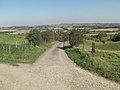
 Track south of Oxenwood - geograph.org.uk - 2627715.jpg 3,648 × 2,477; 1.35 MB
-
 Track towards East Down - geograph.org.uk - 3359479.jpg 3,648 × 2,736; 2.8 MB
-
 Tree-clad Haydown Hill - geograph.org.uk - 4190028.jpg 4,608 × 3,456; 6.35 MB
-
 Undulating farmland south of Beacon Farm near Oxenwood - geograph.org.uk - 6442881.jpg 1,800 × 1,200; 352 KB
-
 View from the church at Fosbury - geograph.org.uk - 5516801.jpg 640 × 427; 66 KB
-
 View north from Chute Causeway - geograph.org.uk - 4263042.jpg 640 × 480; 86 KB
-
 View north-west from Chute Causeway - geograph.org.uk - 4263187.jpg 640 × 480; 92 KB
-
 View over Hippenscombe Bottom - geograph.org.uk - 6250065.jpg 1,024 × 683; 235 KB
-
 View through Oakhill Wood from Fosbury Camp - geograph.org.uk - 6442883.jpg 1,799 × 1,199; 334 KB
-
 View to Hippenscombe, Chute, Wiltshire - geograph.org.uk - 4599595.jpg 3,154 × 2,086; 694 KB
-
 View west from Chute Causeway - geograph.org.uk - 4263112.jpg 640 × 480; 117 KB
-
 Walking group west of Fosbury Farm - geograph.org.uk - 6442888.jpg 1,802 × 1,201; 444 KB
-
 Wheat field near to Hippenscombe. - geograph.org.uk - 4190040.jpg 4,608 × 3,456; 6.25 MB
-
 Wheat field, Hippenscombe Bottom - geograph.org.uk - 4190035.jpg 4,608 × 3,456; 4.84 MB


