Category:Tibberton, Gloucestershire
Jump to navigation
Jump to search
village and civil parish in Gloucestershire, United Kingdom  | |||||
| Upload media | |||||
| Instance of | |||||
|---|---|---|---|---|---|
| Location | Forest of Dean, Gloucestershire, South West England, England | ||||
| Population |
| ||||
 | |||||
Cymraeg: Pentref a chymuned yn Lloegr ydy Tibberton, Swydd Gaerloyw.
English: Tibberton is located in an area with 248 households. The local primary school is Tibberton Community Primary School with roughly 95 pupils and is currently rated "good" by Ofsted, as of Sept 2012.
Polski: Tibberton – wieś w Anglii, w hrabstwie Gloucestershire. Leży 8 km na zachód od miasta Gloucester i 159 km na zachód od Londynu.
Português: Tibberton é uma paróquia e aldeia de Forest of Dean, no condado de Gloucestershire, na Inglaterra. De acordo com o Censo de 2011, tinha 565 habitantes. Tem uma área de 5,67 km².
Main Wikipedia article: Tibberton, Gloucestershire.

Subcategories
This category has the following 2 subcategories, out of 2 total.
B
- Bovone Farm (3 F)
H
Media in category "Tibberton, Gloucestershire"
The following 126 files are in this category, out of 126 total.
-
 Abbey Cottage, near Tibberton - geograph.org.uk - 1955724.jpg 1,024 × 768; 139 KB
-
 Approaching Greenholme Corner - geograph.org.uk - 4776597.jpg 1,600 × 901; 700 KB
-
 Approaching minor junction at Birdsend - geograph.org.uk - 926816.jpg 640 × 464; 163 KB
-
 Bovone Lane, Tibberton - geograph.org.uk - 931555.jpg 640 × 480; 171 KB
-
 Bovone Lane, Tibberton - geograph.org.uk - 931559.jpg 640 × 480; 165 KB
-
 Bridleway-footpath crossroads - geograph.org.uk - 2280964.jpg 640 × 480; 211 KB
-
 Buttermilk Lane, Tibberton - geograph.org.uk - 5218749.jpg 1,024 × 768; 269 KB
-
 Canons, near Tibberton - geograph.org.uk - 1955721.jpg 1,024 × 768; 246 KB
-
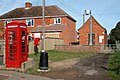 Centre of communication in Tibberton - geograph.org.uk - 64048.jpg 640 × 426; 135 KB
-
 Collier's End Farm - geograph.org.uk - 91178.jpg 640 × 479; 95 KB
-
 Cottages by Bovone Lane - geograph.org.uk - 2394786.jpg 800 × 600; 393 KB
-
 Cow pasture, Rundlesshill - geograph.org.uk - 926878.jpg 640 × 480; 169 KB
-
 Demesne Wood - geograph.org.uk - 926875.jpg 640 × 480; 163 KB
-
 Detail of the Price mortuary chapel, Tibberton - geograph.org.uk - 4357692.jpg 3,562 × 5,205; 4.48 MB
-
 Farm track and footpath - geograph.org.uk - 2333932.jpg 600 × 800; 373 KB
-
 Farmland view - geograph.org.uk - 926830.jpg 640 × 480; 181 KB
-
 Field of dandelions - geograph.org.uk - 435927.jpg 640 × 426; 140 KB
-
 Fields, Tibberton - geograph.org.uk - 5218740.jpg 1,024 × 768; 326 KB
-
 Flat field near Tibberton - geograph.org.uk - 1064906.jpg 640 × 358; 57 KB
-
 Flooding at Tibberton - geograph.org.uk - 3901921.jpg 1,024 × 711; 217 KB
-
 Footbridge on the Three Choirs Way - geograph.org.uk - 2489288.jpg 1,024 × 768; 318 KB
-
 Footbridge without a footpath - geograph.org.uk - 1955734.jpg 768 × 1,024; 290 KB
-
 Footpath north to Tibberton - geograph.org.uk - 2280968.jpg 640 × 480; 244 KB
-
 Footpath on a damp morning - geograph.org.uk - 2280954.jpg 640 × 480; 245 KB
-
 Footpath to Orchard Rise, Tibberton - geograph.org.uk - 4054045.jpg 1,024 × 768; 241 KB
-
 Footpath to Rundlesshill - geograph.org.uk - 1955589.jpg 1,024 × 768; 345 KB
-
 Footpath to Tibberton - geograph.org.uk - 1955699.jpg 1,024 × 768; 172 KB
-
 Footpath to Tibberton - geograph.org.uk - 2280962.jpg 480 × 640; 227 KB
-
 Former British School, Tibberton - geograph.org.uk - 1956626.jpg 1,024 × 768; 189 KB
-
 Former footpath between Tibberton and Taynton - geograph.org.uk - 2489285.jpg 1,024 × 768; 318 KB
-
 Gap between the woods - geograph.org.uk - 1317307.jpg 640 × 480; 96 KB
-
 Gloucester Road, Tibberton - geograph.org.uk - 527763.jpg 640 × 480; 98 KB
-
 Grassland near Merrimans - geograph.org.uk - 5130520.jpg 1,024 × 768; 139 KB
-
 Greenholme Corner - geograph.org.uk - 2203263.jpg 1,024 × 768; 689 KB
-
 Harvested field near Birdsend - geograph.org.uk - 926819.jpg 640 × 480; 186 KB
-
 Heading toward Rundlesshill. - geograph.org.uk - 1046286.jpg 640 × 358; 73 KB
-
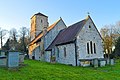
 Holy Trinity Church, Tibberton - geograph.org.uk - 4040162.jpg 4,320 × 3,240; 2.99 MB
-
 Holy Trinity Church, Tibberton - geograph.org.uk - 4040165.jpg 4,320 × 3,240; 2.68 MB
-
 Holy Trinity Church, Tibberton - geograph.org.uk - 4040172.jpg 4,320 × 3,240; 2.71 MB
-
 Holy Trinity Church, Tibberton - geograph.org.uk - 4040177.jpg 3,240 × 4,320; 3.25 MB
-
 Holy Trinity Church, Tibberton - geograph.org.uk - 4040179.jpg 4,320 × 3,240; 3.08 MB
-
 Holy Trinity Church, Tibberton - geograph.org.uk - 4040184.jpg 3,240 × 4,320; 4.14 MB
-
 Holy Trinity, Tibberton - geograph.org.uk - 3901542.jpg 768 × 1,024; 123 KB
-
 Holy Trinity, Tibberton - geograph.org.uk - 4356941.jpg 4,158 × 3,313; 2.64 MB
-
 Holy Trinity, Tibberton - geograph.org.uk - 4356953.jpg 5,879 × 3,909; 6.08 MB
-
 Holy Trinity, Tibberton - geograph.org.uk - 4357346.jpg 5,649 × 4,000; 2.39 MB
-
 Holy Trinity, Tibberton - geograph.org.uk - 4357489.jpg 4,445 × 4,339; 4.31 MB
-
 Holy Trinity, Tibberton - geograph.org.uk - 4357612.jpg 5,461 × 4,603; 3.24 MB
-
 Holy Trinity, Tibberton - geograph.org.uk - 4357729.jpg 5,810 × 3,859; 2.06 MB
-
 Holy Trinity, Tibberton - geograph.org.uk - 4357765.jpg 5,606 × 3,722; 1.44 MB
-
 Holy Trinity, Tibberton - geograph.org.uk - 4357794.jpg 3,353 × 3,684; 978 KB
-
 Holy Trinity, Tibberton - geograph.org.uk - 4357812.jpg 5,619 × 3,735; 1.54 MB
-
 Holy Trinity, Tibberton - geograph.org.uk - 4357907.jpg 5,114 × 3,400; 2.8 MB
-

-
 Huntley Road, Tibberton - geograph.org.uk - 5218744.jpg 1,024 × 768; 461 KB
-
 Huntley Road, Tibberton - geograph.org.uk - 527760.jpg 640 × 480; 137 KB
-
 Landscape near Tibberton - geograph.org.uk - 1955717.jpg 1,024 × 768; 158 KB
-
 Lane to Huntley - geograph.org.uk - 2277931.jpg 800 × 600; 359 KB
-
 Lane to Prestbury Farm - geograph.org.uk - 5903617.jpg 1,024 × 768; 211 KB
-
 Lodge to Tibberton Court - geograph.org.uk - 435925.jpg 640 × 426; 147 KB
-
 Lower House - geograph.org.uk - 49246.jpg 640 × 426; 152 KB
-
 Maize crop off Bovone Lane, Tibberton - geograph.org.uk - 931557.jpg 640 × 480; 203 KB
-
 Morse's Farm in the distance - geograph.org.uk - 2277928.jpg 800 × 600; 437 KB
-
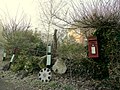
 New use for the K6 phone box - geograph.org.uk - 2428363.jpg 800 × 600; 408 KB
-
 New use for the K6 phone box - geograph.org.uk - 2428373.jpg 600 × 800; 279 KB
-

-
 No through road to Rundlesshill - geograph.org.uk - 926822.jpg 640 × 457; 180 KB
-
 Old^ New^ Borrowed^ Blue^ - geograph.org.uk - 2451899.jpg 800 × 600; 392 KB
-
 Orchard Rise, Tibberton - geograph.org.uk - 1956623.jpg 1,024 × 768; 152 KB
-
 Orchard Rise, Tibberton - geograph.org.uk - 2428302.jpg 800 × 600; 379 KB
-
 Orchard Rise, Tibberton - geograph.org.uk - 5218746.jpg 1,024 × 768; 410 KB
-
 Pasture at Merrimans Farm - geograph.org.uk - 2277924.jpg 800 × 600; 354 KB
-
 Pasture by Poole Farm - geograph.org.uk - 2333924.jpg 800 × 600; 368 KB
-

-
 Pond near Tibberton - geograph.org.uk - 1955710.jpg 1,024 × 768; 301 KB
-
 Poole Farm, Tibberton - geograph.org.uk - 2333928.jpg 800 × 601; 382 KB
-
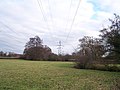 Powerlines - geograph.org.uk - 91180.jpg 640 × 479; 87 KB
-
 Prestbury Lane - geograph.org.uk - 2203244.jpg 1,024 × 768; 669 KB
-
 Prestbury Lane - geograph.org.uk - 4776593.jpg 1,600 × 901; 721 KB
-
 Rain-battered wheat - geograph.org.uk - 926883.jpg 640 × 480; 179 KB
-
 Rise of land at Tibberton - geograph.org.uk - 2428340.jpg 800 × 600; 400 KB
-
 Road junction to Tibberton - geograph.org.uk - 527758.jpg 640 × 480; 105 KB
-
 Road to Tibberton - geograph.org.uk - 926788.jpg 640 × 457; 149 KB
-
 Road to Tibberton - geograph.org.uk - 926811.jpg 640 × 424; 129 KB
-
 Social Club at Tibberton - geograph.org.uk - 675930.jpg 640 × 480; 151 KB
-
 Stile and footpath - geograph.org.uk - 926814.jpg 640 × 480; 198 KB
-
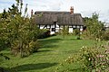 Thatched Cottage near Tibberton - geograph.org.uk - 64129.jpg 640 × 426; 149 KB
-
 The footpath to Tibberton - geograph.org.uk - 1046297.jpg 358 × 640; 51 KB
-
 The other side of the gate. - geograph.org.uk - 1068016.jpg 640 × 358; 52 KB
-
 The Price Mortuary Chapel - geograph.org.uk - 3901545.jpg 1,024 × 768; 277 KB
-
 The Price mortuary chapel, Tibberton - geograph.org.uk - 4357634.jpg 3,384 × 4,579; 3.81 MB
-
 The River Leadon from Wedderburn Bridge - geograph.org.uk - 685717.jpg 640 × 480; 150 KB
-
 The road to Huntley. - geograph.org.uk - 1064926.jpg 640 × 358; 70 KB
-

-
 Tibberton County Primary School - geograph.org.uk - 64094.jpg 640 × 426; 115 KB
-
 Tibberton Court (geograph 6001252).jpg 1,024 × 768; 217 KB
-
 Tibberton Court - geograph.org.uk - 1955704.jpg 1,024 × 768; 143 KB
-
 Tibberton Methodist church - geograph.org.uk - 1955700.jpg 1,024 × 768; 145 KB
-
 Tibberton Road looking south - geograph.org.uk - 4382986.jpg 800 × 600; 100 KB
-
 Tibberton Sunday School - geograph.org.uk - 1955702.jpg 1,024 × 768; 251 KB
-
 To the woods - geograph.org.uk - 926880.jpg 640 × 480; 188 KB
-
 Track and footpath - geograph.org.uk - 2428350.jpg 800 × 600; 390 KB
-
 Track near Bovone - geograph.org.uk - 4054051.jpg 1,024 × 768; 178 KB
-
 Track to Rundlesshill - geograph.org.uk - 1029922.jpg 640 × 358; 59 KB
-
 Trees in an arable field - geograph.org.uk - 2734559.jpg 1,024 × 680; 238 KB
-
 View from Orchard Rise - geograph.org.uk - 2428299.jpg 800 × 600; 402 KB
-
 View towards Tibberton Court - geograph.org.uk - 2499332.jpg 1,024 × 768; 200 KB
-
 Approaching the cattle grid - geograph.org.uk - 675917.jpg 640 × 480; 151 KB
-
 Country road from Highleadon to Upleadon - geograph.org.uk - 623980.jpg 640 × 480; 135 KB
-
 Ell Brook - geograph.org.uk - 623970.jpg 455 × 640; 156 KB
-
 Entrance to Griffins Farm - geograph.org.uk - 527756.jpg 640 × 480; 116 KB
-
 Field of stubble near Taynton - geograph.org.uk - 533482.jpg 640 × 447; 40 KB
-
 Footpath and entrance to farms - geograph.org.uk - 675119.jpg 640 × 453; 143 KB
-
 Footpath from Malswick Mill - geograph.org.uk - 64678.jpg 640 × 426; 154 KB
-
 Footpath near pumping station - geograph.org.uk - 623973.jpg 480 × 640; 207 KB
-
 Grazing land near Taynton - geograph.org.uk - 675916.jpg 640 × 425; 139 KB
-
 Grazing land near The Grove - geograph.org.uk - 675914.jpg 640 × 480; 165 KB
-
 House in the village of Tibberton - geograph.org.uk - 64093.jpg 414 × 640; 85 KB
-
 House on road junction at Kent's Green - geograph.org.uk - 64532.jpg 640 × 426; 105 KB
-
 Lake near Ploddy House - geograph.org.uk - 91515.jpg 640 × 479; 88 KB
-
 Livestock in a field near Tibberton - geograph.org.uk - 64130.jpg 640 × 426; 146 KB
-
 Marchfield - geograph.org.uk - 91208.jpg 640 × 479; 86 KB
-
 Reflections in Ell Brook - geograph.org.uk - 623967.jpg 480 × 640; 185 KB
-
 Road bridge over Ell Brook - geograph.org.uk - 623983.jpg 640 × 480; 187 KB
-
 Stream and bridge, Tibberton - geograph.org.uk - 527759.jpg 466 × 640; 179 KB
-
 Wynford Villas - geograph.org.uk - 91187.jpg 640 × 479; 146 KB


.jpg)


