Category:Thurvaston
Jump to navigation
Jump to search
village in Derbyshire, United Kingdom | |||||
| Upload media | |||||
| Instance of | |||||
|---|---|---|---|---|---|
| Location | Osleston and Thurvaston, South Derbyshire, Derbyshire, East Midlands, England | ||||
 | |||||
Media in category "Thurvaston"
The following 16 files are in this category, out of 16 total.
-
 Backlane at Brookley Meadows - geograph.org.uk - 316054.jpg 640 × 480; 97 KB
-

-
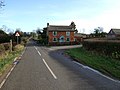 Corner Cottage. - geograph.org.uk - 316056.jpg 640 × 480; 62 KB
-
 Duckpond - geograph.org.uk - 317745.jpg 640 × 480; 115 KB
-
 Elms Farm - geograph.org.uk - 318100.jpg 640 × 480; 90 KB
-
 Elms Farm, Thurvaston - geograph.org.uk - 3710724.jpg 800 × 451; 176 KB
-
 Footpath, Thurvaston - geograph.org.uk - 3035008.jpg 1,200 × 1,600; 628 KB
-
 Moat (with water after heavy rains!!!) - geograph.org.uk - 3035026.jpg 1,600 × 1,200; 807 KB
-
 Osleston 316033 689da282.jpg 640 × 480; 114 KB
-
 Roller in field - geograph.org.uk - 317556.jpg 640 × 480; 107 KB
-
 The Thurvaston Stoop - geograph.org.uk - 4302848.jpg 4,000 × 3,000; 2.41 MB
-
 The Thurvaston Stoop - geograph.org.uk - 4302857.jpg 4,000 × 3,000; 2.24 MB
-
 Thurvaston Farm - geograph.org.uk - 3034985.jpg 1,600 × 1,200; 439 KB
-
 Thurvaston Farm - geograph.org.uk - 318103.jpg 640 × 480; 118 KB
-
 Thurvaston Moat - geograph.org.uk - 318096.jpg 640 × 480; 119 KB
-
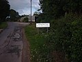 ThurvastonSign.JPG 1,600 × 1,200; 618 KB


_-_geograph.org.uk_-_3035026.jpg)


