Category:Thurlby, South Kesteven
Jump to navigation
Jump to search
English: Thurlby is a village and civil parish in the District of South Kesteven in the English county of Lincolnshire, on the edge of The Fens. It is sometimes referred to as Thurlby by Bourne to distinguish it from other villages in Lincolnshire called Thurlby. The parish had a population of 2,136 at the 2001 census.
village and civil parish in South Kesteven, Lincolnshire, United Kingdom  | |||||
| Upload media | |||||
| Instance of | |||||
|---|---|---|---|---|---|
| Location | South Kesteven, Lincolnshire, East Midlands, England | ||||
| Has part(s) | |||||
 | |||||
Subcategories
This category has the following 13 subcategories, out of 13 total.
A
D
- Dole Wood, Thurlby (1 F)
H
K
- Kate's Bridge (15 F)
N
R
S
T
- St Firmin, Thurlby (15 F)
- Thurlby Fen (6 F)
- Thurlby Fen Slipe (4 F)
- Thurlby Methodist Church (2 F)
- Thurlby railway station (3 F)
Media in category "Thurlby, South Kesteven"
The following 200 files are in this category, out of 267 total.
(previous page) (next page)-
 360 degree by the Car Dyke - geograph.org.uk - 5591009.jpg 17,510 × 1,879; 7.86 MB
-
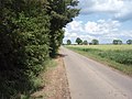
 A bend in Bourne Road (A15) - geograph.org.uk - 3847064.jpg 640 × 480; 54 KB
-
 A dreary view - geograph.org.uk - 5885204.jpg 6,032 × 4,014; 3.85 MB
-
 A Wheatfield - geograph.org.uk - 6196533.jpg 14,463 × 2,790; 7.73 MB
-
 A15 at Thurlby village boundary - geograph.org.uk - 5132573.jpg 640 × 481; 54 KB
-
 A15 heading north - geograph.org.uk - 3846128.jpg 640 × 480; 60 KB
-
 A15 Main Road heading south into Thurlby - geograph.org.uk - 4048922.jpg 1,600 × 1,406; 799 KB
-
 A15 towards Thurlby - geograph.org.uk - 5208863.jpg 4,560 × 2,904; 2.52 MB
-
 Abandoned combine on Thurlby Fen - geograph.org.uk - 3861695.jpg 4,320 × 3,240; 5.55 MB
-
 Abandoned shed on Thurlby Fen - geograph.org.uk - 3861530.jpg 4,320 × 3,240; 6.02 MB
-
 Across the fens - geograph.org.uk - 5860286.jpg 6,032 × 4,014; 5.19 MB
-
 All around me - geograph.org.uk - 5591037.jpg 16,747 × 1,664; 7.79 MB
-
 Along the line - geograph.org.uk - 4213498.jpg 4,896 × 3,672; 6.79 MB
-
 Along the line - geograph.org.uk - 4213501.jpg 4,896 × 3,672; 6.63 MB
-
 Ancient Barn, The Manor School - geograph.org.uk - 523827.jpg 640 × 480; 135 KB
-
 Arctium lappa - geograph.org.uk - 5591969.jpg 6,032 × 4,014; 3.32 MB
-
 Arms of South Kesteven Rural District Council - geograph.org.uk - 4213543.jpg 4,896 × 3,672; 6.39 MB
-
 Back of the Village - geograph.org.uk - 4213523.jpg 4,896 × 3,672; 6.62 MB
-
 Barn and Lane at Manor Farm, Obthorpe - geograph.org.uk - 4100911.jpg 4,000 × 3,000; 2.68 MB
-
 Barn on Thurlby Fen - geograph.org.uk - 2854634.jpg 1,024 × 768; 221 KB
-
 Baston Edge Drove, Thurlby Fen - geograph.org.uk - 523531.jpg 640 × 480; 126 KB
-
 Bend in the track - geograph.org.uk - 4189176.jpg 4,896 × 3,672; 6.39 MB
-
 Betula pendula - geograph.org.uk - 5592031.jpg 4,014 × 6,032; 7.84 MB
-
 Bluebells in Dole Wood, near Bourne, Lincolnshire - geograph.org.uk - 4343323.jpg 2,848 × 2,134; 2.3 MB
-
 Bluebells in Math Wood - geograph.org.uk - 4046678.jpg 1,600 × 1,236; 878 KB
-
 Bluebells in Math Wood - geograph.org.uk - 4046695.jpg 1,600 × 1,200; 836 KB
-
 Bluebells in Math Wood - geograph.org.uk - 4046754.jpg 1,600 × 1,282; 974 KB
-
 Bridge into the nature reserve - geograph.org.uk - 5592042.jpg 6,032 × 4,014; 6.41 MB
-
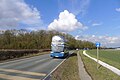
 Bus on the A15 Main Road in Thurlby - geograph.org.uk - 4049020.jpg 1,600 × 1,148; 291 KB
-
 Car Dyke - geograph.org.uk - 3623549.jpg 640 × 427; 124 KB
-
 Car Dyke - geograph.org.uk - 3623550.jpg 640 × 427; 142 KB
-
 Car Dyke crossing Northorpe Fen - geograph.org.uk - 3861486.jpg 4,320 × 3,240; 5.69 MB
-
 Car Dyke, looking towards the southern edge of Bourne - geograph.org.uk - 5707130.jpg 3,776 × 2,520; 3.04 MB
-
-
 Church Street, Thurlby leading to Long Drove and Thurlby Fen - geograph.org.uk - 3445127.jpg 4,000 × 3,000; 4.35 MB
-
 Combine harvester on Thurlby Fen - geograph.org.uk - 3861702.jpg 4,320 × 3,240; 5.42 MB
-
 Communication Mast - geograph.org.uk - 141195.jpg 480 × 640; 57 KB
-
 Crop field off Main Road - geograph.org.uk - 3847057.jpg 640 × 480; 71 KB
-
 Crop field west of the A15 - geograph.org.uk - 3846129.jpg 640 × 480; 79 KB
-
 Crop field, Thurlby Fen - geograph.org.uk - 3846133.jpg 640 × 480; 86 KB
-
 Crop field, Thurlby Fen - geograph.org.uk - 3846137.jpg 640 × 480; 67 KB
-
 Crop field, Thurlby Fen - geograph.org.uk - 3846139.jpg 640 × 480; 118 KB
-
 Crown Lane - geograph.org.uk - 6198390.jpg 4,896 × 3,672; 6.97 MB
-
 Cut for hay - geograph.org.uk - 6198343.jpg 4,896 × 3,672; 6.8 MB
-
 Cycle path along the A15 to Bourne - geograph.org.uk - 5707174.jpg 3,776 × 2,520; 3.59 MB
-
 Datestone - geograph.org.uk - 4213553.jpg 4,896 × 3,672; 6.72 MB
-
 Deeping 5 - geograph.org.uk - 1461304.jpg 480 × 640; 104 KB
-
 Deeping 6 - geograph.org.uk - 2868523.jpg 768 × 1,024; 363 KB
-
 Defibrillator - geograph.org.uk - 6196553.jpg 4,896 × 3,672; 6.92 MB
-
 Defunct pylon - geograph.org.uk - 5860269.jpg 3,856 × 3,857; 7.57 MB
-
 Derelict farm building - geograph.org.uk - 5591952.jpg 6,032 × 4,014; 5.43 MB
-
 Derelict farm buildings on Thurlby Fen - geograph.org.uk - 5591950.jpg 6,032 × 4,014; 6.5 MB
-
 Dew and Sun on the cabbages - geograph.org.uk - 5591954.jpg 6,032 × 4,014; 3.81 MB
-
 Dole Wood - geograph.org.uk - 4941269.jpg 6,000 × 4,000; 6.86 MB
-
 Drain beside Long Drove - geograph.org.uk - 3846140.jpg 640 × 480; 95 KB
-
 Drain heading west from Main Road - geograph.org.uk - 3846145.jpg 640 × 480; 92 KB
-
 Drain, Thurlby Fen - geograph.org.uk - 3846134.jpg 640 × 480; 71 KB
-
 Dry drain, Thurlby Fen - geograph.org.uk - 3846144.jpg 640 × 480; 89 KB
-
 Dutch barn on Northorpe (Thurlby) Fen - geograph.org.uk - 3861805.jpg 4,320 × 3,240; 5.29 MB
-
 Easy access - geograph.org.uk - 6198301.jpg 4,896 × 3,672; 7.03 MB
-
 Elsea Park - geograph.org.uk - 4322407.jpg 2,048 × 1,536; 627 KB
-
 Elsea Wood alongside the A15 - geograph.org.uk - 3448579.jpg 4,000 × 3,000; 4.16 MB
-
 Elsea Wood at Bourne, Lincolnshire - geograph.org.uk - 4380968.jpg 1,764 × 1,178; 947 KB
-
 Entering Kate's Bridge - geograph.org.uk - 3846127.jpg 640 × 480; 63 KB
-
 Entering Northorpe on the A15 - geograph.org.uk - 5208871.jpg 1,600 × 1,014; 270 KB
-
 Entering Obthorpe - geograph.org.uk - 5600922.jpg 3,776 × 2,520; 3.63 MB
-
 Entering Thurlby - geograph.org.uk - 3846131.jpg 640 × 480; 39 KB
-
 Fallen tree in Math Wood - geograph.org.uk - 4047008.jpg 1,600 × 1,200; 757 KB
-
 Farm on Northorpe Fen - geograph.org.uk - 3861470.jpg 4,320 × 3,240; 5.89 MB
-
 Farm track - geograph.org.uk - 4213504.jpg 4,896 × 3,672; 6.7 MB
-
 Farmland and ETL - geograph.org.uk - 5383170.jpg 640 × 480; 86 KB
-
 Farmland east of Bourne Road - geograph.org.uk - 3847062.jpg 640 × 480; 45 KB
-
 Farmland on the edge of Math Wood - geograph.org.uk - 4046721.jpg 1,600 × 1,200; 641 KB
-
 Farmland, Kate's Bridge - geograph.org.uk - 3846126.jpg 640 × 480; 70 KB
-
 Farmland, Thurlby - geograph.org.uk - 2437226.jpg 640 × 480; 73 KB
-
 Farmland, Thurlby Fen - geograph.org.uk - 3846142.jpg 640 × 480; 91 KB
-
 Farmworkers Cottages - geograph.org.uk - 4213551.jpg 4,896 × 3,672; 6.76 MB
-
 Felling oaks in Dole Wood, near Bourne, Lincolnshire - geograph.org.uk - 4355483.jpg 2,848 × 2,134; 2.36 MB
-
 Fen Road and Northorpe Fen - geograph.org.uk - 2437233.jpg 640 × 480; 81 KB
-
 Fen Road crossing the Car Dyke - geograph.org.uk - 3448563.jpg 4,000 × 3,000; 3.94 MB
-
 Fenland drain near Obthorpe - geograph.org.uk - 4941291.jpg 5,700 × 3,800; 7.48 MB
-
 Fenland Field - geograph.org.uk - 6196738.jpg 4,896 × 3,672; 6.38 MB
-
 Field Edge - geograph.org.uk - 6199099.jpg 4,896 × 3,672; 7.22 MB
-
 Field near Obthorpe - geograph.org.uk - 5860325.jpg 6,032 × 4,014; 6.97 MB
-
 Field near Thurlby Slipe - geograph.org.uk - 5591063.jpg 8,000 × 2,974; 7.36 MB
-
 Field north of the River Glen - geograph.org.uk - 2437251.jpg 640 × 480; 82 KB
-
 Field of Barley - geograph.org.uk - 6196535.jpg 10,210 × 2,814; 7.37 MB
-
 Field with Owl Boxes - geograph.org.uk - 5593869.jpg 6,032 × 4,014; 4.15 MB
-
 Fields by the River Glen, Baston - geograph.org.uk - 6193148.jpg 1,872 × 1,204; 1,004 KB
-
 Fields east of Obthorpe - geograph.org.uk - 5601186.jpg 3,776 × 2,520; 3.66 MB
-
 Fingerpost - geograph.org.uk - 6357090.jpg 6,240 × 4,160; 2.17 MB
-
 Footpath - geograph.org.uk - 5383136.jpg 640 × 480; 91 KB
-
 Footpath and stile - geograph.org.uk - 5383142.jpg 640 × 480; 60 KB
-
 Footpath beside Car Dyke - geograph.org.uk - 2437215.jpg 640 × 480; 77 KB
-
 Footpath beside Car Dyke - geograph.org.uk - 2437219.jpg 640 × 480; 85 KB
-
 Footpath closure - geograph.org.uk - 4214352.jpg 3,672 × 4,896; 5.26 MB
-
 Footpath east of Thurlby - geograph.org.uk - 5600913.jpg 3,776 × 2,520; 3.67 MB
-
 Footpath through Lawrance Park - geograph.org.uk - 6198321.jpg 4,896 × 3,672; 6.95 MB
-
 Footpath to Elsea Wood - geograph.org.uk - 4213510.jpg 4,896 × 3,672; 7.02 MB
-
 Former level crossing - geograph.org.uk - 4214355.jpg 4,896 × 3,672; 6.74 MB
-
 Former road bridge at Kate's Bridge, Lincolnshire - geograph.org.uk - 3861880.jpg 4,320 × 3,240; 6.05 MB
-
 Former trackbed - geograph.org.uk - 6198310.jpg 4,896 × 3,672; 6.83 MB
-
 Gate and stile near Math Wood - geograph.org.uk - 4046643.jpg 1,600 × 1,200; 612 KB
-
 Gate fastening - geograph.org.uk - 5592026.jpg 5,000 × 3,333; 7.4 MB
-
 GNR trackbed - geograph.org.uk - 3623276.jpg 640 × 427; 95 KB
-
 Gravel Drain - geograph.org.uk - 5594120.jpg 6,032 × 4,014; 7.81 MB
-
 Grey day, with tree - geograph.org.uk - 6357083.jpg 6,240 × 4,160; 2.96 MB
-
 Hawthorn berries - geograph.org.uk - 5592016.jpg 5,000 × 3,333; 4.37 MB
-
 Haymaking - geograph.org.uk - 6198326.jpg 4,884 × 3,020; 2.08 MB
-
 Hedgerow next to Elsea Wood, Bourne - geograph.org.uk - 3856533.jpg 4,320 × 3,240; 5.95 MB
-
 Hedgerow on Thurlby Fen - geograph.org.uk - 5594122.jpg 6,032 × 4,014; 6.85 MB
-
 Hips in the sunlight - geograph.org.uk - 5592015.jpg 5,000 × 3,333; 4.37 MB
-
 House on Main Road, Thurlby - geograph.org.uk - 6197277.jpg 1,920 × 1,280; 879 KB
-
 Inside a Hawthorn - geograph.org.uk - 5592014.jpg 5,000 × 3,333; 6.69 MB
-
 Junction of Chapel Lane and High Street in Thurlby - geograph.org.uk - 4049039.jpg 1,600 × 1,177; 325 KB
-
 Kate's Bridge across the fields - geograph.org.uk - 3448507.jpg 4,000 × 3,000; 3.87 MB
-
 Kissing gate and path to Math Wood - geograph.org.uk - 4046615.jpg 1,600 × 1,213; 662 KB
-
 Lawrance Park - geograph.org.uk - 6196589.jpg 23,431 × 3,693; 7.21 MB
-
 Lawrance Park - geograph.org.uk - 6198314.jpg 4,896 × 3,672; 6.41 MB
-
 Lidl store - geograph.org.uk - 6078328.jpg 5,818 × 3,585; 3.32 MB
-
 Lifting the covers` - geograph.org.uk - 6305483.jpg 4,032 × 3,024; 5.25 MB
-
 Lincoln Reds - geograph.org.uk - 3623556.jpg 640 × 427; 94 KB
-

-
 Long Drove - geograph.org.uk - 3846135.jpg 640 × 480; 40 KB
-
 Long Drove - geograph.org.uk - 3846141.jpg 640 × 480; 91 KB
-
 Long Drove and Thurlby Fen - geograph.org.uk - 3448529.jpg 4,000 × 3,000; 3.93 MB
-
 Long Drove on Thurlby Fen - geograph.org.uk - 2854607.jpg 1,024 × 731; 201 KB
-
 Long Drove on Thurlby Fen - geograph.org.uk - 3861517.jpg 4,320 × 3,240; 5.53 MB
-
 Long Drove, Thurlby Fen - geograph.org.uk - 3861525.jpg 4,320 × 3,240; 5.63 MB
-
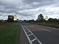
 Main Road (A15) - geograph.org.uk - 3847059.jpg 640 × 480; 54 KB
-
 Main Road, Thurlby - geograph.org.uk - 6193420.jpg 1,836 × 1,138; 1.12 MB
-
 Main Road, Thurlby - geograph.org.uk - 6197275.jpg 1,920 × 1,280; 571 KB
-
 Manor Farm at Obthorpe, near Bourne, Lincolnshire - geograph.org.uk - 4539065.jpg 1,780 × 1,193; 805 KB
-
 Manor farm Obthorpe - geograph.org.uk - 4941286.jpg 6,000 × 4,000; 7.48 MB
-
 Manthorpe Drove, Thurlby Fen - geograph.org.uk - 523681.jpg 640 × 480; 110 KB
-
 Maple Avenue - geograph.org.uk - 4213534.jpg 4,896 × 3,672; 6.81 MB
-
 Math Wood - geograph.org.uk - 4214356.jpg 4,896 × 3,672; 6.7 MB
-
 Middle Drain - geograph.org.uk - 2437238.jpg 640 × 480; 60 KB
-
 Middle Drain - geograph.org.uk - 2448704.jpg 640 × 480; 53 KB
-
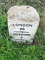
 Milestone - geograph.org.uk - 2868525.jpg 1,024 × 768; 280 KB
-
 Muck heap on Thurlby Fen - geograph.org.uk - 3861724.jpg 4,320 × 3,240; 5.62 MB
-
 Nature reserve at Thurlby Fen near Bourne, Lincolnshire - geograph.org.uk - 4592470.jpg 2,160 × 1,440; 865 KB
-
 Nature reserve next to The River Glen - geograph.org.uk - 3861783.jpg 4,320 × 3,240; 5.42 MB
-
 New houses off South Road, Bourne - geograph.org.uk - 2239981.jpg 800 × 600; 196 KB
-
 New line for old - geograph.org.uk - 5860280.jpg 6,032 × 4,014; 4.26 MB
-
 New petrol station on the A15 entering Bourne - geograph.org.uk - 5653359.jpg 2,304 × 1,728; 822 KB
-
 New petrol station on the A15 entering Bourne - geograph.org.uk - 6194805.jpg 1,908 × 1,260; 1.21 MB
-
 Northorpe Lane, Thurlby - geograph.org.uk - 5600916.jpg 3,776 × 2,520; 3.98 MB
-
 Obthorpe farmland - geograph.org.uk - 3623561.jpg 640 × 427; 92 KB
-
 Obthorpe farmland - geograph.org.uk - 3623563.jpg 640 × 427; 80 KB
-
 Obthorpe Lane - geograph.org.uk - 5383146.jpg 640 × 480; 53 KB
-
 Obthorpe Lane - geograph.org.uk - 5383171.jpg 640 × 480; 70 KB
-
 Obthorpe Lane, looking south, Xmas 2005. - geograph.org.uk - 270290.jpg 480 × 640; 114 KB
-
 Obthorpe village sign - geograph.org.uk - 4941261.jpg 5,800 × 3,867; 7.53 MB
-
 Oil seed blossom at Thurlby, near Bourne, Lincolnshire - geograph.org.uk - 4287420.jpg 2,160 × 1,440; 897 KB
-
 Oil seed outside Thurlby church, near Bourne, Lincolnshire - geograph.org.uk - 4354650.jpg 1,763 × 1,189; 1.06 MB
-
 Oil seed rape next to the A15 - geograph.org.uk - 4047127.jpg 1,600 × 1,303; 817 KB
-
 Old combine - geograph.org.uk - 5591953.jpg 6,032 × 4,014; 6.05 MB
-
 Old farm buildings - geograph.org.uk - 5591956.jpg 6,032 × 4,014; 6.17 MB
-
 Old line and New - geograph.org.uk - 5860291.jpg 6,032 × 4,014; 5.52 MB
-
 Old school house at Thurlby, near Bourne, Lincolnshire - geograph.org.uk - 4431285.jpg 1,728 × 1,136; 803 KB
-
 Old threshing machinery in storage - geograph.org.uk - 3861816.jpg 4,320 × 3,240; 5.48 MB
-
 On the bank of The River Glen - geograph.org.uk - 3861741.jpg 4,320 × 3,240; 5.69 MB
-
 On the edge of The River Glen - geograph.org.uk - 3861735.jpg 4,320 × 3,240; 5.52 MB
-
 Ordnance Survey Cut Mark - geograph.org.uk - 4111133.jpg 4,000 × 3,000; 4.51 MB
-
 Outside The Horseshoe pub in Thurlby - geograph.org.uk - 4049013.jpg 1,600 × 1,289; 446 KB
-
 Overgrown path - geograph.org.uk - 4213506.jpg 4,896 × 3,672; 6.93 MB
-
 Paddock near St Firmin's Church, Thurlby - geograph.org.uk - 3861866.jpg 4,320 × 3,240; 5.68 MB
-
 Path leading into Math Wood - geograph.org.uk - 4046712.jpg 1,200 × 1,600; 870 KB
-
 Path through Elsea Wood - geograph.org.uk - 3847071.jpg 480 × 640; 156 KB
-
 Path through Math Wood - geograph.org.uk - 4047016.jpg 1,600 × 1,200; 806 KB
-
 Path through the bluebells - geograph.org.uk - 4046741.jpg 1,600 × 1,200; 984 KB
-
 Petrol station on the A15, Kate's Bridge - geograph.org.uk - 5652374.jpg 1,709 × 1,284; 775 KB
-
 Picnic table at Elsea Meadows Nature Reserve - geograph.org.uk - 4046704.jpg 1,600 × 1,223; 729 KB
-
 Postbox on Swallow Hill in Thurlby - geograph.org.uk - 4049068.jpg 1,600 × 1,275; 586 KB
-
 Rain-beaten wheat - geograph.org.uk - 6199113.jpg 4,896 × 3,672; 6.42 MB
-
 Raining in Thurlby - geograph.org.uk - 6305479.jpg 4,032 × 3,024; 6.25 MB
-
 Reseeding - geograph.org.uk - 6196592.jpg 4,896 × 3,672; 6.35 MB
-
 River Glen - geograph.org.uk - 4189173.jpg 4,896 × 3,672; 6.93 MB
-
 River Glen near Thurlby - geograph.org.uk - 103644.jpg 640 × 386; 50 KB
-
 River Glen Rapids - geograph.org.uk - 437435.jpg 640 × 477; 121 KB
-
 Road beside Park Wood - geograph.org.uk - 1376803.jpg 480 × 640; 58 KB
-
 Road junction and finger post - geograph.org.uk - 5383173.jpg 640 × 480; 71 KB
-
 Road to Thurlby Fen - geograph.org.uk - 2437267.jpg 640 × 480; 89 KB
-
 Royal Arms - geograph.org.uk - 3623494.jpg 640 × 427; 106 KB
-
 Rusting and abandoned shed on Thurlby Fen - geograph.org.uk - 3861709.jpg 4,320 × 3,240; 5.57 MB
-
 Service station off the A15 - geograph.org.uk - 3847075.jpg 640 × 480; 50 KB
-
 Service station, Kate's Bridge - geograph.org.uk - 3846125.jpg 640 × 480; 62 KB
-
 Sewage works - geograph.org.uk - 4941259.jpg 5,600 × 3,733; 7.97 MB
-
 Short Drove (track) - geograph.org.uk - 3846136.jpg 640 × 480; 64 KB
-
 Short Drove on Thurlby Fen - geograph.org.uk - 3861505.jpg 4,320 × 3,240; 5.19 MB
-
 Short Drove, Thurlby Fen - geograph.org.uk - 523522.jpg 640 × 480; 116 KB
-
 Short Drove, Thurlby Fen - geograph.org.uk - 587828.jpg 640 × 427; 88 KB
-
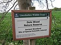 Sign for Dole Wood Nature Reserve - geograph.org.uk - 5383154.jpg 640 × 480; 88 KB
-
 Signpost in Thurlby - geograph.org.uk - 4049051.jpg 1,600 × 1,157; 574 KB
-
 Silver Birch, Betula pendula - geograph.org.uk - 5592027.jpg 3,333 × 5,000; 5.74 MB
-
 Spoiled for the rest - geograph.org.uk - 5592047.jpg 6,032 × 4,014; 3.68 MB
-
 Substation signs - geograph.org.uk - 4213514.jpg 4,896 × 3,672; 6.87 MB
-
 Substation track - geograph.org.uk - 4213513.jpg 4,896 × 3,672; 7.13 MB
-
 Sugar Mill pub sign at Bourne, Lincolnshire - geograph.org.uk - 4399846.jpg 2,441 × 1,787; 903 KB
_-_geograph.org.uk_-_3847064.jpg)


_Fen_-_geograph.org.uk_-_3861805.jpg)


_-_geograph.org.uk_-_3847059.jpg)


_-_geograph.org.uk_-_3846136.jpg)


