Category:Thuringia photographs taken on 2020-05-20
Jump to navigation
Jump to search
Federal states of Germany:
| Thuringia photographs of the previous week | · | Thuringia photographs of the previous day | ← | 2020-05-20 | → | Thuringia photographs of the next day | · | Thuringia photographs of the next week |
| 13 | · | 14 | · | 15 | · | 16 | · | 17 | · | 18 | · | 19 | · | 20 | · | 21 | · | 22 | · | 23 | · | 24 | · | 25 | · | 26 | · | 27 |

Thuringia photographs taken on May 20, 2020.
Files or subcategories can be added here using a direct categorization tag. Image files can be categorized here also automatically using {{Taken on}} template.
Media in category "Thuringia photographs taken on 2020-05-20"
The following 84 files are in this category, out of 84 total.
-
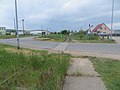
 Bad Frankenhausen, Bahnübergang Seegaer Weg (1).jpg 4,000 × 3,000; 3.31 MB
-
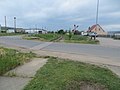
 Bad Frankenhausen, Bahnübergang Seegaer Weg (2).jpg 4,000 × 3,000; 2.72 MB
-
 Bad Frankenhausen, Bahnübergang Seegaer Weg (3).jpg 4,000 × 3,000; 2.51 MB
-
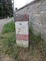
 Bad Frankenhausen, Wegweisersäule (1).jpg 1,200 × 1,600; 541 KB
-
 Bad Frankenhausen, Wegweisersäule (2).jpg 3,000 × 4,000; 2.8 MB
-
 Bad Frankenhausen, Wegweisersäule (3).jpg 3,000 × 4,000; 2.37 MB
-
 Bad Frankenhausen, Wegweisersäule (4).jpg 3,000 × 4,000; 3.42 MB
-
 Bad Frankenhausen, Wegweisersäule (5).jpg 3,000 × 4,000; 3.73 MB
-
 Bad Frankenhausen, Wegweisersäule (6).jpg 3,000 × 4,000; 2.92 MB
-
 Bad Frankenhausen, Wegweisersäule (7).jpg 4,000 × 3,000; 3.43 MB
-
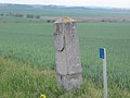
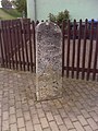
 Bielen, Halbmeilenstein "Im Krug" (2).jpg 4,000 × 3,000; 3.24 MB
-
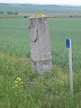
 Bielen, Halbmeilenstein "Im Krug" (3).jpg 4,000 × 3,000; 3.28 MB
-
 Bielen, Halbmeilenstein "Im Krug" (4).jpg 4,000 × 3,000; 4.26 MB
-
 Hermstedt, Wegweiserstein am südlicher Ortsrand (1).jpg 1,200 × 1,600; 550 KB
-
 Hermstedt, Wegweiserstein am südlicher Ortsrand (2).jpg 4,000 × 3,000; 2.83 MB
-
 Hermstedt, Wegweiserstein nach Vierzehnheiligen (1).jpg 1,200 × 1,600; 796 KB
-
 Hermstedt, Wegweiserstein nach Vierzehnheiligen (2).jpg 3,000 × 4,000; 4.21 MB
-
 Hermstedt, Wegweiserstein nach Vierzehnheiligen (3).jpg 4,000 × 3,000; 4.08 MB
-
 Hermstedt, Wegweiserstein nach Vierzehnheiligen (4).jpg 4,000 × 3,000; 4.36 MB
-
 Hoheitsstein Land Thüringen, Grenze Burgenlandkreis - Weimarer Land (1).jpg 1,200 × 1,600; 400 KB
-
 Hoheitsstein Land Thüringen, Grenze Burgenlandkreis - Weimarer Land (2).jpg 4,000 × 3,000; 3.06 MB
-
 Hoheitsstein Land Thüringen, Grenze Burgenlandkreis - Weimarer Land (3).jpg 3,000 × 4,000; 3.35 MB
-
 Hoheitsstein Land Thüringen, Grenze Burgenlandkreis - Weimarer Land (4).jpg 4,000 × 3,000; 2.88 MB
-
 Hoheitsstein Land Thüringen, Grenze Burgenlandkreis - Weimarer Land (5).jpg 3,000 × 4,000; 3.23 MB
-
 Hoheitsstein Land Thüringen, Grenze Burgenlandkreis - Weimarer Land (6).jpg 3,000 × 4,000; 3.3 MB
-
 Hoheitsstein Land Thüringen, Grenze Burgenlandkreis - Weimarer Land (7).jpg 3,000 × 4,000; 3.24 MB
-
 Hoheitsstein Land Thüringen, Grenze Burgenlandkreis - Weimarer Land (8).jpg 3,000 × 4,000; 2.66 MB
-
 Hoheitsstein Land Thüringen, Grenze Burgenlandkreis - Weimarer Land (9).jpg 2,400 × 3,200; 1.93 MB
-
 Kleinromstedt, Grenzstein (Sachsen-Meiningen) (1).jpg 1,600 × 1,200; 659 KB
-
 Kleinromstedt, Grenzstein (Sachsen-Meiningen) (2).jpg 4,000 × 3,000; 2.77 MB
-
 Kleinromstedt, Grenzstein HSM (Sachsen-Meiningen) (1).jpg 1,600 × 1,200; 721 KB
-
 Kleinromstedt, Grenzstein HSM (Sachsen-Meiningen) (2).jpg 4,000 × 3,000; 4.1 MB
-
 Mattstedt, Meilenstein am Gasthof zur Poche (1).jpg 1,600 × 1,200; 609 KB
-
 Mattstedt, Meilenstein am Gasthof zur Poche (2).jpg 3,000 × 4,000; 3.58 MB
-
 Mattstedt, Meilenstein am Gasthof zur Poche (3).jpg 3,000 × 4,000; 3.57 MB
-
 Mattstedt, Meilenstein am Gasthof zur Poche (4).jpg 3,000 × 4,000; 3.67 MB
-
 Mattstedt, Meilenstein am Gasthof zur Poche (5).jpg 3,000 × 4,000; 4.07 MB
-
 Mattstedt, Meilenstein am Gasthof zur Poche (6).jpg 3,000 × 4,000; 3.61 MB
-
 Nauendorf (Apolda), Wegweisersäule (1).jpg 1,200 × 1,600; 631 KB
-
 Nauendorf (Apolda), Wegweisersäule (2).jpg 3,000 × 4,000; 4.55 MB
-
 Nauendorf (Apolda), Wegweisersäule (3).jpg 3,000 × 4,000; 3 MB
-
 Niederreißen, Wegweiserstein (1).jpg 1,200 × 1,600; 632 KB
-
 Niederreißen, Wegweiserstein (2).jpg 3,000 × 4,000; 3.64 MB
-
 Niederreißen, Wegweiserstein (3).jpg 4,000 × 3,000; 4.52 MB
-
 Niederreißen, Wegweiserstein (4).jpg 3,000 × 4,000; 3.71 MB
-
 Niederreißen, Wegweiserstein (5).jpg 3,000 × 4,000; 3.28 MB
-
 Niederreißen, Wegweiserstein (6).jpg 4,000 × 3,000; 2.41 MB
-
 Niederroßla, Wegweiserstein Apoldaer Straße (1).jpg 1,600 × 1,200; 561 KB
-
 Niederroßla, Wegweiserstein Apoldaer Straße (2).jpg 3,000 × 4,000; 4.27 MB
-
 Niederroßla, Wegweiserstein Apoldaer Straße (3).jpg 4,000 × 3,000; 4.15 MB
-
 Niederroßla, Wegweiserstein Apoldaer Straße (4).jpg 4,000 × 3,000; 3.21 MB
-
 Niederroßla, Wegweiserstein Buttstädter Straße (1).jpg 1,200 × 1,600; 501 KB
-
 Niederroßla, Wegweiserstein Buttstädter Straße (2).jpg 3,000 × 4,000; 3.86 MB
-
 Niederroßla, Wegweiserstein Buttstädter Straße (3).jpg 3,000 × 4,000; 3.82 MB
-
 Niederroßla, Wegweiserstein Buttstädter Straße (4).jpg 3,000 × 4,000; 2.74 MB
-
 Stobra, Wegweiserstein am Friedhof (1).jpg 1,200 × 1,600; 791 KB
-
 Stobra, Wegweiserstein am Friedhof (2).jpg 3,000 × 4,000; 3.83 MB
-
 Stobra, Wegweiserstein am Friedhof (3).jpg 3,000 × 4,000; 3.86 MB
-
 Stobra, Wegweiserstein am Friedhof (4).jpg 3,000 × 4,000; 3.43 MB
-
 Stobra, Wegweiserstein am Friedhof (5).jpg 3,000 × 4,000; 4.1 MB
-
 Stobra, Wegweiserstein am Friedhof (6).jpg 4,000 × 3,000; 2.75 MB
-
 Utenbach (Apolda), Wegweiserstein I (1).jpg 1,200 × 1,600; 616 KB
-
 Utenbach (Apolda), Wegweiserstein I (2).jpg 3,000 × 4,000; 3.16 MB
-
 Utenbach (Apolda), Wegweiserstein I (3).jpg 3,000 × 4,000; 3.93 MB
-
 Utenbach (Apolda), Wegweiserstein I (4).jpg 4,000 × 3,000; 4.02 MB
-
 Utenbach (Apolda), Wegweiserstein I (5).jpg 3,000 × 4,000; 3.9 MB
-
 Utenbach (Apolda), Wegweiserstein I (6).jpg 3,000 × 4,000; 3.42 MB
-
 Utenbach (Apolda), Wegweiserstein I (7).jpg 3,000 × 4,000; 3.28 MB
-
 Utenbach (Apolda), Wegweiserstein II (1).jpg 1,200 × 1,600; 456 KB
-
 Utenbach (Apolda), Wegweiserstein II (2).jpg 3,000 × 4,000; 2.98 MB
-
 Utenbach (Apolda), Wegweiserstein II (3).jpg 3,000 × 4,000; 3.48 MB
-
 Utenbach (Apolda), Wegweiserstein II (4).jpg 3,000 × 4,000; 2.5 MB
-
 Utenbach (Apolda), Wegweiserstein III (1).jpg 1,200 × 1,600; 569 KB
-
 Utenbach (Apolda), Wegweiserstein III (2).jpg 3,000 × 4,000; 3.24 MB
-
 Utenbach (Apolda), Wegweiserstein III (3).jpg 3,000 × 4,000; 3.63 MB
-
 Utenbach (Apolda), Wegweiserstein III (4).jpg 3,000 × 4,000; 3.06 MB
-
 Utenbach (Apolda), Wegweiserstein III (5).jpg 3,000 × 4,000; 3.54 MB
-
 Utenbach (Apolda), Wegweiserstein III (6).jpg 3,000 × 4,000; 2.68 MB
-
 Utenbach (Apolda), Wegweiserstein IV (1).jpg 1,200 × 1,600; 592 KB
-
 Utenbach (Apolda), Wegweiserstein IV (2).jpg 3,000 × 4,000; 4.21 MB
-
 Utenbach (Apolda), Wegweiserstein IV (3).jpg 4,000 × 3,000; 3.61 MB
-
 Utenbach (Apolda), Wegweiserstein IV (4).jpg 3,000 × 4,000; 4.18 MB
-
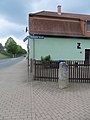
 Wegweiserstein Apolda-Nord (1).jpg 1,600 × 1,200; 655 KB
-
 Wegweiserstein Apolda-Nord (2).jpg 3,000 × 4,000; 4.71 MB
.jpg)
.jpg)
.jpg)
.jpg)
.jpg)
.jpg)
.jpg)
.jpg)
.jpg)
.jpg)
.jpg)
.jpg)
.jpg)
.jpg)
.jpg)
.jpg)
.jpg)
.jpg)
.jpg)
.jpg)
.jpg)
.jpg)
.jpg)
.jpg)
.jpg)
.jpg)
.jpg)
.jpg)
_(1).jpg)
_(2).jpg)
_(1).jpg)
_(2).jpg)
.jpg)
.jpg)
.jpg)
.jpg)
.jpg)
.jpg)
,_Wegweisers%C3%A4ule_(1).jpg)
,_Wegweisers%C3%A4ule_(2).jpg)
,_Wegweisers%C3%A4ule_(3).jpg)
.jpg)
.jpg)
.jpg)
.jpg)
.jpg)
.jpg)
.jpg)
.jpg)
.jpg)
.jpg)
.jpg)
.jpg)
.jpg)
.jpg)
.jpg)
.jpg)
.jpg)
.jpg)
.jpg)
.jpg)
,_Wegweiserstein_I_(1).jpg)
,_Wegweiserstein_I_(2).jpg)
,_Wegweiserstein_I_(3).jpg)
,_Wegweiserstein_I_(4).jpg)
,_Wegweiserstein_I_(5).jpg)
,_Wegweiserstein_I_(6).jpg)
,_Wegweiserstein_I_(7).jpg)
,_Wegweiserstein_II_(1).jpg)
,_Wegweiserstein_II_(2).jpg)
,_Wegweiserstein_II_(3).jpg)
,_Wegweiserstein_II_(4).jpg)
,_Wegweiserstein_III_(1).jpg)
,_Wegweiserstein_III_(2).jpg)
,_Wegweiserstein_III_(3).jpg)
,_Wegweiserstein_III_(4).jpg)
,_Wegweiserstein_III_(5).jpg)
,_Wegweiserstein_III_(6).jpg)
,_Wegweiserstein_IV_(1).jpg)
,_Wegweiserstein_IV_(2).jpg)
,_Wegweiserstein_IV_(3).jpg)
,_Wegweiserstein_IV_(4).jpg)
.jpg)
.jpg)