Category:Thorpe Willoughby
Jump to navigation
Jump to search
village in the United Kingdom  | |||||
| Upload media | |||||
| Instance of | |||||
|---|---|---|---|---|---|
| Location | Selby, North Yorkshire, Yorkshire and the Humber, England | ||||
| Population |
| ||||
 | |||||
Subcategories
This category has only the following subcategory.
T
Media in category "Thorpe Willoughby"
The following 74 files are in this category, out of 74 total.
-
 A line of trees - geograph.org.uk - 4610960.jpg 640 × 348; 38 KB
-
 A1238 towards Selby - geograph.org.uk - 2397320.jpg 1,600 × 1,200; 375 KB
-

-
 Barff Farmhouse, near Brayton - geograph.org.uk - 6343525.jpg 1,280 × 960; 507 KB
-
 Barff Farmhouse, near Brayton - geograph.org.uk - 6343526.jpg 1,280 × 960; 499 KB
-

-
 Bridleway near Thorpe Willoughby - geograph.org.uk - 644691.jpg 640 × 480; 67 KB
-

-
 Church of St Francis of Assisi - geograph.org.uk - 5578901.jpg 800 × 600; 98 KB
-

-

-
-
 Farm building - geograph.org.uk - 4610974.jpg 640 × 257; 23 KB
-
 Farm track off the A1238 - geograph.org.uk - 2397298.jpg 1,600 × 1,200; 613 KB
-
 Farmland and trees - geograph.org.uk - 4610962.jpg 640 × 495; 57 KB
-
 Farmland near Meadow View Farm - geograph.org.uk - 2397302.jpg 1,600 × 1,200; 539 KB
-
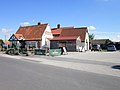
 Field Lane Stores, Thorpe Willoughby - geograph.org.uk - 6383194.jpg 640 × 447; 59 KB
-
 Flat around here^ - geograph.org.uk - 4610975.jpg 640 × 426; 29 KB
-

-
 Fox Lane Surgery, Thorpe Willoughby - geograph.org.uk - 6382504.jpg 800 × 455; 58 KB
-
 Fox Lane, Thorpe Willoughby - geograph.org.uk - 6382502.jpg 800 × 600; 128 KB
-
 Fox Lane, Thorpe Willoughby - geograph.org.uk - 6382506.jpg 800 × 600; 74 KB
-
 Hay Barn - geograph.org.uk - 4610965.jpg 640 × 362; 47 KB
-

-
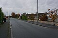
 Houses on Leeds Road, Thorpe Willoughby - geograph.org.uk - 5609212.jpg 1,600 × 1,057; 568 KB
-
 Leeds Road (A1238) - geograph.org.uk - 6382517.jpg 800 × 562; 95 KB
-
 Leeds Road (A1238), Thorpe Willoughby - geograph.org.uk - 6382247.jpg 800 × 569; 115 KB
-
 Leeds Road, Thorpe Willoughby (A1238) - geograph.org.uk - 2397311.jpg 1,600 × 1,200; 383 KB
-
 Level crossing on Dam Lane, Thorpe Willoughby - geograph.org.uk - 5443118.jpg 1,600 × 1,200; 461 KB
-
 Level crossing on Dam Lane, Thorpe Willoughby - geograph.org.uk - 5609203.jpg 1,600 × 1,064; 565 KB
-
 Looking west from Dam Lane level crossing - geograph.org.uk - 5132349.jpg 4,608 × 3,456; 3.51 MB
-
 Meadow Drive, Thorpe Willoughby - geograph.org.uk - 5609697.jpg 1,600 × 1,064; 582 KB
-
 Meadow Drive, Thorpe Willoughby - geograph.org.uk - 5609699.jpg 1,600 × 1,064; 529 KB
-
 Meadow Garth, Thorpe Willoughby - geograph.org.uk - 5609704.jpg 1,600 × 1,064; 745 KB
-
 Meadow View Farm - geograph.org.uk - 4610971.jpg 640 × 426; 40 KB
-
 Near Thorpe Crossing - geograph.org.uk - 4610963.jpg 640 × 522; 58 KB
-
 North View, Thorpe Willoughby - geograph.org.uk - 5609209.jpg 1,600 × 1,064; 421 KB
-

-
 Orchard Way, Thorpe Willoughby - geograph.org.uk - 5609708.jpg 1,600 × 1,064; 501 KB
-
 Play area in Thorpe Willoughby - geograph.org.uk - 13515.jpg 640 × 480; 114 KB
-

-
 Railway towards Leeds - geograph.org.uk - 6383286.jpg 640 × 480; 63 KB
-
 Railway towards Selby - geograph.org.uk - 6383287.jpg 800 × 585; 78 KB
-
 Saint Francis of Assisi Church - geograph.org.uk - 5121636.jpg 1,600 × 1,026; 456 KB
-
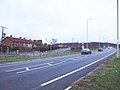 Selby Bypass - geograph.org.uk - 112733.jpg 640 × 480; 46 KB
-
 Selby Dam - geograph.org.uk - 3796035.jpg 1,280 × 960; 540 KB
-
 Selby Dam from Dam Lane - geograph.org.uk - 5609197.jpg 1,600 × 1,064; 500 KB
-
 Shops on Field Lane, Thorpe Willoughby - geograph.org.uk - 3643522.jpg 800 × 600; 106 KB
-

-
 Sign for the Fox Inn, Thorpe Willoughby - geograph.org.uk - 6382511.jpg 770 × 800; 133 KB
-
 Southlands Farm - geograph.org.uk - 281865.jpg 640 × 480; 80 KB
-
 St Francis of Assisi, shared Anglican and Methodist church - geograph.org.uk - 5577610.jpg 5,376 × 3,024; 1.69 MB
-

-
 Stubble field off Leeds Road - geograph.org.uk - 6383291.jpg 800 × 517; 84 KB
-
 The edge of Thorpe - geograph.org.uk - 4610969.jpg 640 × 407; 37 KB
-
 The Fox , Thorpe Willoughby.jpg 640 × 480; 69 KB
-
 The Fox Inn, Thorpe Willoughby - geograph.org.uk - 6382509.jpg 800 × 570; 93 KB
-
 The Fox public house - geograph.org.uk - 3644805.jpg 800 × 600; 98 KB
-
 The Fox Thorpe Willoughby.jpg 2,000 × 1,196; 2.08 MB
-
 The Fox, Thorpe Willoughby - geograph.org.uk - 2397308.jpg 1,600 × 788; 265 KB
-
 The Selby Dam near Thorpe Hall - geograph.org.uk - 5578903.jpg 800 × 600; 257 KB
-

-
 Thorpe Gates level crossing - geograph.org.uk - 2397316.jpg 1,600 × 1,200; 421 KB
-
 Thorpe Gates level crossing - geograph.org.uk - 3796031.jpg 1,280 × 960; 203 KB
-
 Thorpe Gates level crossing - geograph.org.uk - 4285923.jpg 1,024 × 768; 164 KB
-
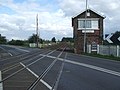
 Thorpe Gates Level Crossing - geograph.org.uk - 5443112.jpg 1,600 × 1,200; 473 KB
-
 Thorpe Gates Level Crossing - geograph.org.uk - 6383283.jpg 800 × 592; 82 KB
-
 Thorpe Gates Level Crossing - geograph.org.uk - 6383288.jpg 800 × 543; 81 KB
-
 Thorpe Hall level crossing - geograph.org.uk - 3796034.jpg 1,280 × 960; 278 KB
-
 Thorpe Willoughby - geograph.org.uk - 4610964.jpg 640 × 321; 39 KB
-
 Town Dike - geograph.org.uk - 2397300.jpg 1,600 × 1,200; 724 KB
-
 Train approaching Thorpe Hall level crossing - geograph.org.uk - 5577530.jpg 5,376 × 3,024; 1.99 MB
-
 War Memorial, Thorpe Willoughby - geograph.org.uk - 6382507.jpg 800 × 544; 84 KB
-
 Water in the ruts - geograph.org.uk - 3796019.jpg 1,280 × 960; 321 KB


_towards_Selby_-_geograph.org.uk_-_6383292.jpg)


_-_geograph.org.uk_-_6382517.jpg)
,_Thorpe_Willoughby_-_geograph.org.uk_-_6382247.jpg)
_-_geograph.org.uk_-_2397311.jpg)


