Category:Thorpe Salvin
Jump to navigation
Jump to search
English: Thorpe Salvin is a village and a civil parish in the Metropolitan Borough of Rotherham in South Yorkshire, England, on the border with Nottinghamshire. It lies between Worksop and Harthill, and is located at an elevation of around 110 metres above sea level. It has a population of 502.
Nederlands: Thorpe Salvin is een dorp (village) en civil parish in het bestuurlijke gebied Rotherham, in het Engelse graafschap South Yorkshire. De civil parish telt
village and civil parish in South Yorkshire, United Kingdom | |||||
| Upload media | |||||
| Instance of | |||||
|---|---|---|---|---|---|
| Location | Rotherham, South Yorkshire, Yorkshire and the Humber, England | ||||
| Population |
| ||||
 | |||||
Subcategories
This category has the following 3 subcategories, out of 3 total.
N
T
Media in category "Thorpe Salvin"
The following 200 files are in this category, out of 312 total.
(previous page) (next page)-
 "The Parish Oven", Thorpe Salvin - geograph.org.uk - 3012816.jpg 4,369 × 2,913; 3.21 MB
-
 3-Way County Boundary at Thorpe Common - geograph.org.uk - 2986183.jpg 3,296 × 2,472; 1.07 MB
-
 A field full of turnips - geograph.org.uk - 4645491.jpg 800 × 600; 142 KB
-
 Albert's Dock - geograph.org.uk - 2576223.jpg 640 × 480; 135 KB
-
 Albert's Dock - geograph.org.uk - 4414169.jpg 1,024 × 768; 324 KB
-
 Albert's Dock on the Chesterfield Canal - geograph.org.uk - 2925403.jpg 1,024 × 768; 265 KB
-
 Albert's Dock on the Chesterfield Canal - geograph.org.uk - 4087464.jpg 2,510 × 1,793; 1.93 MB
-
 Alberts Dock - geograph.org.uk - 2749514.jpg 640 × 480; 80 KB
-
 Alongside Packman Lane - geograph.org.uk - 4618340.jpg 1,024 × 768; 202 KB
-
 Angler on the Chesterfield Canal - geograph.org.uk - 3579851.jpg 3,394 × 2,546; 1.88 MB
-

-
 Approaching Little Wood near Thorpe Salvin - geograph.org.uk - 5983265.jpg 1,024 × 768; 254 KB
-
 Approaching Netherthorpe - geograph.org.uk - 2285498.jpg 900 × 583; 314 KB
-
 Around the bend in Thorpe Salvin - geograph.org.uk - 1293346.jpg 640 × 480; 55 KB
-
 Autumn Colours - geograph.org.uk - 2682347.jpg 640 × 411; 108 KB
-
 Back Lane near Thorpe Salvin - geograph.org.uk - 3924543.jpg 3,904 × 2,870; 1.28 MB
-
 Bit of a dump on Southard's Lane - geograph.org.uk - 4258384.jpg 4,000 × 2,248; 4.83 MB
-
 Bluebells in Loscar Wood near Thorpe Salvin - geograph.org.uk - 6838078.jpg 5,184 × 2,912; 5.73 MB
-
 Bondhay Brook - geograph.org.uk - 4258387.jpg 2,248 × 4,000; 5.87 MB
-
 Bondhay Dyke - geograph.org.uk - 6266278.jpg 1,024 × 768; 226 KB
-
 Bottom Farm, Netherthorpe - geograph.org.uk - 4299816.jpg 640 × 480; 94 KB
-
 Brickyard double lock - geograph.org.uk - 2579762.jpg 640 × 480; 115 KB
-
 Brickyard Double Lock - geograph.org.uk - 4478724.jpg 1,024 × 683; 345 KB
-
 Brickyard Double Lock - geograph.org.uk - 5183550.jpg 1,024 × 683; 337 KB
-
 Brickyard Double Lock on Chesterfield Canal - geograph.org.uk - 2959913.jpg 4,000 × 2,248; 1.98 MB
-
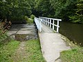
 Bridge 32 on the Chesterfield Canal - geograph.org.uk - 2925406.jpg 1,024 × 768; 319 KB
-
 Bridge 32, Chesterfield Canal - geograph.org.uk - 4618800.jpg 1,024 × 768; 251 KB
-
 Bridge 34 on the Chesterfield Canal - geograph.org.uk - 2925415.jpg 768 × 1,024; 309 KB
-
 Bridge 34A on the Chesterfield Canal - geograph.org.uk - 2925419.jpg 1,024 × 768; 280 KB
-
 Bridge 35 - geograph.org.uk - 4476897.jpg 1,024 × 683; 346 KB
-
 Bridleway crosses the railway near Thorpe Bridge - geograph.org.uk - 3836735.jpg 1,600 × 1,200; 966 KB
-
 Bridleway from Lady Field Road - geograph.org.uk - 6883905.jpg 1,024 × 768; 132 KB
-
 Bridleway towards Lady Field Road - geograph.org.uk - 3836741.jpg 1,600 × 1,200; 662 KB
-
 Brook House at Netherthorpe - geograph.org.uk - 4107551.jpg 2,424 × 1,818; 1.58 MB
-
 Buildings at Netherthorpe Aerodrome - geograph.org.uk - 6804670.jpg 1,600 × 1,026; 109 KB
-
 By Moor Hill Farm, Thorpe Common - geograph.org.uk - 4258386.jpg 3,946 × 2,148; 5.15 MB
-
 By Whitwell Road - geograph.org.uk - 2403067.jpg 950 × 694; 380 KB
-
 Canal and cottage at Cinder Hill - geograph.org.uk - 2286157.jpg 701 × 900; 319 KB
-
 Canal and railway - geograph.org.uk - 4618783.jpg 1,024 × 768; 214 KB
-
 Canal and railway side by side - geograph.org.uk - 2286061.jpg 900 × 564; 380 KB
-
 Canal overflow - panoramio.jpg 2,048 × 1,536; 936 KB
-
 Canal overspill and footbridge - geograph.org.uk - 2286092.jpg 900 × 606; 406 KB
-

-
 Chesterfield Canal - geograph.org.uk - 1334642.jpg 640 × 443; 101 KB
-
 Chesterfield Canal - geograph.org.uk - 2578862.jpg 640 × 480; 150 KB
-
 Chesterfield Canal - geograph.org.uk - 2579763.jpg 640 × 480; 111 KB
-
 Chesterfield Canal - geograph.org.uk - 4414109.jpg 1,024 × 768; 322 KB
-
 Chesterfield Canal - geograph.org.uk - 4478728.jpg 1,024 × 683; 341 KB
-
 Chesterfield Canal - geograph.org.uk - 6357917.jpg 1,024 × 768; 311 KB
-
 Chesterfield Canal - Hawks Wood - geograph.org.uk - 6357921.jpg 1,024 × 768; 258 KB
-

-

-
 Chesterfield Canal at Bridge 33 - geograph.org.uk - 2925410.jpg 1,024 × 768; 251 KB
-
 Chesterfield Canal at Hawks Wood - geograph.org.uk - 3836747.jpg 1,600 × 1,200; 760 KB
-
 Chesterfield Canal at Quarry Bridge, Thorpe Salvin - geograph.org.uk - 6681760.jpg 5,184 × 2,912; 4.63 MB
-
 Chesterfield Canal east of Thorpe Bridge - geograph.org.uk - 5980351.jpg 1,024 × 764; 608 KB
-
 Chesterfield Canal east of Thorpe Bridge - geograph.org.uk - 5992781.jpg 1,024 × 688; 233 KB
-
 Chesterfield Canal Historic Limekilns - geograph.org.uk - 6252907.jpg 1,024 × 768; 423 KB
-

-
 Chesterfield Canal near Thorpe Salvin - geograph.org.uk - 2198023.jpg 3,264 × 2,448; 1.75 MB
-
 Chesterfield Canal overspill - geograph.org.uk - 2579468.jpg 640 × 480; 120 KB
-
 Chesterfield Canal towards Kiveton Park - geograph.org.uk - 2286055.jpg 900 × 666; 390 KB
-
 Chesterfield Canal, bridge 33 - geograph.org.uk - 2286079.jpg 900 × 556; 322 KB
-
 Chesterfield Canal, bridge 34 near Thorpe Salvin - geograph.org.uk - 3836729.jpg 1,600 × 1,200; 886 KB
-
 Chesterfield Canal, bridge 35 at Old Spring Wood - geograph.org.uk - 3836713.jpg 1,600 × 1,200; 883 KB
-
 Chesterfield Canal, bridge No. 32 - geograph.org.uk - 3368544.jpg 1,500 × 843; 1.88 MB
-
 Church Cottage - geograph.org.uk - 1090201.jpg 640 × 480; 82 KB
-
 Common Road - geograph.org.uk - 4299847.jpg 640 × 480; 89 KB
-
 Common Road in Thorpe Salvin - geograph.org.uk - 5468127.jpg 3,264 × 2,448; 3.31 MB
-

-

-
 Crossroads at Bull Hill - geograph.org.uk - 3702584.jpg 3,776 × 2,520; 3.51 MB
-
 Cuckoo Way - geograph.org.uk - 2578869.jpg 640 × 480; 174 KB
-
 Cuckoo Way - geograph.org.uk - 2578903.jpg 640 × 480; 136 KB
-
 Cuckoo Way along the Chesterfield Canal - geograph.org.uk - 4965196.jpg 800 × 557; 180 KB
-
 Cuckoo Way along the Chesterfield Canal - geograph.org.uk - 4965236.jpg 800 × 600; 198 KB
-
 Cuckoo Way sign - geograph.org.uk - 2749522.jpg 640 × 321; 84 KB
-
 Cycle Route 6 on Back Lane approaching Thorpe Salvin - geograph.org.uk - 3701453.jpg 3,776 × 2,520; 4.04 MB
-
 Cycle Route 6 on Back Lane heading towards Thorpe Salvin - geograph.org.uk - 3701452.jpg 3,776 × 2,520; 3.9 MB
-
 Dead end lane to Turnerwood - geograph.org.uk - 2235814.jpg 640 × 427; 61 KB
-
 Defending Turnerwood^ - geograph.org.uk - 2668811.jpg 1,024 × 768; 214 KB
-
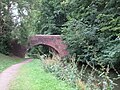
 Devil Hole Bridge - geograph.org.uk - 3579817.jpg 3,648 × 2,736; 2.02 MB
-
 Devil's Hole Bridge - geograph.org.uk - 2579449.jpg 640 × 480; 169 KB
-
 Devil's Hole Bridge - geograph.org.uk - 4618889.jpg 1,024 × 768; 248 KB
-
 Devil's Hole Bridge No 33 - geograph.org.uk - 4965224.jpg 800 × 517; 189 KB
-
 Devil's Hole Bridge on the Chesterfield Canal - geograph.org.uk - 6247889.jpg 1,024 × 768; 319 KB
-
 Don't seek direction here^ - geograph.org.uk - 4258388.jpg 4,000 × 2,248; 3.43 MB
-

-
 Dumb Hall Lane - geograph.org.uk - 1293367.jpg 640 × 480; 62 KB
-
 Dumb Hall Lane - geograph.org.uk - 4299856.jpg 640 × 480; 55 KB
-
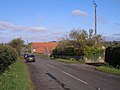
 Entering Thorpe Salvin - geograph.org.uk - 4299833.jpg 640 × 475; 91 KB
-
 Entering Thorpe Salvin on Back Lane - geograph.org.uk - 3701458.jpg 3,776 × 2,520; 3.95 MB
-
 Entrance to woodland - geograph.org.uk - 4299820.jpg 640 × 480; 134 KB
-
 Evidence of Dutch Elm Disease - geograph.org.uk - 4618878.jpg 768 × 1,024; 311 KB
-
 Fan Field Farm - geograph.org.uk - 3836724.jpg 1,600 × 1,200; 449 KB
-
 Fan Field Farm - geograph.org.uk - 5992407.jpg 1,024 × 768; 147 KB
-
 Fan Field Farm - geograph.org.uk - 5992423.jpg 1,024 × 602; 228 KB
-
 Farm Track - geograph.org.uk - 128719.jpg 640 × 480; 84 KB
-
 Farmland at Thorpe Common - geograph.org.uk - 4480011.jpg 4,000 × 3,000; 2.3 MB
-
 Farmland east of Thorpe Salvin - geograph.org.uk - 4299828.jpg 640 × 480; 81 KB
-
 Farmland north of Bunker's Hill, Thorpe Salvin - geograph.org.uk - 6681755.jpg 5,184 × 2,912; 1.7 MB
-
 Farmland south of Back Lane - geograph.org.uk - 4299827.jpg 640 × 480; 78 KB
-
 Farmland towards Old Meadow Wood - geograph.org.uk - 4299831.jpg 640 × 413; 71 KB
-
-
 Field edge and wind turbines - geograph.org.uk - 4618289.jpg 1,024 × 768; 162 KB
-
 Field north of Harthill Road - geograph.org.uk - 6804668.jpg 1,600 × 1,248; 181 KB
-
 Field on north side of Chesterfield Canal - geograph.org.uk - 3368569.jpg 1,500 × 843; 1.23 MB
-
 Field towards Honey Syke Wood from Packman Lane - geograph.org.uk - 6804660.jpg 1,600 × 1,179; 112 KB
-
 Field towards Lob Wells Wood - geograph.org.uk - 6804671.jpg 1,600 × 1,086; 124 KB
-

-
 Fields by Back Lane - geograph.org.uk - 2285504.jpg 900 × 534; 295 KB
-
 Fields by the end of Whitwell Road - geograph.org.uk - 2403054.jpg 950 × 699; 419 KB
-
 Footbridge along the Chesterfield Canal - geograph.org.uk - 4965267.jpg 800 × 547; 186 KB
-
 Footpath crossing the railway near Fan Field Farm - geograph.org.uk - 3836726.jpg 1,600 × 1,200; 604 KB
-
 Footpath from Top Hall Farm to Netherthorpe - geograph.org.uk - 5982895.jpg 1,024 × 566; 197 KB
-
 Footpath to Harthill - geograph.org.uk - 4618264.jpg 1,024 × 768; 223 KB
-
 Footpath to Harthill - geograph.org.uk - 4618331.jpg 1,024 × 768; 200 KB
-
 Footpath to Netherthorpe - geograph.org.uk - 4618273.jpg 1,024 × 768; 195 KB
-
 Footpath to Netherthorpe from Top Hall - geograph.org.uk - 5982930.jpg 1,024 × 768; 315 KB
-
 Footpath towards Lady Field Road - geograph.org.uk - 6272582.jpg 1,600 × 1,200; 626 KB
-
 Footpath towards Little Wood from Southard's Lane - geograph.org.uk - 4371870.jpg 1,600 × 1,200; 422 KB
-
 Footpath towards Netherthorpe - geograph.org.uk - 4299850.jpg 640 × 480; 87 KB
-
 G-BFHU leaving Netherthorpe Aerodrome - geograph.org.uk - 6804672.jpg 1,600 × 1,165; 90 KB
-
 G-BFHU lining up for take off at Netherthorpe Aerodrome - geograph.org.uk - 6804673.jpg 1,600 × 1,358; 187 KB
-
 Gate into Loscar Wood - geograph.org.uk - 6804664.jpg 1,600 × 1,293; 341 KB
-
 Gate into Loscar Wood sign - geograph.org.uk - 6804665.jpg 1,600 × 1,209; 173 KB
-

-
 Harthill Road leaving Thorpe Salvin - geograph.org.uk - 3702581.jpg 3,776 × 2,520; 3.61 MB
-
 Harthill Road towards Thorpe Salvin - geograph.org.uk - 6804669.jpg 1,600 × 1,156; 144 KB
-
 Harthill Road, Thorpe Salvin - geograph.org.uk - 4299836.jpg 640 × 480; 78 KB
-
 Harthill Road, Thorpe Salvin - geograph.org.uk - 4299839.jpg 640 × 480; 97 KB
-
 Hawks Wood from Devil's Hole Bridge - geograph.org.uk - 4491887.jpg 640 × 448; 150 KB
-
 Hedge dividing fields - geograph.org.uk - 3367682.jpg 1,500 × 843; 1.13 MB
-
 Honeysyke - geograph.org.uk - 3927629.jpg 3,840 × 2,774; 1.95 MB
-
 Honeysyke Farm through a gateway on Packman Lane - geograph.org.uk - 6804661.jpg 1,600 × 1,239; 140 KB
-
 Honeysyke Wood - geograph.org.uk - 3367676.jpg 1,500 × 843; 1.15 MB
-
 Horses in a field - geograph.org.uk - 2235548.jpg 640 × 428; 66 KB
-
 House by Old Spring Wood - geograph.org.uk - 2285501.jpg 900 × 675; 281 KB
-
 Houses beyond Lady Field - geograph.org.uk - 3367702.jpg 1,500 × 843; 1.08 MB
-
 Junction of paths on Firbeck Common - geograph.org.uk - 3012802.jpg 3,072 × 4,608; 3.15 MB
-
 Lady Field - geograph.org.uk - 4618358.jpg 1,024 × 768; 153 KB
-
 Lady Field Road approaching Kiveton Park - geograph.org.uk - 2286018.jpg 900 × 638; 272 KB
-
 Ladyfield Road, Thorpe Salvin - geograph.org.uk - 1293339.jpg 640 × 480; 76 KB
-

-
 Lichen covered wall by the Chesterfield Canal - geograph.org.uk - 5999820.jpg 1,024 × 768; 314 KB
-
 Lichen covered wall by the Chesterfield Canal - geograph.org.uk - 5999829.jpg 1,024 × 768; 372 KB
-
 Lime House Lock No 25 - geograph.org.uk - 4967629.jpg 800 × 561; 187 KB
-
 Limehouse lock - geograph.org.uk - 2579766.jpg 640 × 480; 121 KB
-
 Little Wood Lane Piggery - geograph.org.uk - 4618322.jpg 1,024 × 768; 167 KB
-
 Lock 20, Chesterfield Canal - geograph.org.uk - 2286122.jpg 900 × 675; 393 KB
-
 Locks on the Chesterfield Canal - geograph.org.uk - 2286134.jpg 675 × 900; 352 KB
-
 Looking into the shadows of Loscar Wood - geograph.org.uk - 4143018.jpg 2,493 × 1,781; 2.33 MB
-

-
 Looking north towards Loscar Wood - geograph.org.uk - 845455.jpg 640 × 480; 50 KB
-
 Looking towards Honeysyke Wood from Packman Lane - geograph.org.uk - 4255862.jpg 4,000 × 2,248; 5.24 MB
-
 Looking towards Loscar Wood - geograph.org.uk - 4258381.jpg 4,000 × 2,248; 4.54 MB
-
 Looking west along Harthill Road - geograph.org.uk - 3012821.jpg 3,072 × 4,608; 3.49 MB
-
 Loscar Farm Wind Farm - geograph.org.uk - 4252274.jpg 800 × 600; 53 KB
-
 Loscar Wind Farm - geograph.org.uk - 5983286.jpg 1,024 × 640; 222 KB
-
 Loscar Wood - geograph.org.uk - 5983272.jpg 1,024 × 651; 278 KB
-
 Malthouse Cottages - geograph.org.uk - 4414156.jpg 1,024 × 768; 249 KB
-
 Meeting Netherthorpe Road - geograph.org.uk - 2114642.jpg 640 × 480; 68 KB
-
 Menage beside the stream - geograph.org.uk - 4252285.jpg 800 × 600; 163 KB
-
 Milestone Lock - geograph.org.uk - 2668841.jpg 1,024 × 768; 162 KB
-
 Moor Mill Farm - geograph.org.uk - 4371903.jpg 1,600 × 1,200; 555 KB
-
 Muddy Footpath - geograph.org.uk - 2235972.jpg 640 × 427; 60 KB
-
 Narrow boat moored on the Chesterfield Canal - geograph.org.uk - 3579834.jpg 3,418 × 2,734; 2 MB
-
 Narrow section of the Chesterfield Canal - geograph.org.uk - 4965134.jpg 800 × 499; 134 KB
-
 Narrowboat moored up on the Chesterfield canal. - geograph.org.uk - 6003258.jpg 1,024 × 495; 176 KB
-
 Narrowing of Chesterfield Canal - geograph.org.uk - 3368560.jpg 1,500 × 843; 1.78 MB
-
 Narrowing of the Chesterfield Canal - geograph.org.uk - 4618855.jpg 1,024 × 768; 294 KB
-
 Narrows on the Chesterfield Canal - geograph.org.uk - 2925409.jpg 1,024 × 768; 343 KB
-
 National Cycle Route 6 - geograph.org.uk - 4299829.jpg 640 × 480; 65 KB
-
 National Cycle Route 6 - geograph.org.uk - 4299832.jpg 640 × 480; 71 KB
-

-

-
 Nether Thorpe Road - geograph.org.uk - 4299819.jpg 640 × 480; 115 KB
-
-
 Netherthorpe Road - geograph.org.uk - 2114646.jpg 640 × 480; 51 KB
-

-
 No public right of way - geograph.org.uk - 4618905.jpg 1,024 × 768; 148 KB
-
 Old Spring Wood - geograph.org.uk - 3924536.jpg 4,000 × 3,000; 2.9 MB
-
 On Southard's Lane near Thorpe Salvin - geograph.org.uk - 4143033.jpg 1,944 × 2,592; 1.77 MB
-
 Open Countryside - geograph.org.uk - 2235986.jpg 640 × 427; 90 KB
-
 Overflow weir on Chesterfield Canal - geograph.org.uk - 2934591.jpg 4,000 × 2,248; 2.18 MB
-
 Passingpoint on narrow lane - geograph.org.uk - 2235961.jpg 640 × 415; 38 KB
-
 Path near Lady Field Road - geograph.org.uk - 3924564.jpg 3,834 × 2,764; 1.73 MB
-
 Path to the road - geograph.org.uk - 4618468.jpg 1,024 × 768; 334 KB
-
 Peck Mill Farm - geograph.org.uk - 2898662.jpg 3,072 × 2,304; 1.49 MB
-
 Poppies and rapeseed near Thorpe Salvin - geograph.org.uk - 3012812.jpg 4,008 × 2,863; 2.39 MB
-
 Power to Thorpe Salvin - geograph.org.uk - 4252278.jpg 800 × 600; 57 KB
-
 Prospect of Thorpe Salvin - geograph.org.uk - 4258382.jpg 4,000 × 2,248; 4.07 MB
-
 Pudding Dike Bridge - geograph.org.uk - 2579460.jpg 640 × 480; 165 KB
-
 Pudding Dike Bridge - geograph.org.uk - 4618898.jpg 1,024 × 768; 340 KB
-
 Pudding Dike Bridge No 34 - geograph.org.uk - 4965244.jpg 800 × 580; 213 KB
-
 Pudding Dike Bridge No 34 - geograph.org.uk - 4965251.jpg 800 × 600; 174 KB
-
 Pudding Dyke Bridge, Chesterfield Canal - geograph.org.uk - 6261989.jpg 1,024 × 566; 231 KB
-
 Ramblers approaching Top Farm at Netherthorpe - geograph.org.uk - 5982879.jpg 1,024 × 768; 288 KB
-
 Ramblers at Top Hall near Thorpe Salvin - geograph.org.uk - 5983017.jpg 1,024 × 768; 311 KB
-
 Ramblers at Top Hall near Thorpe Salvin - geograph.org.uk - 5984201.jpg 1,024 × 768; 305 KB


