Category:Thorngumbald
Jump to navigation
Jump to search
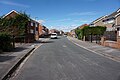
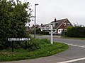
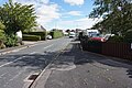
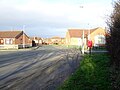
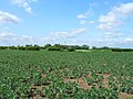
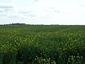
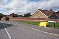
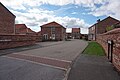
English: Thorngumbald is a village and civil parish in the East Riding of Yorkshire, England in an area known as Holderness. It lies approximately 8 miles (13 km) to the east of Hull city centre on the A1033 road.
village and civil parish in the East Riding of Yorkshire, UK  | |||||
| Upload media | |||||
| Instance of | |||||
|---|---|---|---|---|---|
| Location | East Riding of Yorkshire, Yorkshire and the Humber, England | ||||
| Population |
| ||||
 | |||||
Subcategories
This category has the following 5 subcategories, out of 5 total.
C
R
T
Media in category "Thorngumbald"
The following 200 files are in this category, out of 307 total.
(previous page) (next page)-
 10-1413 Private Herbert Harold Pawson - geograph.org.uk - 5105318.jpg 1,065 × 1,600; 713 KB
-
 A dwelling on Hooks Lane - geograph.org.uk - 887496.jpg 640 × 404; 217 KB
-
 A1033 at Ryehill Lane junction - geograph.org.uk - 5254469.jpg 640 × 480; 27 KB
-
 A1033 at Station Road junction - geograph.org.uk - 5254468.jpg 640 × 513; 38 KB
-
 A1033 Main Road, Thorngumbald - geograph.org.uk - 5254466.jpg 640 × 480; 38 KB
-
 A1033 towards Hull - geograph.org.uk - 1931812.jpg 640 × 480; 60 KB
-
 A1033 towards Hull - geograph.org.uk - 1931814.jpg 640 × 480; 68 KB
-
 A1033 towards Hull - geograph.org.uk - 1931820.jpg 640 × 480; 79 KB
-
 A1033, Bridge Bungalows - geograph.org.uk - 6367473.jpg 640 × 480; 87 KB
-
 After the show - geograph.org.uk - 5531069.jpg 1,024 × 768; 120 KB
-

-
 Approaching Station Road, Burstwick - geograph.org.uk - 5508850.jpg 1,024 × 768; 237 KB
-
 Ash Drive off Beech Avenue, Thorngumbald - geograph.org.uk - 5107383.jpg 1,600 × 1,065; 601 KB
-
 Ashton House on Main Road, Thorngumbald - geograph.org.uk - 5105571.jpg 1,600 × 1,065; 548 KB
-
 Askholme Hill Farm near Hedon - geograph.org.uk - 5535068.jpg 800 × 570; 109 KB
-
 Askholme Hill Farm, Thorngumbald - geograph.org.uk - 314188.jpg 640 × 479; 102 KB
-
 B1240 towards Hedon - geograph.org.uk - 1931821.jpg 640 × 480; 61 KB
-
 Beech Avenue from Sycamore Drive, Thorngumbald - geograph.org.uk - 5107326.jpg 1,600 × 1,065; 588 KB
-
 Beech Avenue, Thorngumbald - geograph.org.uk - 5105392.jpg 1,600 × 1,065; 535 KB
-
 Beech Avenue, Thorngumbald - geograph.org.uk - 5107343.jpg 1,600 × 1,065; 594 KB
-
 Beech Avenue, Thorngumbald - geograph.org.uk - 5107349.jpg 1,600 × 1,065; 456 KB
-
 Beech Avenue, Thorngumbald - geograph.org.uk - 5107351.jpg 1,600 × 1,065; 534 KB
-
 Beech Avenue, Thorngumbald - geograph.org.uk - 5107357.jpg 1,600 × 1,065; 478 KB
-
 Beech Avenue, Thorngumbald - geograph.org.uk - 5107373.jpg 1,600 × 1,065; 521 KB
-
 Beech Avenue, Thorngumbald - geograph.org.uk - 5107378.jpg 1,600 × 1,065; 496 KB
-
 Beech Avenue, Thorngumbald - geograph.org.uk - 5107391.jpg 1,600 × 1,065; 580 KB
-
 Beech Avenue, Thorngumbald - geograph.org.uk - 5107396.jpg 1,600 × 1,065; 764 KB
-
 Bellcroft Lane - geograph.org.uk - 1473881.jpg 640 × 358; 47 KB
-
 Bellcroft Lane - geograph.org.uk - 51696.jpg 640 × 480; 151 KB
-
 Bellcroft Lane, South Holderness - geograph.org.uk - 2054188.jpg 800 × 600; 194 KB
-
 Bellcroft Lane, Thorngumbald - geograph.org.uk - 1089434.jpg 640 × 450; 176 KB
-
 Bellcroft Lane, Thorngumbald - geograph.org.uk - 295658.jpg 466 × 640; 101 KB
-
 Bellcroft Road off St Martin's Road, Thorngumbald - geograph.org.uk - 5106175.jpg 1,600 × 1,065; 684 KB
-
 Bridge Bungalows - geograph.org.uk - 6367474.jpg 640 × 429; 78 KB
-
 Bridge over a drain - geograph.org.uk - 5508847.jpg 1,024 × 768; 235 KB
-
 Bridge over Ryhill Drain - geograph.org.uk - 1993562.jpg 800 × 600; 284 KB
-
 Bridge over Ryhill Old Drain - geograph.org.uk - 5697664.jpg 1,024 × 768; 166 KB
-
 Bridge over Ryhill Old Drain - geograph.org.uk - 5697672.jpg 1,024 × 768; 181 KB
-
 Bungalows on Main Road, Thorngumbald - geograph.org.uk - 5105472.jpg 1,600 × 1,083; 522 KB
-
 Bungalows on Main Road, Thorngumbald - geograph.org.uk - 5105694.jpg 1,600 × 1,065; 533 KB
-
 Burstwick Station - geograph.org.uk - 1979856.jpg 800 × 600; 215 KB
-
 Cafe and shop on Main Road, Thorngumbald - geograph.org.uk - 6366571.jpg 5,184 × 3,888; 3.44 MB
-
 Camerton and Burstwick, aerial 2014 - geograph.org.uk - 3874151.jpg 1,024 × 683; 118 KB
-
 Chapel and Institute, Thorngumbald - geograph.org.uk - 1087335.jpg 640 × 441; 185 KB
-
 Chinese takeaway, Thorngumbald - geograph.org.uk - 5993138.jpg 1,600 × 1,200; 242 KB
-
 Church Lane at Langham Road, Thorngumbald - geograph.org.uk - 5107093.jpg 1,600 × 1,065; 532 KB
-
 Church Lane House, Thorngumbald - geograph.org.uk - 5107084.jpg 1,600 × 1,065; 566 KB
-
 Church Lane, Thorngumbald - geograph.org.uk - 5105558.jpg 1,600 × 1,065; 486 KB
-
 Church Lane, Thorngumbald - geograph.org.uk - 5107089.jpg 1,600 × 1,065; 808 KB
-
 Church Lane, Thorngumbald - geograph.org.uk - 6366642.jpg 640 × 463; 63 KB
-
 Church of St. Mary, Thorngumbald - geograph.org.uk - 5697698.jpg 1,024 × 768; 151 KB
-
 Cleeve Road, Hedon - geograph.org.uk - 6367537.jpg 640 × 480; 65 KB
-
-

-

-
-
 Co-op shop, Main Road, Thorngumbald - geograph.org.uk - 5486379.jpg 1,600 × 1,065; 492 KB
-
 Co-op, Thorngumbald (geograph 5993140).jpg 1,600 × 1,200; 187 KB
-
 Community Institute on Main Road, Thorngumbald - geograph.org.uk - 5105517.jpg 1,600 × 1,600; 809 KB
-
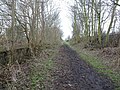
 Copse from railway track - geograph.org.uk - 11941.jpg 640 × 480; 94 KB
-
 Cream KC telephone kiosk on Main Road, Thorngumbald - geograph.org.uk - 5105536.jpg 1,600 × 1,065; 576 KB
-
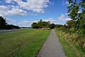
 Cycle track towards Patrington - geograph.org.uk - 1930599.jpg 640 × 480; 125 KB
-
 Cycle track towards Patrington - geograph.org.uk - 1930611.jpg 640 × 480; 97 KB
-
 Damson Road, Thorngumbald - geograph.org.uk - 5107244.jpg 1,600 × 1,065; 533 KB
-
 Damson Road, Thorngumbald - geograph.org.uk - 5107247.jpg 1,600 × 1,065; 500 KB
-
 Damson Road, Thorngumbald - geograph.org.uk - 5107252.jpg 1,600 × 1,065; 557 KB
-
 Damson Road, Thorngumbald - geograph.org.uk - 5107255.jpg 1,600 × 1,065; 555 KB
-
 Damson Road, Thorngumbald - geograph.org.uk - 5107276.jpg 1,600 × 1,065; 632 KB
-
 Disused railway path - geograph.org.uk - 1979852.jpg 800 × 600; 246 KB
-
 Drain and field edge near Hedon - geograph.org.uk - 4330998.jpg 1,024 × 768; 171 KB
-
 Drain off Marsh Lane - geograph.org.uk - 5697712.jpg 1,024 × 768; 209 KB
-
 Drainage ditch off Bellcroft Lane - geograph.org.uk - 2418471.jpg 1,600 × 1,200; 356 KB
-
 Driveway to Old Little Humber Farm - geograph.org.uk - 5535146.jpg 800 × 491; 101 KB
-
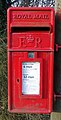
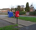 Elizabeth II postbox on Church Lane, Thorngumbald - geograph.org.uk - 6366640.jpg 3,236 × 2,702; 1.94 MB
-
-
 Elizabeth II postbox on Marsh Lane, Ryehill - geograph.org.uk - 6367459.jpg 3,760 × 2,868; 3.52 MB
-
 Elizabeth II postbox on the A1033, Bridge Bungalows - geograph.org.uk - 6367470.jpg 4,257 × 2,905; 4.32 MB
-
 Entrance to St. Martin's House Farm - geograph.org.uk - 5697706.jpg 1,024 × 768; 173 KB
-
 Farm - geograph.org.uk - 12999.jpg 567 × 640; 120 KB
-
 Farm - geograph.org.uk - 13000.jpg 640 × 335; 62 KB
-
 Farm buildings - geograph.org.uk - 16338.jpg 640 × 480; 143 KB
-
 Farm Track - geograph.org.uk - 12833.jpg 640 × 480; 77 KB
-
 Farm track in Thorngumbald - geograph.org.uk - 5697700.jpg 1,024 × 768; 167 KB
-
 Farm track off Bellcroft Lane - geograph.org.uk - 2418455.jpg 1,600 × 1,200; 423 KB
-
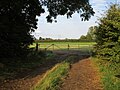
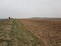
 Farmland near Hedon - geograph.org.uk - 1930588.jpg 640 × 480; 74 KB
-
 Farmland near Old Little Humber Farm - geograph.org.uk - 2418484.jpg 1,600 × 1,200; 581 KB
-
 Farmland near Thorngumbald - geograph.org.uk - 5673110.jpg 640 × 480; 62 KB
-
 Farmland off Bellcroft Lane - geograph.org.uk - 2418461.jpg 1,600 × 1,200; 442 KB
-
 Farmland off Villa Lane - geograph.org.uk - 5697709.jpg 1,024 × 768; 143 KB
-
 Ferry View, Thorngumbald - geograph.org.uk - 217626.jpg 640 × 474; 106 KB
-
 Ferry View, Thorngumbald - geograph.org.uk - 5105360.jpg 1,600 × 1,065; 534 KB
-
 Fields on Thorn Marsh - geograph.org.uk - 1473848.jpg 640 × 480; 25 KB
-
 Flats on Plumtree Road, Thorngumbald - geograph.org.uk - 5107286.jpg 1,600 × 1,065; 695 KB
-
 Footpath in Thorngumbald - geograph.org.uk - 5697696.jpg 1,024 × 768; 178 KB
-
 Forge Court, Thorngumbald - geograph.org.uk - 5105499.jpg 1,600 × 1,065; 559 KB
-
 Former Hull to Withernsea railway line - geograph.org.uk - 5657977.jpg 1,600 × 1,200; 811 KB
-
 Former Wesleyan Methodist Chapel dated 1904 - geograph.org.uk - 5105509.jpg 1,600 × 1,065; 549 KB
-
 Furdales, Thorngumbald - geograph.org.uk - 481336.jpg 640 × 471; 109 KB
-
 Gates across a farm track - geograph.org.uk - 5508861.jpg 1,024 × 768; 259 KB
-

-
 Grange Road, off St Martin's Road, Thorngumbald - geograph.org.uk - 5106833.jpg 1,600 × 1,065; 530 KB
-
 Grassland between drains - geograph.org.uk - 5697717.jpg 1,024 × 768; 171 KB
-
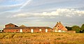
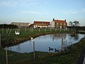 Green Marsh Farm - geograph.org.uk - 1084831.jpg 640 × 480; 60 KB
-
 Green Marsh Farm - geograph.org.uk - 2418131.jpg 640 × 480; 71 KB
-
 Green Marsh Farm - geograph.org.uk - 885922.jpg 640 × 480; 200 KB
-
 Green Marsh Farm, Thorngumbald - geograph.org.uk - 293997.jpg 640 × 492; 87 KB
-
 Green Marsh Farm, Thorngumbald - geograph.org.uk - 885149.jpg 640 × 480; 213 KB
-
 Green on Beech Avenue, Thorngumbald - geograph.org.uk - 5107371.jpg 1,600 × 1,065; 718 KB
-
 Hariff Lane and Bridge Bungalows - geograph.org.uk - 5697654.jpg 1,024 × 768; 152 KB
-
 Hastings Road at St Martin's Road, Thorngumbald - geograph.org.uk - 5106867.jpg 1,600 × 1,065; 567 KB
-
 Haylands Drain and road bridge - geograph.org.uk - 1084825.jpg 640 × 480; 76 KB
-
 Haylands Drain, Thorngumbald - geograph.org.uk - 885153.jpg 480 × 640; 252 KB
-
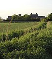
 Hill Farm, Thorngumbald - geograph.org.uk - 253555.jpg 640 × 475; 42 KB
-
 Holding off Hariff Lane - geograph.org.uk - 5697650.jpg 1,024 × 768; 180 KB
-
 Holding off Station Road - geograph.org.uk - 5697559.jpg 1,024 × 768; 161 KB
-
 Home Stead Road off St Martin's Road, Thorngumbald - geograph.org.uk - 5106193.jpg 1,600 × 1,065; 511 KB
-
 Hooks Lane at St Martin's Road, Thorngumbald - geograph.org.uk - 5105796.jpg 1,600 × 1,065; 845 KB
-
 Hooks Lane into Thorngumbald - geograph.org.uk - 6366556.jpg 800 × 600; 72 KB
-
 Hooks Lane, Thorngumbald - geograph.org.uk - 5105779.jpg 1,600 × 1,065; 479 KB
-
 Hooks Lane, Thorngumbald - geograph.org.uk - 5105788.jpg 1,600 × 1,065; 570 KB
-
 Hooks Lane, Thorngumbald - geograph.org.uk - 5105793.jpg 1,600 × 1,065; 776 KB
-
 Hooks Lane, Thorngumbald - geograph.org.uk - 887493.jpg 640 × 480; 182 KB
-
 House on Main Road, Camerton - geograph.org.uk - 6366587.jpg 4,031 × 3,138; 3.11 MB
-
 House on Main Road, Camerton - geograph.org.uk - 6366589.jpg 4,798 × 3,120; 2.89 MB
-
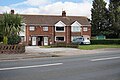 Houses on Main Road, Thorngumbald - geograph.org.uk - 5105406.jpg 1,600 × 1,065; 689 KB
-
 Houses on Main Road, Thorngumbald - geograph.org.uk - 5105567.jpg 1,600 × 1,065; 611 KB
-
 Houses on Main Road, Thorngumbald - geograph.org.uk - 5105702.jpg 1,600 × 1,065; 561 KB
-
 Houses on Main Road, Thorngumbald - geograph.org.uk - 5105767.jpg 1,600 × 1,065; 597 KB
-
 Houses on Main Road, Thorngumbald - geograph.org.uk - 5697703.jpg 1,024 × 768; 194 KB
-
 Houses on Marsh Lane, Ryehill - geograph.org.uk - 6367464.jpg 4,540 × 3,182; 4.05 MB
-
 Ings Drain - geograph.org.uk - 298071.jpg 640 × 477; 131 KB
-
 Ivy Lodge, Sacred Gate, Hedon - geograph.org.uk - 5108789.jpg 1,600 × 1,065; 764 KB
-
 J Hart on Grange Road, Thorngumbald - geograph.org.uk - 5105737.jpg 1,600 × 1,065; 609 KB
-

-
-
 Katie's Kindergarten - geograph.org.uk - 5697687.jpg 1,024 × 768; 116 KB
-
 Kingston Veterinary Group - geograph.org.uk - 5105375.jpg 1,600 × 1,065; 622 KB
-
 Land to the north of Old Little Humber - geograph.org.uk - 5772224.jpg 1,024 × 768; 116 KB
-
 Langham Plantation - geograph.org.uk - 1094011.jpg 640 × 480; 52 KB
-
 Langham Plantation - geograph.org.uk - 5508843.jpg 1,024 × 768; 212 KB
-
 Langham Plantation - geograph.org.uk - 6336832.jpg 1,024 × 768; 181 KB
-
 Langham Plantation, Thorngumbald - geograph.org.uk - 314182.jpg 640 × 431; 118 KB
-
 Langham Road at Damson Road, Thorngumbald - geograph.org.uk - 5107242.jpg 1,600 × 1,065; 430 KB
-
 Langham Road, Thorngumbald - geograph.org.uk - 5107098.jpg 1,600 × 1,065; 511 KB
-
 Langham Road, Thorngumbald - geograph.org.uk - 5107111.jpg 1,600 × 1,065; 579 KB
-
 Late Evening Flies - geograph.org.uk - 893516.jpg 640 × 480; 141 KB
-
 Looking across the fields - geograph.org.uk - 1993555.jpg 800 × 600; 242 KB
-

-
 Looking towards Thorngumbald - geograph.org.uk - 1993586.jpg 800 × 600; 212 KB
-
 Main Road Thorngumbald towards Camerton - geograph.org.uk - 3166916.jpg 4,000 × 3,000; 2.09 MB
-
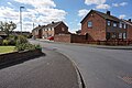
 Main Road, Thorngumbald - geograph.org.uk - 2100667.jpg 800 × 600; 321 KB
-
 Main Road, Thorngumbald - geograph.org.uk - 5105399.jpg 1,600 × 1,065; 683 KB
-
 Main Road, Thorngumbald - geograph.org.uk - 5105495.jpg 1,600 × 1,065; 663 KB
-
 Main Road, Thorngumbald - geograph.org.uk - 5105563.jpg 1,600 × 1,065; 503 KB
-
 Main Road, Thorngumbald - geograph.org.uk - 5105704.jpg 1,600 × 1,065; 501 KB
-
 Main Road, Thorngumbald - geograph.org.uk - 5105764.jpg 1,600 × 1,065; 554 KB
-
 Main Road, Thorngumbald - geograph.org.uk - 5105776.jpg 1,600 × 1,065; 613 KB
-
 Main Road, Thorngumbald - geograph.org.uk - 5107398.jpg 1,600 × 1,065; 490 KB
-
 Marsh Lane - geograph.org.uk - 5697658.jpg 1,024 × 768; 287 KB
-
 Marsh Lane and Ryhill Old Drain - geograph.org.uk - 5697667.jpg 1,024 × 768; 178 KB
-
 Marsh Lane, Ryehill - geograph.org.uk - 5697656.jpg 1,024 × 768; 272 KB
-
 Marsh Lane, Ryehill - geograph.org.uk - 6367463.jpg 4,054 × 2,921; 2.95 MB
-
 Mast and BT building - geograph.org.uk - 1993582.jpg 800 × 600; 224 KB
-
 Mast and Camerton Farm - geograph.org.uk - 5697733.jpg 1,024 × 744; 113 KB
-
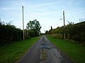
 Minor road towards Burstwick - geograph.org.uk - 6367130.jpg 640 × 480; 62 KB
-
 New Thorngumbald World War I Memorial - geograph.org.uk - 5964662.jpg 3,551 × 2,313; 5.93 MB
-
 Newton Garth Drain - geograph.org.uk - 289759.jpg 503 × 640; 131 KB
-
 Notice off Hariff Lane, Burstwick - geograph.org.uk - 5064246.jpg 1,200 × 799; 458 KB
-
 Old pit - geograph.org.uk - 5508839.jpg 1,024 × 768; 251 KB
-
 Owl nesting box near Ryhill Old Drain - geograph.org.uk - 5697716.jpg 1,024 × 768; 180 KB
-
 Parish Council Office, Thorngumbald - geograph.org.uk - 994847.jpg 480 × 640; 142 KB
-
 Path leading to Sycamore Drive, Thorngumbald - geograph.org.uk - 5107296.jpg 1,600 × 1,065; 757 KB
-

-
 Pavement on the A1033 west of Thorngumbald - geograph.org.uk - 5907546.jpg 1,600 × 1,064; 936 KB
-
 Pick your own Pumpkins - geograph.org.uk - 6642755.jpg 3,123 × 2,586; 5.69 MB
-
 Pick your own Pumpkins - geograph.org.uk - 6642761.jpg 3,162 × 2,367; 7.72 MB
-
 Pit Lane, Ryhill - geograph.org.uk - 2618326.jpg 800 × 600; 245 KB
-
 Play Area off Main Road, Thorngumbald - geograph.org.uk - 5105476.jpg 1,600 × 1,065; 910 KB
-
 Play Area off Main Road, Thorngumbald - geograph.org.uk - 5105478.jpg 1,600 × 1,065; 910 KB
-
 Ploughed land off Hariff Lane - geograph.org.uk - 5697728.jpg 1,024 × 768; 189 KB
-
 Plumtree Road, Thorngumbald - geograph.org.uk - 5107107.jpg 1,600 × 1,065; 591 KB
-
 Plumtree Road, Thorngumbald - geograph.org.uk - 5107279.jpg 1,600 × 1,065; 488 KB
-
 Plumtree Road, Thorngumbald - geograph.org.uk - 5107281.jpg 1,600 × 1,065; 544 KB
-
 Poplar Cottage, Thorngumbald - geograph.org.uk - 217649.jpg 467 × 640; 200 KB
-

-
 Post Office and shops, Thorngumbald - geograph.org.uk - 6366557.jpg 800 × 516; 97 KB
-
 Post Office and shops, Thorngumbald - geograph.org.uk - 6366644.jpg 4,912 × 3,185; 3.02 MB
-
 Promises, promises^ - geograph.org.uk - 5697692.jpg 1,024 × 768; 125 KB
-
 Rail trail near Burstwick - geograph.org.uk - 4710402.jpg 640 × 432; 464 KB
-
 Rail Trail near Keyingham - geograph.org.uk - 6336828.jpg 1,024 × 768; 248 KB
-
 Rails still in situ - geograph.org.uk - 5697642.jpg 1,024 × 768; 150 KB
-
 Red BT telephone kiosk on Main Road, Thorngumbald - geograph.org.uk - 5105527.jpg 1,600 × 1,065; 669 KB
-
 Rusty Old Gate - geograph.org.uk - 6673385.jpg 3,453 × 2,390; 4.75 MB
-
 Ryecroft House - geograph.org.uk - 1993576.jpg 800 × 600; 316 KB
-
 Ryehill Farm Ryehill - geograph.org.uk - 2063342.jpg 4,000 × 3,000; 2.09 MB
-
 Ryhill Drain - geograph.org.uk - 5697661.jpg 1,024 × 768; 213 KB
-
 Ryhill Drain along Hooks Lane, Thorngumbald - geograph.org.uk - 5105781.jpg 1,600 × 1,065; 776 KB
-
 Ryhill Drain, Thorngumbald - geograph.org.uk - 306348.jpg 478 × 640; 97 KB
-
 Ryhill Marsh - geograph.org.uk - 295654.jpg 640 × 477; 109 KB
-
 Ryhill Old Drain - geograph.org.uk - 5697670.jpg 1,024 × 768; 191 KB


.jpg)


