Category:Thorney Island, West Sussex
Jump to navigation
Jump to search
island in West Sussex, UK  | |||||
| Upload media | |||||
| Instance of | |||||
|---|---|---|---|---|---|
| Location | West Sussex, South East England, England | ||||
 | |||||
Media in category "Thorney Island, West Sussex"
The following 39 files are in this category, out of 39 total.
-
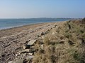 Beach and Sea Wall, Thorney Island - geograph.org.uk - 113199.jpg 640 × 480; 73 KB
-
 Body of water on Thorney Island - geograph.org.uk - 4606781.jpg 800 × 600; 145 KB
-

-
 Ditch and Field, Thorney Island - geograph.org.uk - 113168.jpg 640 × 480; 55 KB
-
 Emsworth seen from Thorney Island.JPG 3,264 × 2,448; 2.06 MB
-
 Grazing land at Thorney Island.JPG 3,264 × 2,448; 2.14 MB
-
 Great Deep, Thorney Island.JPG 3,264 × 2,448; 2.26 MB
-
 Half frozen pool - geograph.org.uk - 113187.jpg 640 × 480; 65 KB
-
 Looking Inland from the Harbour Wall - geograph.org.uk - 603426.jpg 640 × 480; 111 KB
-
 Marker Point, Thorney Island - geograph.org.uk - 113183.jpg 640 × 480; 58 KB
-
 Marker point, Thorney Island - geograph.org.uk - 2147866.jpg 1,024 × 768; 221 KB
-
 Memorial Bench, Thorney Island - geograph.org.uk - 2875538.jpg 4,288 × 3,216; 3.63 MB
-
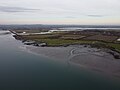
 Mudflats on the west side of Thorney Island - geograph.org.uk - 1715442.jpg 2,592 × 1,944; 2.16 MB
-
 North tip Of Thorney Island.jpg 4,000 × 3,000; 5.71 MB
-
 Old Runway Ends, Thorney Island - geograph.org.uk - 2875554.jpg 4,288 × 3,216; 3.52 MB
-
 Old Track, Thorney Island - geograph.org.uk - 2875569.jpg 4,288 × 3,216; 3.5 MB
-
 Pilsey Island.JPG 3,264 × 2,448; 2.12 MB
-
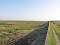 Sea Wall at Thorney Island - geograph.org.uk - 595715.jpg 640 × 480; 64 KB
-
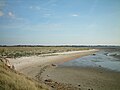
 Slipway across mudflats - geograph.org.uk - 113243.jpg 640 × 480; 43 KB
-
 South tip of Thorney Island.jpg 4,000 × 3,000; 5.59 MB
-
 Swan at Thorney Island.JPG 3,264 × 2,448; 2.21 MB
-
 Thorney Island - geograph.org.uk - 18781.jpg 640 × 480; 68 KB
-
 Thorney Island - geograph.org.uk - 2875408.jpg 4,288 × 3,216; 2.25 MB
-
 Thorney Island - geograph.org.uk - 525394.jpg 640 × 480; 80 KB
-
 Thorney Island - The Three Harbours.svg 377 × 211; 1.99 MB
-

-
 Thorney Island Drain - geograph.org.uk - 2875441.jpg 4,288 × 3,216; 3.63 MB
-
 Thorney Island nr. Prinsted Point - geograph.org.uk - 41017.jpg 419 × 640; 134 KB
-
 Thorney Island panorama.jpg 4,195 × 1,201; 2.5 MB
-
 Thorney Island, Western Shore - geograph.org.uk - 2875434.jpg 4,288 × 3,216; 3.45 MB
-
 Thorney Island, Western Shore - geograph.org.uk - 2875452.jpg 4,288 × 3,216; 3.63 MB
-
 Thorney Island.jpg 3,634 × 1,759; 4.29 MB
-
 Thornham Grange marina - geograph.org.uk - 399367.jpg 640 × 480; 191 KB
-
 Thornham Grange Marina - geograph.org.uk - 67085.jpg 640 × 480; 101 KB
-
 Thornham Point alias Prinsted Point - geograph.org.uk - 594876.jpg 480 × 640; 106 KB
-
 View east towards Chichester Harbour - geograph.org.uk - 595672.jpg 640 × 480; 77 KB
-
 View from the birdwatching hide near Longmere Point - geograph.org.uk - 1715409.jpg 2,592 × 1,944; 1.78 MB
-

-
 Muddy corner, Thorney Island - geograph.org.uk - 113208.jpg 640 × 466; 139 KB


