Category:Thornapple River (Michigan)
Jump to navigation
Jump to search
river in Michigan, United States | |||||
| Upload media | |||||
| Instance of | |||||
|---|---|---|---|---|---|
| Location |
| ||||
| Mouth of the watercourse | |||||
| Drainage basin |
| ||||
| Tributary |
| ||||
 | |||||
- Mouth (Ada)
- ;Headwaters (approximate location SE of Potterville, near Snow Lake) From the English Wikipedia article on the Thornapple River
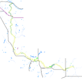
The Thornapple River is an approximately 100 mile long tributary of Michigan's longest river, the Grand River. The Thornapple is located in western Michigan. It joins the Grand in Ada, Michigan. The Thornapple, one of the Grand's major tributaries, is about 100 miles (160 km) long. It has headwaters in Eaton County and flows through Barry County before entering the Grand River in Kent County.
Subcategories
This category has the following 6 subcategories, out of 6 total.
Media in category "Thornapple River (Michigan)"
The following 9 files are in this category, out of 9 total.
-
Ada Covered Bridge TIGER map.png 422 × 359; 15 KB
-
Ada Michigan ThornappleRiver Dam DSCN9695.JPG 1,600 × 1,200; 337 KB
-
Canoe Livery Thornapple River Dscn0195crop.jpg 1,350 × 600; 572 KB
-
Nashville Dam Thornapple River DSCN0186.JPG 1,600 × 1,200; 403 KB
-
Thornapple River Drive Bridge.jpg 1,727 × 1,083; 795 KB
-
Thornapple River TIGER Highighted.png 1,500 × 1,500; 103 KB
-
Thornapple TIGER Irving dam area map3c.PNG 422 × 359; 7 KB
-
Thornapple TIGER Irving dam area map3c.svg 936 × 819; 26 KB
-
ThornappleRiver MI USGS SatImage.PNG 1,085 × 850; 1.34 MB


