Category:Thomas-Mann-Straße 40 (Bonn)
Jump to navigation
Jump to search
| Object location | | View all coordinates using: OpenStreetMap |
|---|
 | |||||
| Upload media | |||||
| Instance of | |||||
|---|---|---|---|---|---|
| Location | Bonn, Cologne Government Region, North Rhine-Westphalia, Germany | ||||
| Legal form | |||||
| Inception |
| ||||
| official website | |||||
 | |||||
Media in category "Thomas-Mann-Straße 40 (Bonn)"
The following 4 files are in this category, out of 4 total.
-
 2015-01-28 Thomas-Mann-Str 40 HdK Organisationen.JPG 1,208 × 1,564; 1.31 MB
-
 2015-01-28 Thomas-Mann-Str 40 HdK.JPG 2,324 × 3,094; 4.82 MB
-
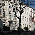 2015-03-28 Bonn Thomas-Mann-Strasse 40 01.jpg 2,311 × 2,308; 3.82 MB
-
 2015-03-28 Bonn Thomas-Mann-Strasse 40.jpg 2,018 × 2,964; 4.4 MB


