Category:Thoai Son
Jump to navigation
Jump to search
rural district of An Giang, Vietnam   | |||||
| Upload media | |||||
| Instance of | |||||
|---|---|---|---|---|---|
| Location | An Giang, Vietnam | ||||
| Area |
| ||||
| Elevation above sea level |
| ||||
 | |||||
Media in category "Thoai Son"
The following 72 files are in this category, out of 72 total.
-
 Bia Thoại Sơn mới.jpg 2,472 × 3,296; 2.04 MB
-
 Bia Thoại Sơn.jpg 3,133 × 2,344; 1.79 MB
-
 Bản đồ hành chính huyện Thoại Sơn.jpg 1,080 × 1,021; 170 KB
-
 Chùa Khmer ở Ba Thê.jpg 4,370 × 3,280; 2.63 MB
-
 Chùa Ông núi Sập.jpg 4,608 × 3,456; 4.21 MB
-
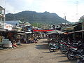 Chợ Ba Thê.jpg 1,300 × 975; 381 KB
-
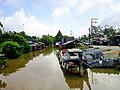
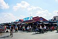 Chợ Thoại Sơn.jpg 4,373 × 2,935; 5.8 MB
-
 Chợ Vĩnh Chánh.jpg 4,161 × 3,121; 3.62 MB
-
 Chợ Vĩnh Khánh.jpg 4,370 × 2,953; 9.94 MB
-
 Chợ Vọng Đông.jpg 4,116 × 2,379; 5.35 MB
-
 Cảnh ở chân núi Ba Thê.jpg 4,488 × 2,953; 9.24 MB
-
 Cầu dây văng Thành Vĩnh.jpg 4,391 × 3,293; 2.42 MB
-
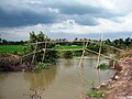 Cầu khỉ.jpg 3,648 × 2,736; 2.62 MB
-
 Cầu Phú Thuận.jpg 4,608 × 3,456; 1.82 MB
-
 Cầu Thoại Hà 3.jpg 4,608 × 3,456; 3.2 MB
-
 Cẩu dây văng Phú Vĩnh.jpg 4,608 × 3,456; 4.41 MB
-
 Hồ Ông Thoại (Núi Sập).jpg 3,229 × 2,212; 4.83 MB
-
 Hồ Ông Thoại 2.jpg 3,296 × 2,472; 3.39 MB
-
 Hồ Ông Thoại.jpg 3,296 × 2,472; 1.86 MB
-
 Kênh nhỏ ở Phú Hòa.jpg 4,608 × 3,456; 5.29 MB
-
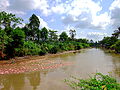
 Kênh Thoại Hà ở Vọng Đông.jpg 4,560 × 3,000; 1.21 MB
-
 Kênh Thoại Hà ở Định Mỹ.jpg 4,624 × 3,103; 3.2 MB
-
 Kênh Thoại Hà, đoạn thị trấn Núi Sập.jpg 4,608 × 3,456; 2.67 MB
-
 Kênh Đông Xuyên 2.jpg 3,648 × 2,736; 5.75 MB
-
 Kênh Đông Xuyên.jpg 4,608 × 3,456; 5.76 MB
-
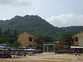
 Mount Ba Thê, Óc Eo town, Thoại Sơn district, An Giang, Vietnam, at February-2023.jpg 4,608 × 2,592; 4.52 MB
-
 Một góc thi trấn Núi Sập.jpg 3,296 × 2,472; 2 MB
-
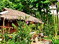 Nhà tranh.jpg 4,608 × 3,456; 5.91 MB
-
 Núi Ba Thê ở Thoại Sơn.jpg 4,608 × 3,456; 2.4 MB
-
 Núi Ba Thê.jpg 3,296 × 2,472; 1.33 MB
-
 Nơi đình Định Mỹ.jpg 3,565 × 2,392; 6.87 MB
-
 Phu thuan 2.jpg 4,322 × 3,242; 5.52 MB
-
 Phu thuan 3k.jpg 4,608 × 3,456; 4.55 MB
-
 Phu thuan 5.jpg 4,432 × 3,326; 3.6 MB
-
 Phố chợ Óc Eo.jpg 3,543 × 2,362; 10.28 MB
-
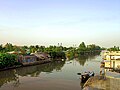
 Rạch Long Xuyên.jpg 4,608 × 3,456; 3.8 MB
-
 Rạch Phú Hòa.jpg 4,501 × 3,314; 3.09 MB
-
 Rạch ở Vĩnh Chánh.jpg 4,608 × 3,456; 4.17 MB
-
 Tam Khê ngày nay.jpg 1,600 × 1,200; 502 KB
-
 Thoai Son District.png 113 × 205; 4 KB
-
 Thoại Sơn.jpg 2,891 × 1,736; 1.5 MB
-
 Thạch đại đao.jpg 2,953 × 4,488; 2.27 MB
-
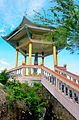 Tiểu đình Thạch Đại Đao.jpg 2,953 × 4,488; 2.51 MB
-
 Toàn cảnh đình Định Mỹ.jpg 4,482 × 3,008; 2.87 MB
-
 Trong chùa Lan Nhã Kỳ Duyên.jpg 3,375 × 4,499; 2.29 MB
-
 Trung tâm xã Vĩnh Chánh.jpg 3,264 × 2,448; 1.44 MB
-
 Truong vong dong.jpg 4,560 × 3,000; 5.86 MB
-
 Trường Tiểu học B Vĩnh Chánh.jpg 3,120 × 2,340; 2.49 MB
-
 Trường Trung học cơ sở Định Mỹ.jpg 4,720 × 3,167; 3.32 MB
-
 Trạm y tế xã Vĩnh Trạch.jpg 2,150 × 1,559; 813 KB
-
 Trạm y tế ở Vọng Đông.jpg 4,560 × 3,000; 7.3 MB
-
 Tượng Phật bốn tay.jpg 2,953 × 4,488; 6.24 MB
-
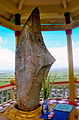
 Tượng Thoại Ngọc Hầu tại Núi Sập.jpg 2,472 × 3,296; 1.06 MB
-
 Tượng Thoại Ngọc Hầu.jpg 3,296 × 2,472; 6 MB
-
 Tỉnh lộ 943.jpg 4,608 × 3,456; 13.95 MB
-
 UBND xã Thoại Giang.jpg 4,390 × 3,288; 2.61 MB
-
 UBND xã Vĩnh Trạch.jpg 4,081 × 3,061; 4.58 MB
-
 UBND xã Định Thành.jpg 4,103 × 3,077; 2.18 MB
-
 Xuồng chở người.jpg 4,452 × 3,276; 4.41 MB
-
 Óc Eo lake, Óc Eo town, Thoại Sơn district, An Giang, Vietnam, at February-2023.jpg 4,608 × 2,592; 3.28 MB
-
 Đình Thần Thoại Sơn.jpg 3,296 × 2,472; 1.78 MB
-
 Đình Vĩnh Chánh.jpg 4,608 × 3,456; 3.31 MB
-
 Đình Định Mỹ.JPG 4,752 × 3,168; 6.31 MB
-
 Đường liên ấp ở Vĩnh Trạch.jpg 4,608 × 3,456; 6.32 MB
-
 Đường nhựa ở Phú Thuận.jpg 4,461 × 3,347; 2.41 MB
-
 Đường phố Phú Hòa.jpg 4,385 × 3,289; 1.69 MB
-
 Đường vào xã Vĩnh Chánh.jpg 4,608 × 3,456; 4.53 MB
-
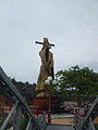
 Đền thần Thoại Ngọc Hầu.jpg 4,608 × 3,456; 4.59 MB
-
 Đồng lúa ở Vĩnh Trạch.jpg 3,180 × 2,385; 1.41 MB
-
 Đồng lúa ở Vọng Đông.jpg 4,560 × 3,000; 1.25 MB
-
 Ở xã Vĩnh Khánh.jpg 4,491 × 3,014; 6.99 MB
-
 Ủy ban xã Phú Thuận.jpg 4,608 × 3,456; 2.41 MB


.jpg)


