Category:Thermal power plant of Aramon
Jump to navigation
Jump to search
| Object location | | View all coordinates using: OpenStreetMap |
|---|
 | |||||
| Upload media | |||||
| Instance of | |||||
|---|---|---|---|---|---|
| Location | Aramon, Gard, Occitania, Metropolitan France, France | ||||
| Owned by | |||||
| Operator | |||||
| Service retirement |
| ||||
| Nominal power capacity |
| ||||
 | |||||
Media in category "Thermal power plant of Aramon"
The following 9 files are in this category, out of 9 total.
-
 Abbaye de Saint-Roman sur une colline au-dessus du Rhône.JPG 3,648 × 2,736; 4.67 MB
-
 Aramon Centrale EDF 048.tif 2,376 × 1,584; 29.15 MB
-
 Bâteau près de l'écluse à proximité de Vallabrègues.JPG 3,216 × 2,144; 3.01 MB
-
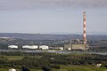
 Centrale d'aramon.JPG 3,236 × 2,269; 1.26 MB
-
 Centrale EDF Aramon 170409.tif 1,600 × 1,067; 4.91 MB
-
 Démolition de la cheminée de l'usine thermique d'Aramon (1).jpg 2,304 × 3,456; 2.16 MB
-
 Plateau des Costières - panoramio.jpg 2,048 × 1,536; 755 KB
-
 Railway bridge Tarascon-Beaucaire 06.jpg 4,608 × 3,456; 4.3 MB
-
 Rhone chez Tarascon-bjs180813-02.jpg 4,583 × 3,055; 2.97 MB


.jpg)


