Category:Therapia Lane tram stop
Jump to navigation
Jump to search
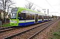
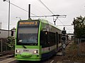
Tramlink tram stop on the boundary between the London Boroughs of Sutton and Croydon, UK  | |||||
| Upload media | |||||
| Instance of | |||||
|---|---|---|---|---|---|
| Location |
| ||||
| Transport network | |||||
| Operator |
| ||||
| Date of official opening |
| ||||
| Connecting line | |||||
| Adjacent station |
| ||||
 | |||||
Media in category "Therapia Lane tram stop"
The following 27 files are in this category, out of 27 total.
-

-
-

-

-

-
 A tram leaves Therapia Lane Tramlink Stop (geograph 2959163).jpg 4,000 × 3,000; 4.3 MB
-
 Au Morandarte Flickr DSC01348 (9900407044).jpg 3,072 × 2,304; 2.74 MB
-
 Croydon Tram Approaching the Therapia Lane Tram Halt (geograph 2675068).jpg 4,288 × 3,216; 4.75 MB
-
 London Tramlink Therapia Lane tram stop, Croydon - geograph.org.uk - 3289759.jpg 1,024 × 675; 209 KB
-
 London Tramlink Therapia Lane tram stop, Croydon - geograph.org.uk - 3290773.jpg 1,024 × 655; 182 KB
-

-
 Therapia Lane tram stop, 1999 - geograph.org.uk - 2180161.jpg 640 × 428; 92 KB
-
 Therapia Lane tram stop, Greater London - geograph.org.uk - 5650163.jpg 1,600 × 1,200; 480 KB
-
 Therapia Lane Tramlink Stop (geograph 2947171).jpg 4,000 × 3,000; 3.9 MB
-
 Therapia Lane tramstop eastern entrance.JPG 1,600 × 1,200; 466 KB
-
 Therapia Lane tramstop look east.JPG 1,600 × 1,200; 617 KB
-
 Therapia Lane tramstop look east2.JPG 1,600 × 1,200; 457 KB
-
 Therapia Lane tramstop look west.JPG 1,600 × 1,200; 616 KB
-
 Therapia Lane tramstop look west2.JPG 1,600 × 1,200; 630 KB
-
 Therapia Lane tramstop northeastern entrance.JPG 1,600 × 1,200; 613 KB
-
 Therapia Lane tramstop signage.JPG 1,200 × 1,600; 603 KB
-
 Therapia Lane tramstop western entrance.JPG 1,600 × 1,200; 489 KB
-
 Therapia Lane, The 'Purple Peril' - geograph.org.uk - 4182542.jpg 4,320 × 3,240; 5.6 MB
-
 Tram 2549 at Therapia Lane 2024-01-09.jpg 6,192 × 4,128; 13.3 MB
-
 Tram 2550 at Therapia Lane.JPG 2,560 × 1,920; 1.1 MB
-
 Tram 2558 at Therapia Lane.JPG 2,560 × 1,920; 1.06 MB
-

.jpg)
.jpg)
.jpg)
.jpg)
.jpg)
.jpg)
.jpg)
.jpg)


.jpg)


