Category:The ocean, atmosphere, and life, being the second series of a descriptive history of the life of the globe (1873)
Jump to navigation
Jump to search
Media in category "The ocean, atmosphere, and life, being the second series of a descriptive history of the life of the globe (1873)"
The following 130 files are in this category, out of 130 total.
-
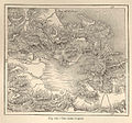
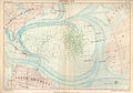
 FMIB 43852 Gulf of Cape Breton.jpeg 857 × 676; 170 KB
-
-
 FMIB 43854 Profile of the Bed of the Adriatic.jpeg 710 × 392; 38 KB
-
-
 FMIB 43856 Depth of the English Channel.jpeg 895 × 732; 175 KB
-
 FMIB 43857 Depth of the Sea at the Mouth of the Ganges.jpeg 852 × 619; 165 KB
-
 FMIB 43858 Salt Marshes of Bessarabia.jpeg 848 × 705; 173 KB
-
 FMIB 43859 Glacier of La Madeleine, on the Coast of Spitzbergen.jpeg 887 × 771; 206 KB
-
 FMIB 43860 Course of the Icebergs Between Europe and America.jpeg 873 × 783; 241 KB
-
 FMIB 43861 Icebergs of the Antarctic Ocean (after Wilkes).jpeg 882 × 331; 68 KB
-
 FMIB 43862 Icebergs of the Antarctic Ocean (after Wilkes).jpeg 883 × 310; 65 KB
-

-
 FMIB 43864 Course of Icebergs in the Southern Hemisphere.jpeg 869 × 525; 87 KB
-
 FMIB 43865 Bay of St Jean de Luz.jpeg 865 × 1,003; 253 KB
-
 FMIB 43866 Channel of Florida Soundings are in Fathoms.jpeg 895 × 1,231; 390 KB
-
 FMIB 43867 Route of Steam-packets, after Maury.jpeg 861 × 512; 108 KB
-
 FMIB 43869 Profile of the Straits of Gibraltar.jpeg 895 × 301; 38 KB
-
 FMIB 43870 Co-tidal Lines of the British Isles.jpeg 913 × 1,274; 270 KB
-
 FMIB 43871 Bay of Fundy.jpeg 865 × 689; 196 KB
-
 FMIB 43872 Mouth of the Avon, After Beardmore.jpeg 827 × 357; 94 KB
-
 FMIB 43873 Strait of Noirmoutiers Depth indicated in feet.jpeg 908 × 1,101; 358 KB
-
 FMIB 43874 Tides of the English Channel.jpeg 891 × 555; 135 KB
-
 FMIB 43875 Height of the Tides in St George's Channel.jpeg 857 × 1,283; 292 KB
-
 FMIB 43876 Course of the Tide in the Irish Sea.jpeg 883 × 985; 249 KB
-
 FMIB 43877 Lysefjord, Norway.jpeg 904 × 473; 82 KB
-
 FMIB 43878 Fjords of Greenland.jpeg 452 × 908; 149 KB
-
 FMIB 43879 Mouths of Cattaro.jpeg 904 × 757; 279 KB
-
 FMIB 43880 Fjords of South America.jpeg 878 × 848; 286 KB
-
 FMIB 43881 Ancient Fjords of Northern Italy.jpeg 891 × 787; 298 KB
-
 FMIB 43882 Fjords of the South-east of Iceland.jpeg 778 × 687; 200 KB
-
 FMIB 43883 Filled-up Fjords of Christiansand.jpeg 852 × 684; 142 KB
-
 FMIB 43884 Ancient Fjords of Carentan.jpeg 895 × 986; 326 KB
-
 FMIB 43885 Roads of the Downs.jpeg 891 × 1,295; 375 KB
-
 FMIB 43886 Map of Abervrac'h.jpeg 861 × 878; 309 KB
-
 FMIB 43888 Isle of Borkum in 1738.jpeg 912 × 365; 124 KB
-
 FMIB 43889 Isle of Borkum in 1825.jpeg 899 × 409; 142 KB
-
 FMIB 43890 Curves of the Coast Between Oneglia and Savone.jpeg 869 × 1,029; 401 KB
-
 FMIB 43891 Straits of Dover.jpeg 2,151 × 1,567; 470 KB
-
 FMIB 43892 Submarine Plateau of the British Isles.jpeg 1,016 × 1,614; 360 KB
-
 FMIB 43893 Northern Atlantic Ocean.jpeg 2,173 × 1,575; 543 KB
-
 FMIB 43894 Antarctic Land.jpeg 2,117 × 1,506; 446 KB
-
 FMIB 43895 Current of the Gulf Stream.jpeg 2,194 × 1,537; 945 KB
-
 FMIB 43896 Oceanic Currents.jpeg 2,181 × 1,549; 1,019 KB
-
 FMIB 43897 Bay of St Michel.jpeg 1,046 × 1,605; 340 KB
-
 FMIB 43898 Fjords of Norway.jpeg 1,011 × 1,575; 385 KB
-
 FMIB 43899 Depths of the Zuider-Zee.jpeg 981 × 1,558; 375 KB
-
 FMIB 43900 Mouth of the Liamone.jpeg 882 × 1,055; 384 KB
-
 FMIB 43901 Mouth of the Bidassoa.jpeg 857 × 995; 355 KB
-
 FMIB 43902 Mouth of the Orne.jpeg 831 × 654; 184 KB
-
 FMIB 43903 Peninsula of Giens.jpeg 869 × 869; 266 KB
-
 FMIB 43904 Peninsula of Cape Sepet Depths are expressed in fathoms.jpeg 869 × 598; 187 KB
-
 FMIB 43905 Chesil Bank.jpeg 908 × 869; 296 KB
-
 FMIB 43906 Miquelon Isles.jpeg 929 × 1,334; 476 KB
-
 FMIB 43907 Coast-ridges between Port-Vendres and Aigues-Mortes.jpeg 878 × 1,110; 351 KB
-
 FMIB 43908 Lagunes and Lidi of Venice.jpeg 555 × 1,162; 238 KB
-
 FMIB 43909 Coasts of Dantzic and Pillan.jpeg 887 × 788; 196 KB
-
 FMIB 43910 Different positions of Cape Ferret from 1768 to 1863.jpeg 869 × 1,011; 406 KB
-
 FMIB 43911 Road of La Madeleine, California.jpeg 874 × 783; 265 KB
-
 FMIB 43912 Gulf or Carentan.jpeg 873 × 861; 280 KB
-
 FMIB 43913 Bahr-el-Assal and the Gulf of Tedjura.jpeg 882 × 891; 202 KB
-
 FMIB 43914 Choa-Canzouni.jpeg 878 × 1,110; 422 KB
-
 FMIB 43915 Nossi-Mitsion.jpeg 869 × 1,111; 435 KB
-
 FMIB 43916 Celebes and Gilolo.jpeg 869 × 723; 130 KB
-
 FMIB 43917 Etangs, or Littoral Lakes of Cazau, Parentis, and Aureilhan.jpeg 581 × 1,235; 301 KB
-
 FMIB 43918 Isle Thelenji, in the Caspian Sea.jpeg 805 × 611; 179 KB
-
 FMIB 43919 Sable Island.jpeg 865 × 551; 189 KB
-
 FMIB 43920 Cloud of Cinders from Morne Garou.jpeg 917 × 517; 104 KB
-
 FMIB 43921 Island of Teneriffe.jpeg 887 × 818; 319 KB
-
 FMIB 43922 Variations in the Trade-Winds.jpeg 852 × 611; 131 KB
-
 FMIB 43923 Trade-winds and Monsoons of the Atlantic.jpeg 865 × 702; 188 KB
-
 FMIB 43924 Map showing the general Direction of Winds in France.jpeg 857 × 883; 286 KB
-
 FMIB 43926 Calm during the Hurricane at Reunion, February 17, 1761.jpeg 869 × 762; 201 KB
-
 FMIB 43927 Cyclone in the Indian Ocean in January, 1852.jpeg 882 × 887; 98 KB
-
 FMIB 43928 Cyclone in the Indian Ocean in Feburary, 1860.jpeg 891 × 964; 144 KB
-
-
 FMIB 43930 Storm in the Pyrenees (After Lartigue).jpeg 749 × 835; 120 KB
-
 FMIB 43931 Storm in the Pyrenees (after Lartigue).jpeg 753 × 822; 104 KB
-
 FMIB 43932 Hurricane of Monville.jpeg 491 × 1,227; 164 KB
-
 FMIB 43933 Whirlwinds of Dust.jpeg 555 × 598; 96 KB
-
 FMIB 43934 Whirlwinds of Dust.jpeg 654 × 495; 81 KB
-
 FMIB 43935 Ravines in the Craters of Reunion.jpeg 882 × 973; 349 KB
-

-

-
 FMIB 43938 Circumpolar Zone of the Aurora Borealis.jpeg 882 × 1,157; 295 KB
-
 FMIB 43939 Isodynamic Lines.jpeg 891 × 590; 183 KB
-
 FMIB 43941 Map showing treeless Regions around the North Pole.jpeg 882 × 912; 217 KB
-
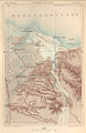
 FMIB 43942 Forests of Transylvania.jpeg 899 × 779; 218 KB
-

-
 FMIB 43944 Botanical Map of Java.jpeg 917 × 435; 78 KB
-

-
 FMIB 43946 Stages of Vegetaion on the Flanks of Canigou.jpeg 951 × 495; 103 KB
-
 FMIB 43947 Roadstead of Papeiti (Island of Tahiti).jpeg 899 × 801; 288 KB
-
 FMIB 43948 Gambler Island.jpeg 1,007 × 938; 153 KB
-
 FMIB 43949 Profile of Gambler Island.jpeg 891 × 172; 37 KB
-
 FMIB 43950 Atoll of Menchikoff.jpeg 865 × 680; 96 KB
-
 FMIB 43951 Red Sea and its Coral Reefs.jpeg 877 × 1,218; 468 KB
-
 FMIB 43952 Keys of Florida.jpeg 869 × 667; 202 KB
-
 FMIB 43953 Bahama Archipelago.jpeg 895 × 753; 127 KB
-
 FMIB 43954 Islands of Eleuthera and New Providence.jpeg 869 × 749; 113 KB
-
 FMIB 43955 Monte San-Giuliano.jpeg 878 × 710; 238 KB
-
 FMIB 43956 Lake Copais.jpeg 861 × 805; 267 KB
-
 FMIB 43957 Polders of Haarlem.jpeg 874 × 827; 241 KB
-
 FMIB 43958 Zuyder Polder.jpeg 895 × 1,016; 417 KB
-
 FMIB 43959 Salt-works of Trapani.jpeg 882 × 883; 272 KB
-
 FMIB 43960 Dikes of Uithuizen.jpeg 865 × 633; 210 KB
-
 FMIB 43961 Embankments of Westkapelle.jpeg 886 × 1,317; 478 KB
-
 FMIB 43962 Embankments of Petten.jpeg 883 × 1,317; 349 KB
-
 FMIB 43963 Isthmus of Corinth.jpeg 878 × 783; 274 KB
-
 FMIB 43964 Transatlantic Cables.jpeg 887 × 461; 126 KB
-
 FMIB 43965 Roadstead of Aiguillon.jpeg 878 × 1,227; 479 KB
-
 FMIB 43966 Shipwrecks in the Mediterranean.jpeg 857 × 427; 116 KB
-
 FMIB 43967 Headlands of North Carolina.jpeg 1,003 × 1,601; 266 KB
-
 FMIB 43968 Dunes of La Teste.jpeg 989 × 1,580; 457 KB
-
 FMIB 43969 Showers of Volcanic Ashes.jpeg 2,147 × 1,545; 776 KB
-
 FMIB 43970 Hurricane of August and September 1848.jpeg 1,016 × 1,545; 457 KB
-
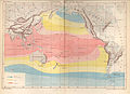
 FMIB 43971 Rain Map of the World.jpeg 2,117 × 1,493; 869 KB
-
 FMIB 43972 Isogonic and Isoclinic Lines.jpeg 2,160 × 1,515; 875 KB
-
 FMIB 43973 Isothermal Lines.jpeg 2,147 × 1,550; 783 KB
-
 FMIB 43974 Isothermal Lines of the Pacific.jpeg 2,169 × 1,567; 797 KB
-
 FMIB 43975 Isothermal Lines of January & July in the Northern Hemisphere.jpeg 1,041 × 1,589; 543 KB
-
 FMIB 43976 Forests of the Vosges.jpeg 1,028 × 1,567; 612 KB
-
 FMIB 43977 Sargasso Sea.jpeg 2,177 × 1,528; 846 KB
-
 FMIB 43978 Great Barrier Reef and the Straits of Torres.jpeg 1,041 × 1,653; 392 KB
-
 FMIB 43979 Greece.jpeg 2,147 × 1,515; 615 KB
-
 FMIB 43980 Unexplored Regions of the Northern Polar Circle.jpeg 1,037 × 1,101; 303 KB
-
 FMIB 43981 Unexplored Regions of the Southern Polar Ocean.jpeg 1,037 × 1,101; 166 KB
-
 FMIB 43982 Defensive Works of the Pointe de Grave.jpeg 1,041 × 1,605; 334 KB
-
 FMIB 43983 Passes of the Maurienne.jpeg 2,203 × 1,571; 1.24 MB
-
 FMIB 43984 Isthmus of Suez.jpeg 1,007 × 1,554; 459 KB
-
 FMIB 43985 Central America.jpeg 2,160 × 1,614; 624 KB

.jpeg)


.jpeg)
.jpeg)


.jpeg)


.jpeg)
.jpeg)