Category:The University of Manila historical marker
Jump to navigation
Jump to search
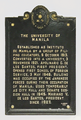
PHC historical marker for the University of Manila  | |||||
| Upload media | |||||
| Instance of | |||||
|---|---|---|---|---|---|
| Commemorates | |||||
| Location | University of Manila, Manila, Metro Manila, PH | ||||
| Street address |
| ||||
| Creator |
| ||||
| Inception |
| ||||
 | |||||
Media in category "The University of Manila historical marker"
The following 3 files are in this category, out of 3 total.
-
 1956-PHC-The University of Manila.png 2,598 × 3,552; 13.12 MB
-
 The University of Manila NHCP Historical Marker.png 1,537 × 2,283; 3.56 MB
-
 The University of Manila.jpg 1,833 × 2,643; 1.67 MB

