Category:The Universal atlas 1894
Jump to navigation
Jump to search
Media in category "The Universal atlas 1894"
The following 37 files are in this category, out of 37 total.
-
 Map of (West) Virginia.jpg 3,468 × 2,935; 3.81 MB
-
 Map of Alabama.jpg 2,927 × 3,556; 2.66 MB
-
 Map of Alaska.jpg 3,480 × 2,939; 2.77 MB
-
 Map of Arizona and New Mexico.jpg 3,492 × 2,939; 3.21 MB
-
 Map of Arkansas.jpg 3,482 × 2,936; 3.47 MB
-
 Map of California and Nevada.jpg 2,934 × 3,515; 2.45 MB
-
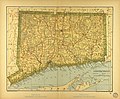 Map of Connecticut.jpg 3,562 × 2,932; 3.79 MB
-
 Map of Delaware.jpg 1,453 × 1,592; 926 KB
-
 Map of Florida.jpg 3,491 × 2,940; 3.2 MB
-
 Map of Fremont County, Colorado.jpg 365 × 207; 42 KB
-
 Map of Idaho, Montana, and Wyoming.jpg 3,447 × 2,932; 3.84 MB
-
 Map of Illinois.jpg 2,922 × 3,515; 2.79 MB
-
 Map of Indiana.jpg 2,920 × 3,501; 2.65 MB
-
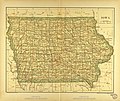 Map of Iowa.jpg 3,487 × 2,931; 3.9 MB
-
 Map of Kansas.jpg 3,525 × 2,929; 3.65 MB
-
 Map of Kentucky and Tennessee.jpg 3,501 × 2,935; 3.94 MB
-
 Map of Louisiana.jpg 3,568 × 2,936; 3.63 MB
-
 Map of Maine.jpg 2,939 × 3,550; 2.47 MB
-
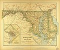 Map of Maryland.jpg 3,510 × 2,931; 3.51 MB
-
 Map of Massachusetts.jpg 3,561 × 2,942; 3.52 MB
-
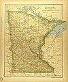 Map of Minnesota.jpg 2,929 × 3,524; 2.53 MB
-
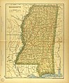 Map of Mississippi.jpg 2,932 × 3,537; 2.61 MB
-
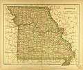 Map of Missouri.jpg 3,465 × 2,921; 3.97 MB
-
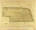 Map of Nebraska.jpg 3,465 × 2,926; 3.52 MB
-
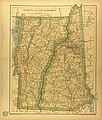 Map of New Hampshire and Vermont.jpg 2,933 × 3,443; 2.69 MB
-
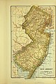 Map of New Jersey.jpg 1,975 × 2,918; 1.96 MB
-
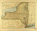 Map of New York.jpg 3,480 × 2,936; 3.54 MB
-
 Map of North and South Dakota.jpg 2,928 × 3,566; 2.75 MB
-
 Map of North Carolina.jpg 3,546 × 2,926; 3.65 MB
-
 Map of Ohio.jpg 2,925 × 3,535; 2.51 MB
-
 Map of Oklahoma.jpg 2,924 × 1,971; 1.32 MB
-
 Map of Oregon and Washington.jpg 2,929 × 3,492; 2.72 MB
-
 Map of Rhode Island.jpg 1,959 × 2,904; 1.79 MB
-
 Map of South Carolina.jpg 2,895 × 1,992; 1.36 MB
-
 Map of Texas.jpg 3,461 × 2,916; 3.38 MB
-
 Map of Utah and Colorado.jpg 3,465 × 2,938; 3.28 MB
-
 Map of Wisconsin and Michigan.jpg 3,467 × 2,926; 3.73 MB
_Virginia.jpg)


