Category:The Towans
Jump to navigation
Jump to search
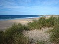
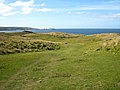
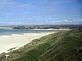
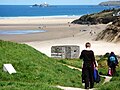
English: The Towans (towan means 'sand dune' in Cornish) refers to the three-mile (5 km) stretch of coastal dunes extending north east from the estuary of the River Hayle (at 50.19256°N 5.43111°W) to Gwithian Beach (at 50.22991°N 5.39145°W) with a midpoint near Upton (at 50.21053°N 5.40768°W). Although 'The Towans' refers to the whole stretch, individual areas of the dunes have their own identities - from southwest to northeast: Hayle Towans, Riviere Towans, Mexico Towans, Common Towans, Phillack Towans, Upton Towans and Gwithian Towans.
dunes between Hayle and Gwithian Beach in Cornwall, England, UK | |||||
| Upload media | |||||
| Instance of | |||||
|---|---|---|---|---|---|
| Location |
| ||||
| Has part(s) |
| ||||
 | |||||
Subcategories
This category has the following 2 subcategories, out of 2 total.
G
- Gwithian Towans (8 F)
U
- Upton Towans (13 F)
Media in category "The Towans"
The following 25 files are in this category, out of 25 total.
-
 Beach near Upton Towans - geograph.org.uk - 107863.jpg 640 × 480; 107 KB
-

-
 Caravan Site, Hayle Towans - geograph.org.uk - 903840.jpg 640 × 428; 55 KB
-
 Caravans at Riviere Towans - geograph.org.uk - 1505648.jpg 640 × 480; 70 KB
-
 Church at Lelant from Riviere Towans - geograph.org.uk - 958146.jpg 640 × 480; 77 KB
-
 Dunes and beach at Mexico Towans - geograph.org.uk - 1505602.jpg 640 × 480; 77 KB
-

-
 Grass covered dunes on Common Towans - geograph.org.uk - 1505572.jpg 640 × 480; 81 KB
-
 Hayle Towans - geograph.org.uk - 318473.jpg 640 × 427; 86 KB
-
 Hayle Towans beach, looking toward Estuary from Godrevy.jpg 1,600 × 1,200; 348 KB
-
 Hayle Towans from Lelant Towans - geograph.org.uk - 580477.jpg 640 × 427; 62 KB
-
 Holiday chalets on Hayle Towans - geograph.org.uk - 35416.jpg 640 × 480; 91 KB
-
 Kitesurfer off Mexico Towans.jpg 3,935 × 2,623; 3.95 MB
-
 Lelant Towans - geograph.org.uk - 470207.jpg 640 × 474; 74 KB
-
 Lethlean House.jpg 1,530 × 1,712; 1 MB
-
 Lethlean Towans (SSSI).jpg 966 × 1,232; 376 KB
-
 Looking southeast on Godrevy Towans - geograph.org.uk - 1545283.jpg 640 × 426; 83 KB
-
 Mouth of the River Hayle - geograph.org.uk - 1774871.jpg 640 × 422; 69 KB
-
 Penwith , Coastline ^ Buildings - geograph.org.uk - 2501328.jpg 4,194 × 2,700; 4.17 MB
-
 Porth Kidney beach - geograph.org.uk - 288461.jpg 640 × 427; 68 KB
-
 Reedbed below Godrevy Towans - geograph.org.uk - 1545251.jpg 640 × 434; 149 KB
-
 SWCP Lelant Towans.jpg 800 × 600; 182 KB
-
 The beach at Mexico Towans - geograph.org.uk - 1505611.jpg 640 × 480; 50 KB
-
 The beach below Mexico Towans - geograph.org.uk - 1505592.jpg 480 × 640; 63 KB
-
 Grass covered dunes at Hayle Towans - geograph.org.uk - 758231.jpg 640 × 480; 53 KB


.jpg)


