Category:The Street, Smarden, Kent
Jump to navigation
Jump to search
Subcategories
This category has the following 3 subcategories, out of 3 total.
C
- Chessenden, Smarden, Kent (2 F)
T
- The Chequers Inn, Smarden (7 F)
Media in category "The Street, Smarden, Kent"
The following 13 files are in this category, out of 13 total.
-
 Looking towards Church Gate, Smarden, Kent-geograph-3995474-by-Marathon.jpg 4,000 × 3,000; 3.92 MB
-
 Post Office & Stores, Smarden, Kent-geograph-2250519.jpg 640 × 480; 102 KB
-
 Post Office and Stores, Smarden, Kent-geograph-3950863-by-Brian-Chadwick.jpg 3,121 × 2,071; 1.26 MB
-
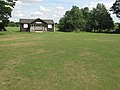 Smarden Cricket Pavilion - geograph.org.uk - 1420797.jpg 640 × 480; 90 KB
-
 Smarden High Street.JPG 1,908 × 1,449; 1.24 MB
-
 Smarden Village - geograph.org.uk - 46369.jpg 640 × 480; 144 KB
-
 Smarden Village Pump - geograph.org.uk - 1420821.jpg 640 × 480; 110 KB
-
 Smarden Village Sign - geograph.org.uk - 1420809.jpg 480 × 640; 61 KB
-
 The Old Post Office, Smarden - geograph.org.uk - 1420817.jpg 640 × 480; 85 KB
-
 The Smarden Charter Hall - geograph.org.uk - 1420824.jpg 640 × 480; 71 KB
-
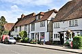
 The Street, Smarden, Kent-geograph-2210168-by-Roger-Smith.jpg 1,137 × 738; 117 KB
-
 The Street, Smarden, Kent-geograph-3554982.jpg 480 × 640; 112 KB
-
 Zion Baptist Church, Smarden - geograph.org.uk - 1420800.jpg 640 × 480; 72 KB


