Category:The Schil
Jump to navigation
Jump to search

Subcategories
This category has only the following subcategory.
D
- Distant views of The Schil (12 F)
Media in category "The Schil"
The following 17 files are in this category, out of 17 total.
-
 Hen Hole - geograph.org.uk - 279495.jpg 640 × 514; 67 KB
-
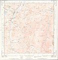 Ordnance Survey Sheet NT 82 Yetholm, Published 1954.jpg 7,345 × 7,597; 5.62 MB
-
 Outcrop just north of The Schil - geograph.org.uk - 1530031.jpg 480 × 640; 74 KB
-
 Pennine Way below The Schil - geograph.org.uk - 48622.jpg 480 × 640; 126 KB
-
 Pennine Way on the Schil - geograph.org.uk - 2051274.jpg 640 × 480; 97 KB
-
 Schil.jpg 500 × 333; 95 KB
-
-
 Sourhope Valley - geograph.org.uk - 179784.jpg 640 × 441; 73 KB
-
 Summit rocks, The Schil - geograph.org.uk - 48623.jpg 640 × 480; 118 KB
-

-
 The Schil (1971 feet) - geograph.org.uk - 1569653.jpg 640 × 480; 36 KB
-
 The Schil - geograph.org.uk - 3697262.jpg 1,600 × 1,200; 374 KB
-
 The Schil - geograph.org.uk - 4156465.jpg 2,560 × 1,920; 2.54 MB
-
 The Schil from Corbie Craig - geograph.org.uk - 3166770.jpg 1,024 × 769; 207 KB
-
 The Schil from the descent of The Curr - geograph.org.uk - 6351654.jpg 1,600 × 1,200; 364 KB
-
 The Schil summit in the cloud - geograph.org.uk - 6351670.jpg 1,600 × 1,200; 399 KB
-
 The Schil's rocky slopes - geograph.org.uk - 4506824.jpg 640 × 348; 71 KB


_-_geograph.org.uk_-_1569653.jpg)


