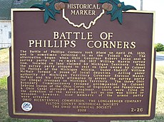
Category:The Ohio Michigan Boundary War - Battle of Phillips Corners Historic Marker 2-26
Jump to navigation
Jump to search
Ohio historical marker 2-26 | |||||
| Upload media | |||||
| Instance of | |||||
|---|---|---|---|---|---|
| Location | Fulton County, Ohio | ||||
 | |||||
Media in category "The Ohio Michigan Boundary War - Battle of Phillips Corners Historic Marker 2-26"
The following 4 files are in this category, out of 4 total.
-
Phillips Corners Battlefield.jpg 6,016 × 4,000; 6.33 MB
-
Toledowarphilipscorner.jpg 800 × 600; 225 KB
-
Toledowarphillipscorner2.jpg 800 × 600; 306 KB
-
Toledowarphillipswar3.jpg 800 × 600; 317 KB


